Powakka
Powakka | |
|---|---|
Village | |
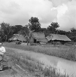 Powakka (1971) | |
 Powakka | |
| Coordinates: 5°26′44″N 55°04′21″W / 5.4456°N 55.0724°WCoordinates: 5°26′44″N 55°04′21″W / 5.4456°N 55.0724°W | |
| Country | |
| District | Para District |
| Resort | Oost |
| Government | |
| • Captain | Sergio Sabajo[1] |
| Population (2020)[2] | |
| • Total | 640 |
| Time zone | UTC-3 (AST) |

Powakka is an indigenous village of Lokono[2] Amerindians in the resort of Oost in the Para District in Suriname. The village is located on the road to Carolina which connects to the Afobakaweg to Paramaribo.[3]
Overview[]
Powakka is located in a savanna area. The economy is mainly based on production of pineapples,[4] Tourism has become important as well, and several tourist resorts are located in Powakka.[5] An animal husbandry project was started in the 1930s, however it only yielded limited success.[6]
The Catholic mission had been active in the village since the late 18th century.[7] The village has a school and a clinic.[8] On 15 December 2020, Sergio Sabajo was elected as the village chief.[1]
References[]
- ^ a b "Powakka heeft nieuw dorpsbestuur". Dagblad Suriname (in Dutch). Retrieved 19 February 2021.
- ^ a b "Dorpen en Dorpsbesturen". Vereniging van inheemse dorpshoofden in Suriname (in Dutch). Retrieved 19 February 2021.
- ^ "SURINAME IN DE 20 ste EEUW". Suriname.nu (in Dutch). Retrieved 19 February 2021.
- ^ "Inheemse Ananas telers Powakka verzekerd van afzet". Waterkant (in Dutch). Retrieved 19 February 2021.
- ^ Planning Office 2014, p. 158.
- ^ Joop Vernooij (1994). "Indianen en Kerken". OSO. Tijdschrift voor Surinaamse taalkunde, letterkunde en geschiedenis (in Dutch). p. 199. Cite magazine requires
|magazine=(help) - ^ "Distrikt Para". Suriname.nu (in Dutch). Retrieved 19 February 2021.
- ^ Planning Office 2014, p. 147.
Bibliography[]
- Planning Office (2014). "Planning Office Suriname - Districts" (PDF). Planning Office Suriname (in Dutch).
This Suriname location article is a stub. You can help Wikipedia by . |
- Indigenous villages in Suriname
- Populated places in Para District
- Suriname geography stubs