Puerto Rico Highway 60
 | ||||
|---|---|---|---|---|
| Ruta 60 | ||||
| Avenida Dionisio Casillas | ||||
| Route information | ||||
| Maintained by Puerto Rico DTPW | ||||
| Length | 3.55 km[1] (2.21 mi) | |||
| Major junctions | ||||
| West end | ||||
| East end | ||||
| Location | ||||
| Municipalities | Humacao | |||
| Highway system | ||||
| ||||
Puerto Rico Highway 60 or PR-60 (Avenida Dionisio Casillas) is a 1.9-mile-long (3.1 km) freeway entirely located in Humacao, Puerto Rico. It connects Puerto Rico Highway 30 to Puerto Rico Highway 3 and has two exits:
- PR-198, Humacao Centro: Access to Hospital Ryder, one of the most important hospitals in Humacao; Downtown Humacao and East Las Piedras
- PR-924, Antón Ruiz: Access to Downtown Humacao and barrio Antón Ruíz.
History[]
The freeway was part of PR-30 before the latter, then called Puerto Rico Alt Highway 30 (or ramal), ended in the intersection with PR-909 near Mariana. When PR-53 was under construction, PR-30 was also extended to its terminus and the Department of Transportation and Public Works of Puerto Rico (DTOP) renumbered the final 1.9 miles (3 kilometers) of former PR-30 to PR-60.[2]

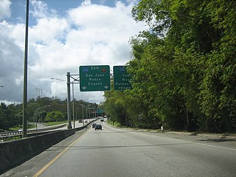
PR-30 approaching PR-60 in Humacao
PR-60 going west to PR-30


Exit list[]
The entire route is located in Humacao. All exits are unnumbered.
| Location | km[3] | mi | Destinations | Notes | |
|---|---|---|---|---|---|
| Tejas | 0.0 | 0.0 | Western terminus of PR-60; PR-30 exit 25; trumpet interchange | ||
| Mabú | 0.7– 0.8 | 0.43– 0.50 | Partial cloverleaf interchange | ||
| Humacao barrio-pueblo– line | 1.9– 3.0 | 1.2– 1.9 | Antón Ruíz; diamond interchange | ||
| Río Abajo | 3.55 | 2.21 | Eastern terminus of PR-60; at-grade intersection | ||
| 1.000 mi = 1.609 km; 1.000 km = 0.621 mi | |||||
See also[]
References[]
- ^ Guía de Carreteras Principales, Expresos y Autopistas. Departamento de Transportación y Obras Publicas de Puerto Rico. Accessed 5 May 2019.
- ^ National Geographic Maps (2011). Puerto Rico (Map). 1:125,000. Adventure Map (Book 3107). Evergreen, Colorado: National Geographic Maps. ISBN 978-1566955188. OCLC 756511572.
- ^ Google (28 February 2020). "PR-60" (Map). Google Maps. Google. Retrieved 28 February 2020.
External links[]
 Media related to Puerto Rico Highway 60 at Wikimedia Commons
This Humacao, Puerto Rico location article is a stub. You can help Wikipedia by . |
This Puerto Rico road-related article is a stub. You can help Wikipedia by . |
- Highways in Puerto Rico
- Humacao, Puerto Rico
- Puerto Rico Senatorial district VII geography stubs
- Puerto Rico road stubs