Qikiqtaryuaq (Queen Maud Gulf)
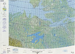 Map including Qikiqtaryuaq | |
 Qikiqtaryuaq | |
| Geography | |
|---|---|
| Location | Northern Canada |
| Coordinates | 68°30′02″N 104°42′44″W / 68.50056°N 104.71222°WCoordinates: 68°30′02″N 104°42′44″W / 68.50056°N 104.71222°W |
| Archipelago | Arctic Archipelago |
| Area | 381 km2 (147 sq mi) |
| Administration | |
Canada | |
| Territory | Nunavut |
| Region | Kitikmeot |
| Demographics | |
| Population | Uninhabited |


Qikiqtaryuaq formerly Melbourne Island[1] is an island in the Kitikmeot Region, Nunavut, Canada. It is located at the western end of Queen Maud Gulf, off Kiillinnguyaq. To the north lies the Canadian Arctic's second largest island, Victoria Island.
Melbourne Island is oval shaped, and dominated by lakes and marshlands. It has an area of 381 km2 (147 sq mi).
References[]
- Oceandots.com at the Wayback Machine (archived December 23, 2010)
This Kitikmeot Region, Nunavut location article is a stub. You can help Wikipedia by . |
Categories:
- Islands of Kitikmeot Region
- Uninhabited islands of Kitikmeot Region
- Islands of the Canadian Arctic Archipelago
- Kitikmeot Region, Nunavut geography stubs