Queen's Road, Gibraltar
 | |||
| Location | Gibraltar | ||
|---|---|---|---|
| Coordinates | 36°07′57″N 5°20′53″W / 36.132398°N 5.348089°WCoordinates: 36°07′57″N 5°20′53″W / 36.132398°N 5.348089°W | ||

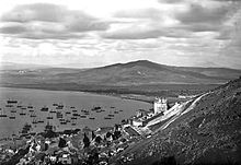
Queen's Road is the longest road in the British Overseas Territory of Gibraltar. It runs north–south through the Upper Rock Nature Reserve on the Rock of Gibraltar. It forks into which runs almost parallel with it for some part. The narrow road is halfway up the Rock and overlooks the Bay of Gibraltar. St. Michael's Cave lies off this road on .[1] This is a large show cave featuring stalactites and stalagmites and an auditorium large enough to take orchestras.[2] Also of note, apart from the nature reserve, are the Great Siege Tunnels at the northern end.
References[]
- ^ Fodor, Eugene (2004). Fodor's Spain. D. McKay. p. 452. Retrieved 2 May 2013.
- ^ Price, Danforth (2009). Frommer's Seville, Granada and the Best of Andalusia. John Wiley & Sons. p. 298. ISBN 9780470487143.
This Gibraltar-related article is a stub. You can help Wikipedia by . |
This European road or road transport-related article is a stub. You can help Wikipedia by . |
Categories:
- Streets in Gibraltar
- Gibraltar stubs
- Europe road stubs