Qurayyat, Saudi Arabia
This article needs additional citations for verification. (June 2011) |
Qurayyat
القريات | |
|---|---|
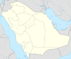 Qurayyat Location in Al Jawf Province, Saudi Arabia | |
| Coordinates: 31°19′N 037°22′E / 31.317°N 37.367°ECoordinates: 31°19′N 037°22′E / 31.317°N 37.367°E | |
| Country | |
| Province | Al Jawf (Al-Jouf) |
| Population (2010)[1] | |
| • Total | 147,550 |

Qurayyat (also Al Qurayyat or Gurayat, Arabic: القريات) is a city located in Al Jawf Province, in northern Saudi Arabia. It is 30 kilometres (19 mi) from border of Jordan. Qurayyat had a population of 147,550 at the 2010 Census.[1] It is a small city with a very big market. Qurayyat is known for its olives and salt.
Al-Hadithah border crossing[]
Al-Hadithah border crossing is the largest and most important border crossing in Saudi Arabia. It is located 30 km west of the city of Qurayyat, and is the one of the largest land crossings in the Middle East, linking to Jordan and indirectly to Syria, Lebanon and Turkey, both for people coming for Hajj and Umrah as well as for cargo export and import.
Climate[]
In Qurayyat, there is a desert climate. Most rain falls in the winter. The Köppen-Geiger climate classification is BWh. The average annual temperature in Qurayyat is 20.2 °C (68.4 °F). About 42 mm (1.65 in) of precipitation falls annually.
| hideClimate data for Qurayyat | |||||||||||||
|---|---|---|---|---|---|---|---|---|---|---|---|---|---|
| Month | Jan | Feb | Mar | Apr | May | Jun | Jul | Aug | Sep | Oct | Nov | Dec | Year |
| Average high °C (°F) | 14.9 (58.8) |
18.1 (64.6) |
22.1 (71.8) |
27.3 (81.1) |
32.2 (90.0) |
35.9 (96.6) |
37.3 (99.1) |
37.1 (98.8) |
35.2 (95.4) |
30.7 (87.3) |
22.6 (72.7) |
16.5 (61.7) |
27.5 (81.5) |
| Average low °C (°F) | 3.0 (37.4) |
5.1 (41.2) |
8.2 (46.8) |
12.5 (54.5) |
16.5 (61.7) |
19.5 (67.1) |
20.8 (69.4) |
21.4 (70.5) |
19.0 (66.2) |
15.1 (59.2) |
9.1 (48.4) |
4.3 (39.7) |
12.9 (55.2) |
| Average precipitation mm (inches) | 7 (0.3) |
5 (0.2) |
5 (0.2) |
5 (0.2) |
2 (0.1) |
0 (0) |
0 (0) |
0 (0) |
0 (0) |
4 (0.2) |
6 (0.2) |
8 (0.3) |
42 (1.7) |
| Source: Climate-Data.org,Climate data | |||||||||||||
Livelihood of the population[]
- Grazing: due to natural pastures along the Wadi Sirhan at all times of the year.
- Industry: based on agricultural products such as olive oil - and canning salt and olive extract.
- Trade: border area direct land trade.
- Agriculture: olive cultivation and some crops suited to the quality of the soil
Hospitals[]
There are two main albeit smallhospitals in Gurayat: Gurayat General Hospital and King Faisal Hospital.
Gurayat General Hospital (GGH)[]
Gurayat General Hospital is 350-bed secondary referral center with a catchment area of almost 400 km area with referrals from seven district general hospitals, each comprising 50 beds, and many primary health centres. It has almost all branches of surgery, namely, general surgery with minimal access surgical facilities, neurosurgery, urology, paediatric surgery, orthopaedics, ENT, maxillo-facial, ophthalmology.
There is a very busy accident & emergency (A & E) department, led by a general surgeon, two specialists and 14 residents, having fully equipped resuscitation room, with 5 beds, triage areas, observation rooms, cubicles, plaster and minor surgery procedure rooms (clean and dirty), Ob ER, pediatric ER. The total number of beds in ER is 27. This hospital receives emergency referrals for general surgery, neurosurgery, pediatric surgery, urology and other specialties on daily basis. As the number of population is increased in this area, so is the number of attendants in A & E with last year[when?] being just above 100,000. A & E is just next to fully equipped radiology department, having two emergency X-rays for male and female patients, with emergency facilities for two helical CT scans, and MRI, portable US, covered by radiologists on call. A & E is backed up by 20 bed fully equipped ICU, with a resident and specialist on duty round the clock, and PICU, NICU. We have a separate burn unit where major burns are treated.
Airports[]
The city has a domestic airport (IATA: URY, ICAO: OEGT) about 10 km from the center. It operates by Saudia to Riyadh and Jeddah. The nearest airport is Turaif Domestic Airport.
Other transport facilities[]
Other transport include the main bus facilities[2]
There is a new proposed railway facility going under construction, the Saudi Railway (SAR) to link Qurayyat, Saudi Arabia and Riyadh.
Buildings and structures[]
At 31.585774 N 37.900386 E there is a 468 metres high guyed radio mast. Close to this, at 31.583635 N 37.903883 E, there is a 458 metres high guyed radio mast.[1]
Schools[]
There are many Arabic schools in Gurayat. The only English IGCSE school is in Sakakah.[3] The nearest university is Al Jouf University.
Tourism[]
Al Qurayyat's most important tourist destination point is . It is located in the Ka'af village next to the castle Mountain Saidi from the east, which is a historic mansion built in 1338 AH by Sheikh Nawaf al-Shaalan before subject area of Saudi rule, a castle warship shape built of stone sedimentary limestone white witharchitectural style unique to the rocky area, and consists of a number of rooms for residential use and other management and some ammunition stores, with four towers at each corner is a square shape.
Archaeological sites[]
- Castle Mountain Saidi: located to the north-west of Ka'af castle.
References[]
- ^ Jump up to: a b "Saudi Arabia: Al-Jouf: Alquryyat". Geohive. Archived from the original on 2013-08-28.
- ^ SAPTCO and other Syrian and Jordanian buses.
- ^ Al Jouf international school
External links[]
| show Authority control |
|---|
- Populated places in Al-Jawf Province