Qurnat as Sawda'
| Qurnat as Sawdā | |
|---|---|
 Qurnat As Sawda | |
| Highest point | |
| Elevation | 3,088 m (10,131 ft) |
| Prominence | 2,393 m (7,851 ft) |
| Listing | Country high point Ultra |
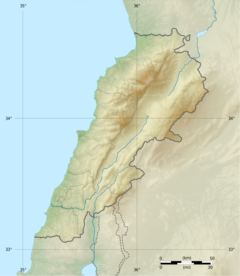
| Coordinates | 34°18′00″N 36°07′00″E / 34.30000°N 36.11667°ECoordinates: 34°18′00″N 36°07′00″E / 34.30000°N 36.11667°E |
| Naming | |
| Native name | القرنة السوداء (Arabic) |
| Geography | |
 Qurnat as Sawdā | |
| Parent range | Jabal Al-Makmel |

Qurnat as Sawdā (Arabic: القرنة السوداء), is the highest point in Lebanon and the Levant, at 3,088 meters above sea level. It is found at the peak of Mount Lebanon, a mountain range in the Bsharri District, North Lebanon.
Name[]
The mountain's name derives from the Classical Syriac ܩܪܢܬ ܣܗܕ̈ܐ (Qornet Sohde), for "Martyrs' Mountain". This, in turn, refers to late-13th century campaigns in the region by the Muslim Mamluk Sultanate during its conquest of the Christian Crusader states. Its name, like many other local toponyms, was retained even after the decline of Syriac as a vernacular tongue in the region.
References in Medieval religious literature[]
In Jacobus de Voragine's Golden Legend, the summit of Mount Lebanon (Qurnat as Sawda') is the site on which Noah, after having survived the flood, replanted a sacred tree. Voragine states that the tree's seeds were given to Seth by an angel in the Garden of Eden and placed in Adam's mouth upon his passing such that his blood could feed its growth.[1]
References[]
External links[]
This Lebanon location article is a stub. You can help Wikipedia by . |
- Mountains of Lebanon
- Highest points of countries
- Lebanon geography stubs