
RAF Appledram
RAF Appledram | |||||||||||
|---|---|---|---|---|---|---|---|---|---|---|---|
| Summary | |||||||||||
| Airport type | Military | ||||||||||
| Owner | Air Ministry | ||||||||||
| Operator | Royal Air Force | ||||||||||
| Location | Apuldram, West Sussex | ||||||||||
| Built | 1944 | ||||||||||
| In use | 1944–45 | ||||||||||
| Elevation AMSL | 16 ft / 5 m | ||||||||||
| Coordinates | 50°48′36″N 000°48′21″W / 50.81000°N 0.80583°W | ||||||||||
| Map | |||||||||||
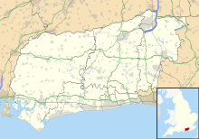 RAF Appledram Location in West Sussex | |||||||||||
| Runways | |||||||||||
| |||||||||||
RAF Appledram is a former Royal Air Force Advanced Landing Ground 2.3 miles (3.7 km) southwest of Chichester, West Sussex and 12.2 miles (19.6 km) east of Portsmouth, Hampshire.[1]
History[]
The airfield was an Advanced Landing Ground for Operation Overlord (the invasion of German-occupied Europe) as part of 11 Group, RAF Fighter Command.[2]
Posted units[]
- No. 175 Squadron RAF[3]
- No. 181 Squadron RAF[3]
- No. 182 Squadron RAF[4]
- No. 302 Polish Fighter Squadron[5]
- No. 308 Polish Fighter Squadron[6]
- No. 310 Squadron RAF[6]
- No. 312 (Czechoslovak) Squadron RAF[7]
- No. 313 Squadron RAF[7]
- No. 317 Polish Fighter Squadron[7]
- No. 124 Airfield[1]
- No. 131 (Polish) (Fighter) Wing RAF[1]
- No. 134 Airfield[1]
- [1]
- No. 411 (Polish) Repair & Salvage Unit[1]
- No. 420 Repair & Salvage Unit[1]
- No. 1312 Mobile Wing RAF Regiment[1]
- No. 1315 Mobile Wing RAF Regiment[1]
See also[]
References[]
| Wikimedia Commons has media related to RAF Appledram. |
Citations[]
- ^ a b c d e f g h i "RAF Appledram". Airfields of Britain Conservation Trust. Retrieved 23 April 2020.
- ^ "Appledram Airfield". Pastscape. English Heritage. Retrieved 20 May 2012.
- ^ a b Jefford 1988, p. 65.
- ^ Jefford 1988, p. 66.
- ^ Jefford 1988, p. 84.
- ^ a b Jefford 1988, p. 85.
- ^ a b c Jefford 1988, p. 86.
Bibliography[]
- Jefford, CG (1988). RAF Squadrons. A comprehensive record of the movement and equipment of all RAF squadrons and their antecedents since 1912. Shrewsbury: Airlife. ISBN 1-85310-053-6.
| Formations and units |
|  | ||||||
|---|---|---|---|---|---|---|---|---|
| Branches and components | ||||||||
| Reserve forces | ||||||||
| Associated civil organisations | ||||||||
| Equipment | ||||||||
| Personnel |
| |||||||
| Appointments | ||||||||
| Symbols and uniform | ||||||||
Categories:
- Royal Air Force stations in West Sussex
- Royal Air Force stations of World War II in the United Kingdom