
RAF Swingfield
RAF Swingfield | |||||||||||||||||||
|---|---|---|---|---|---|---|---|---|---|---|---|---|---|---|---|---|---|---|---|
| Summary | |||||||||||||||||||
| Airport type | Military | ||||||||||||||||||
| Operator | Royal Air Force | ||||||||||||||||||
| Location | Wootton, Kent | ||||||||||||||||||
| Built | 1916 | ||||||||||||||||||
| In use | 1917-1945 | ||||||||||||||||||
| Elevation AMSL | 458 ft / 140 m | ||||||||||||||||||
| Coordinates | 51°09′44″N 001°12′06″E / 51.16222°N 1.20167°E | ||||||||||||||||||
| Map | |||||||||||||||||||
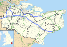 RAF Swingfield Location in Kent | |||||||||||||||||||
| Runways | |||||||||||||||||||
| |||||||||||||||||||
Royal Air Force Swingfield or more simply RAF Swingfield is a former Royal Air Force Advanced Landing Ground located 5.5 miles (8.9 km) north west of Dover, Kent and 4.5 miles (7.2 km) south of Aylesham, Kent. The airfield was operational between February 1917 and 28 April 1945.
History[]
The airfield was used by both the Royal Flying Corps and the Royal Air Force opening during February 1917 and closing on 28 April 1945.[1]
Based units[]
- [1]
- No. 119 Squadron RAF flying Fairey Albacores between 9 August 1944 and 2 October 1944[2]
- 819 Naval Air Squadron[1]
References[]
Citations[]
- ^ a b c "Swingfield". Airfields of Britain Conservation Trust. Retrieved 3 June 2012.
- ^ Jefford 1988, p. 57.
Bibliography[]
- Jefford, C G (1988). RAF Squadrons. A comprehensive record of the movement and equipment of all RAF squadrons and their antecedents since 1912. Shrewsbury: Airlife. ISBN 1-85310-053-6.
| Formations and units |
|  | ||||||
|---|---|---|---|---|---|---|---|---|
| Branches and components | ||||||||
| Reserve forces | ||||||||
| Associated civil organisations | ||||||||
| Equipment | ||||||||
| Personnel |
| |||||||
| Appointments | ||||||||
| Symbols and uniform | ||||||||
Categories:
- Royal Flying Corps airfields
- Royal Flying Corps airfields in Kent
- Royal Air Force stations in Kent
- Royal Air Force stations of World War II in the United Kingdom