Rachecourt-Suzémont
Rachecourt-Suzémont | |
|---|---|
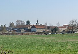 A general view of Rachecourt-Suzémont | |
show Location of Rachecourt-Suzémont | |
 Rachecourt-Suzémont | |
| Coordinates: 48°27′29″N 4°57′56″E / 48.4581°N 4.9656°ECoordinates: 48°27′29″N 4°57′56″E / 48.4581°N 4.9656°E | |
| Country | France |
| Region | Grand Est |
| Department | Haute-Marne |
| Arrondissement | Saint-Dizier |
| Canton | Wassy |
| Intercommunality | |
| Government | |
| • Mayor (2014-2020) | Didier Thierry |
| Area 1 | 3.57 km2 (1.38 sq mi) |
| Population (Jan. 2018)[1] | 105 |
| • Density | 29/km2 (76/sq mi) |
| Time zone | UTC+01:00 (CET) |
| • Summer (DST) | UTC+02:00 (CEST) |
| INSEE/Postal code | 52413 /52130 |
| Elevation | 176–240 m (577–787 ft) (avg. 180 m or 590 ft) |
| 1 French Land Register data, which excludes lakes, ponds, glaciers > 1 km2 (0.386 sq mi or 247 acres) and river estuaries. | |


Rachecourt-Suzémont is a commune in the Haute-Marne department in north-eastern France.
Population[]
| Year | Pop. | ±% |
|---|---|---|
| 2004 | 100 | — |
| 2006 | 107 | +7.0% |
| 2007 | 108 | +0.9% |
| 2008 | 108 | +0.0% |
| 2009 | 108 | +0.0% |
| 2010 | 111 | +2.8% |
| 2011 | 111 | +0.0% |
| 2012 | 110 | −0.9% |
| 2013 | 108 | −1.8% |
| 2014 | 107 | −0.9% |
| 2015 | 106 | −0.9% |
| 2016 | 104 | −1.9% |
Geography[]
The river Blaise flows through the commune.
See also[]
References[]
- ^ "Populations légales 2018". INSEE. 28 December 2020.
| Wikimedia Commons has media related to Rachecourt-Suzémont. |
This geography Haute-Marne article is a stub. You can help Wikipedia by . |
Categories:
- Communes of Haute-Marne
- Haute-Marne geography stubs