Raleigh, North Dakota
Raleigh, North Dakota | |
|---|---|
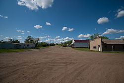 Street in Raleigh | |
 Raleigh | |
| Coordinates: 46°21′26″N 101°18′19″W / 46.35722°N 101.30528°W | |
| Country | United States |
| State | North Dakota |
| County | Grant |
| Area | |
| • Total | 0.287 sq mi (0.74 km2) |
| • Land | 0.287 sq mi (0.74 km2) |
| • Water | 0 sq mi (0 km2) |
| Elevation | 2,057 ft (627 m) |
| Population | |
| • Total | 12 |
| • Density | 42/sq mi (16/km2) |
| Time zone | UTC-7 (Mountain (MST)) |
| • Summer (DST) | UTC-6 (MDT) |
| Area code(s) | 701 |
| GNIS feature ID | 2584354[3] |


Raleigh is a census-designated place (CDP) in Grant County, North Dakota, United States. An unincorporated community, it was designated as part of the U.S. Census Bureau's Participant Statistical Areas Program on March 31, 2010.[4] It was not counted separately during the 2000 Census,[5] but was included in the 2010 Census,[6] where a population of 12 was reported.[7]
Geography[]
Raleigh is located at 46°21′28″N 101°18′23″W / 46.35778°N 101.30639°W (46.357781 -101.306528).[4] It is located in the northeast quarter of section 12 of Township 133 north, Range 86 west.[8] The post office opened October 1, 1910, with Charles C. Leonard as postmaster, after he moved his general store here from Dogtooth, a nearby town and post office which soon afterward ceased to exist.[8][9]
History[]
Raleigh is situated in what was originally Morton County but today is Grant County. Raleigh was created as a coaling stop along the Milwaukee Road branch line that separated from the railroad's Pacific Extension in McLaughlin, South Dakota and ran to New England, North Dakota. The name comes from Sir Walter Raleigh and was settled by a wave of German Russians who had previously settled near Strasburg in Emmons County.[8]
References[]
- ^ "US Gazetteer files: 2010, 2000, and 1990". United States Census Bureau. 2011-02-12. Retrieved 2011-04-23.
- ^ "U.S. Census website". United States Census Bureau. Retrieved 2011-05-14.
- ^ "Raleigh". Geographic Names Information System. United States Geological Survey.
- ^ a b "Raleigh Census Designated Place". Geographic Names Information System. United States Geological Survey.
- ^ U.S. Census Bureau (2003). "Population and Housing Unit Counts, North Dakota" (PDF). 2000 Census of Population and Housing. Government Printing Office. Retrieved 2008-07-20.
- ^ U.S. Census Bureau (February 13, 2008). "Census Designated Place (CDP) Program for the 2010 Census—Final Criteria" (PDF). Federal Register. Archived from the original (PDF) on October 18, 2010. Retrieved 2010-07-13.
- ^ "2010 Census Redistricting Data (Public Law 94-171) Summary File". American FactFinder. United States Census Bureau. Retrieved 2 May 2011.[dead link]
- ^ a b c Wick, Douglas A. (1988). North Dakota Place Names. Bismarck, North Dakota: Hedemarken Collectibles. ISBN 0-9620968-0-6. OCLC 191277027.
- ^ http://geonames.usgs.gov/pls/gnispublic/f?p=132:3:4226366677584152::NO:3:P3_FID,P3_TITLE:1030835%2CRaleigh
Coordinates: 46°21′28″N 101°18′24″W / 46.357781°N 101.306528°W
Municipalities and communities of Grant County, North Dakota, United States | ||
|---|---|---|
| Cities |  | |
| Townships | ||
| Unorganized territories | ||
| CDPs | ||
| Other communities | ||
| Ghost town | ||
| ||
| Counties |  | |
|---|---|---|
| Core cities | ||
| Surrounding areas | ||
- German-Russian culture in North Dakota
- Census-designated places in Grant County, North Dakota
- Census-designated places in North Dakota
- Unincorporated communities in North Dakota
- Unincorporated communities in Grant County, North Dakota