Ramorino Glacier
| Ramorino Glacier | |
|---|---|
 Location of Vinson Massif in Western Antarctica | |
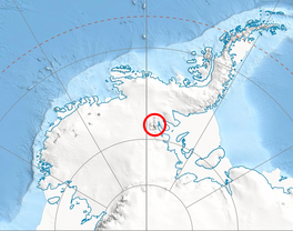
 Location of Ramorino Glacier in Antarctica | |
| Type | tributary |
| Location | Ellsworth Land |
| Coordinates |  78°24′00″S 85°38′00″W / 78.40000°S 85.63333°W / -78.40000; -85.63333 78°24′00″S 85°38′00″W / 78.40000°S 85.63333°W / -78.40000; -85.63333 |
| Length | 4.5 nautical miles (8.3 km; 5.2 mi) |
| Thickness | unknown |
| Terminus | Crosswell Glacier |
| Status | unknown |

Ramorino Glacier ( WikiMiniAtlas78°24′S 85°38′W / 78.400°S 85.633°W / -78.400; -85.633) is the 4.5 nautical miles (8.3 km; 5.2 mi) long glacier situated northwest of upper Crosswell Glacier and southeast of Cervellati Glacier on the east slope of Sentinel Range in the Ellsworth Mountains, Antarctica. It flows northeastwards between Epperly Ridge and Shinn Ridge, and enters Crosswell Glacier northwest of Mount Segers. The feature was named by US-ACAN in 2006 after Maria Chiara Ramorino, manager of the Italian team that compiled and promulgated the SCAR Composite Gazetteer of Antarctica, 1998–2006.
Contents
Maps[]
- Vinson Massif. Scale 1:250 000 topographic map. Reston, Virginia: US Geological Survey, 1988.
- Antarctic Digital Database (ADD). Scale 1:250000 topographic map of Antarctica. Scientific Committee on Antarctic Research (SCAR). Since 1993, regularly updated.
See also[]
- List of glaciers in the Antarctic
- Glaciology
References[]
 This article incorporates public domain material from the United States Geological Survey document: "Ramorino Glacier". (content from the Geographic Names Information System)
External links[]
- Ramorino Glacier SCAR Antarctic Gazetteer.
Glaciers | |||||||
|---|---|---|---|---|---|---|---|
| Types |
| ||||||
| Anatomy |
| ||||||
| Processes |
| ||||||
| Measurements |
| ||||||
| Volcanic relations | |||||||
| Landforms |
| ||||||
| |||||||
Glaciers in the Antarctic | |
|---|---|
|
Glaciers of Ellsworth Land | |
|---|---|
|
This article about a glacier in Ellsworth Land is a stub. You can help Wikipedia by . |
- v
- t
- Glaciers of Ellsworth Land
- Ellsworth Land glacier stubs
- Coordinates on Wikidata
- Wikipedia articles incorporating text from the USGS Geographic Names Information System
- All stub articles