Rawene
Rawene | |
|---|---|
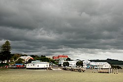 Rawene, as viewed from the sea | |
 Rawene | |
| Coordinates: 35°23′46″S 173°30′18″E / 35.39611°S 173.50500°ECoordinates: 35°23′46″S 173°30′18″E / 35.39611°S 173.50500°E | |
| Country | New Zealand |
| Region | Northland Region |
| District | Far North District |

Rawene is a town on the south side of the Hokianga harbour, in Northland, New Zealand. State Highway 12 passes to the south.[1] The town lies at the apex of a peninsula. A car ferry links it to Kohukohu and the northern Hokianga.[2]
Demographics[]
| Year | Pop. | ±% p.a. |
|---|---|---|
| 2006 | 1,065 | — |
| 2013 | 1,239 | +2.19% |
| 2018 | 1,236 | −0.05% |
| Source: [3] | ||
The statistical area of Hokianga South, which at 126 square kilometres is much larger than Rawene, covers the southern side of Hokianga Harbour between Rawene and Koutu.
Hokianga South had a population of 1,236 at the 2018 New Zealand census, a decrease of 3 people (-0.2%) since the 2013 census, and an increase of 171 people (16.1%) since the 2006 census. There were 444 households. There were 612 males and 624 females, giving a sex ratio of 0.98 males per female. Of the total population, 270 people (21.8%) were aged up to 15 years, 162 (13.1%) were 15 to 29, 531 (43.0%) were 30 to 64, and 273 (22.1%) were 65 or older. Figures may not add up to the total due to rounding.
Ethnicities were 52.4% European/Pākehā, 63.1% Māori, 6.3% Pacific peoples, 1.5% Asian, and 1.5% other ethnicities. People may identify with more than one ethnicity.
The percentage of people born overseas was 10.4, compared with 27.1% nationally.
Although some people objected to giving their religion, 42.7% had no religion, 41.5% were Christian, and 8.3% had other religions.
Of those at least 15 years old, 129 (13.4%) people had a bachelor or higher degree, and 198 (20.5%) people had no formal qualifications. The median income was $18,700. The employment status of those at least 15 was that 288 (29.8%) people were employed full-time, 162 (16.8%) were part-time, and 66 (6.8%) were unemployed.[3]
History[]

Rawene started as a timber centre, with a mill and shipyards[4] established in the early 19th century. An attempted settlement by the first New Zealand Company in 1826 failed.[2] Captain James Herd in 1822 had taken out the first shipment of kauri from the Hokianga in his ship Providence. In 1825 he returned as an agent for the Company, sailing the Rosanna in company with the Lambton,[5] and 60 settlers between the two vessels. Starting at Stewart Island/Rakiura,[6] Herd sailed up the east coast eventually rounding North Cape to enter Hokianga - his old stamping ground. Herd negotiated to buy a vast tract of land.[7] The deal was contested[by whom?] but for decades Europeans referred to the town as "Herd's Point".[8] Later it was called "Hokianga Township", and in 1884 it became "Rawene", possibly to identify the post office and telegraph.[9][need quotation to verify]
The post office had started operating by 1845 - one of eight in the country.[10]
Aperahama Taonui, chief of Te Popoto hapū, allegedly operated a school at Rawene in the mid-19th century.[11]
James Reddy Clendon, previously the United States Consul to New Zealand, settled in Rawene in 1862 and served as the local magistrate under the until 1867.[12] His house still stands and is open to the public.[13]
By 1872 Rawene had two hotels and two stores. There was a Wesleyan church, and the Roman Catholics owned a section. Von Sturmer was the Postmaster, Customs Officer and Magistrate.[14]
During the Dog Tax War of 1898 the residents of Rawene left for Kohukohu or took refuge on a steamer after the tax rebels threatened to march on the town.[15] On 5 May 1898 120 men marched from Rawene to Waima to deal with the "rebels", but the dispute was settled without them.[16]

A small cottage hospital was built on a hill overlooking the town in 1910.[17] A new hospital was completed in 1928.[18] Dr George McCall Smith headed the hospital from 1914 to 1948 and developed a unique health-system for the Hokianga.[19]
Dr Smith became a practitioner of "painless childbirth" in the early 1930s, using premedication with the barbiturate Nembutal combined with Hyoscine. This proved very popular and attracted women to Rawene from far afield. The annual average of thirty births per year now peaked at two hundred. In 1937 a "Commission of Inquiry into Maternity Services" investigated Smith's practice. Smith fronted up with case notes on his last two hundred patients, and his results could not be bettered anywhere.[20]
Parliament declared a special health area in the 1940s.[21] This meant that all medical officers in the Hokianga were salaried, and all consultations, pharmaceuticals, investigations and hospital admissions were free. The whole scheme was funded through a per-capita grant.[2][22][23]
Education[]
Rawene School is a coeducational full primary (years 1-8) school[24] has a roll of 70 students as of March 2021.[25]
A room for secondary students was added to Rawene Primary School in 1922. In 1947 a stand-alone Rawene District High School was built. It was extended in 1952, but was destroyed by fire in 1972.[9][26]
The Rawene Learning Centre is a campus of NorthTec polytechnic.[27][28]
Notable people[]
- Norm Maxwell, rugby union footballer and All Black.
- Ron Guthrey, mayor of Christchurch (1968 to 1971).
- Gordon Cochrane, WWII RNZAF bomber pilot.
- René Shadbolt, nurse in Spanish Civil War, Hokianga hospital matron
- George McCall Smith, doctor, medical superintendent, community leader
References[]
- ^ Roger Smith, GeographX (2005). The Geographic Atlas of New Zealand. Robbie Burton. map 22. ISBN 1-877333-20-4.
- ^ Jump up to: a b c "Hokianga district". Te Ara: The Encyclopedia of New Zealand.
- ^ Jump up to: a b "Statistical area 1 dataset for 2018 Census". Statistics New Zealand. March 2020. Hokianga South (102100). 2018 Census place summary: Hokianga South
- ^ Most shipbuilding in the Hokianga occurred at Kohukohu, New Zealand and Horeke
- ^
Moon, Paul (2012). A Savage Country. Penguin Books Limited. ISBN 9781742532431. Retrieved 2016-05-03.
The company acquired two ships – the Rosanna and the Lambton – with James Herd, whom the Company had appointed to lead the expedition, as captain of the former.
- ^ Moon, Paul (2013). "Thomas Shepherd and the First New Zealand Company" (PDF). New Zealand Journal of History. 47.
- ^ The deed lies in National Archives in Wellington, with a photocopy held by the Hokianga Historical Society.
- ^ McDonnell, Hilda (2002). "Northern New Zealand". The Rosanna Settlers (PDF). p. 72.
- ^ Jump up to: a b Irvine, Jean (1976). Township of Rawene.
- ^ "POST OFFICE - HISTORY". Encyclopedia of New Zealand (1966).
- ^ "TAONUI, Aperahama". Encyclopedia of New Zealand (1966).
- ^ "Clendon, James Reddy". Dictionary of New Zealand Biography.
- ^ "Northland Heritage Sites". Heritage New Zealand.
- ^ Olive Harris and Chris Lancaster, ed. (2006). "The Pioneers Reminisce - Memoirs of Alfred Cooke Yarborough". Remember the Hokianga. p. 162. ISBN 978-0-473-11859-4.
- ^ Alfred Cooke Yarborough in Remember the Hokianga p 164
- ^ "HOKIANGA AND HARBOUR". Encyclopedia of New Zealand (1966).
In May 1898 Hokianga was the scene of the famous "Dog Tax Rebellion". This arose when the Mahurehure hapu of Ngapuhi tribe refused to pay a dog tax recently instituted by the local county council. On 5 May 120 men of the Permanent Force under Colonel Newall marched from Rawene to Waima, the seat of the "rebellion", only to find that Hone Heke, M.H.R., had already interceded to preserve the peace.
- ^ "Northland - Hospital services". Te Ara: The Encyclopedia of New Zealand.
- ^ "History: The Hospital in 1928". Hokianga Health Enterprise Trust.
- ^ Parkes, W. F. (August 2004). A Northland Legend: Dr G.M. Smith of Rawene 1883 – 1958. . ISBN 0-476-00851-4.
- ^ Parkes, pp 18-19
- ^ Parliament gazetted the scheme on 1 September 1941 (NZ Gazette, 28 August 1941, p2702, but it lay in limbo until September 1945 before a "trial period" could begin. By 1947 the hospital boards in Northland were amalgamated but Hokianga retained its special area - it was finally official.
- ^ Parkes, pp 22-23
- ^ "History: Dr G M Smith". Hokianga Health Enterprise Trust.
- ^ Education Counts: Rawene School
- ^ "New Zealand Schools Directory". New Zealand Ministry of Education. Retrieved 27 April 2021.
- ^ "Arson suspected in two fires". The New Zealand Herald. 20 April 2006.
- ^ "CAMPUSES : RAWENE". NorthTec.
- ^ "Rawene". NorthTec. Retrieved 4 March 2010.
External links[]
 Rawene travel guide from Wikivoyage
- Rawene - Hokianga's Picturesque Port Town
- rawene.nz
- [1]
| hide Authority control | |
|---|---|
| General |
|
| National libraries | |
- Far North District
- Hokianga
- Populated places in the Northland Region