Richfield Township, Adams County, Illinois
Richfield Township | |
|---|---|
 Location in Adams County | |
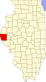 Adams County's location in Illinois | |
| Coordinates: 39°47′35″N 91°04′56″W / 39.79306°N 91.08222°WCoordinates: 39°47′35″N 91°04′56″W / 39.79306°N 91.08222°W | |
| Country | United States |
| State | Illinois |
| County | Adams |
| Established | November 6, 1849 |
| Area | |
| • Total | 38.03 sq mi (98.5 km2) |
| • Land | 38.01 sq mi (98.4 km2) |
| • Water | 0.02 sq mi (0.05 km2) 0.05% |
| Elevation | 663 ft (202 m) |
| Population (2010) | |
| • Estimate (2016)[1] | 406 |
| • Density | 10.8/sq mi (4.2/km2) |
| Time zone | UTC-6 (CST) |
| • Summer (DST) | UTC-5 (CDT) |
| ZIP codes | 62312, 62347, 62365 |
| FIPS code | 17-001-63550 |

Richfield Township is one of twenty-two townships in Adams County, Illinois, United States. As of the 2010 census, its population was 411 and it contained 183 housing units.[2]
Geography[]
According to the 2010 census, the township has a total area of 38.03 square miles (98.5 km2), of which 38.01 square miles (98.4 km2) (or 99.95%) is land and 0.02 square miles (0.052 km2) (or 0.05%) is water.[2]
Unincorporated towns[]
Cemeteries[]
The township contains seven cemeteries: Baker Family, Franks, Klarner, Lock Family, Potter, Rice Family and Shiloh.
Major highways[]
 Illinois State Route 104
Airports and landing strips[]
- Dale A Klassing Airport
Demographics[]
| Historical population | |||
|---|---|---|---|
| Census | Pop. | %± | |
| 2016 (est.) | 406 | [1] | |
| U.S. Decennial Census[3] | |||
School districts[]
- Barry Community Unit School District 1
- Liberty Community Unit School District 2
- Payson Community Unit School District 1
Political districts[]
- Illinois' 18th congressional district
- State House District 93
- State Senate District 47
References[]
- "Richfield Township, Adams County, Illinois". Geographic Names Information System. United States Geological Survey. Retrieved 2010-01-04.
- United States Census Bureau 2007 TIGER/Line Shapefiles
- United States National Atlas
- ^ a b "Population and Housing Unit Estimates". Retrieved June 9, 2017.
- ^ a b "Population, Housing Units, Area, and Density: 2010 - County -- County Subdivision and Place -- 2010 Census Summary File 1". United States Census. Archived from the original on 2020-02-12. Retrieved 2013-05-28.
- ^ "Census of Population and Housing". Census.gov. Retrieved June 4, 2016.
External links[]
Places adjacent to Richfield Township, Adams County, Illinois | |
|---|---|
Municipalities and communities of Adams County, Illinois, United States | ||
|---|---|---|
| City | ||
| Town | ||
| Villages | ||
| Townships | ||
| CDPs | ||
| Other communities | ||
| ||
Categories:
- Townships in Adams County, Illinois
- 1849 establishments in Illinois
- Populated places established in 1849
- Townships in Illinois