Richland Township, Barton County, Missouri
Richland Township | |
|---|---|
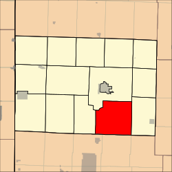 Location in Barton County | |
| Coordinates: 37°25′42″N 094°12′53″W / 37.42833°N 94.21472°WCoordinates: 37°25′42″N 094°12′53″W / 37.42833°N 94.21472°W | |
| Country | United States |
| State | Missouri |
| County | Barton |
| Area | |
| • Total | 50.71 sq mi (131.33 km2) |
| • Land | 50.55 sq mi (130.91 km2) |
| • Water | 0.16 sq mi (0.42 km2) 0.32% |
| Elevation | 958 ft (292 m) |
| Population (2000) | |
| • Total | 611 |
| • Density | 12.1/sq mi (4.7/km2) |
| GNIS feature ID | 0766286 |

Richland Township is a township in Barton County, Missouri, USA. As of the 2000 census, its population was 611.
Richland Township was so named on account of their fertile soil.[1]
Geography[]
Richland Township covers an area of 50.71 square miles (131.3 km2) and contains no incorporated settlements.
The streams of Dorris Creek, Little Coon Creek and West Fork Spring River run through this township.
References[]
- ^ "Barton County Place Names, 1928-1945 (archived)". The State Historical Society of Missouri. Archived from the original on 24 June 2016. Retrieved 31 August 2016.CS1 maint: bot: original URL status unknown (link)
External links[]
Municipalities and communities of Barton County, Missouri, United States | ||
|---|---|---|
| Cities |  | |
| Villages | ||
| Townships | ||
| CDPs | ||
| Other communities | ||
| Ghost towns | ||
| ||
This Barton County, Missouri state location article is a stub. You can help Wikipedia by . |
Categories:
- Townships in Barton County, Missouri
- Townships in Missouri
- Southwest Missouri geography stubs