Roadside 165F
Roadside 165F | |
|---|---|
| Roadside Indian Reserve No. 165F | |
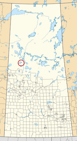 Location in Saskatchewan | |
| First Nation | Canoe Lake |
| Country | Canada |
| Province | Saskatchewan |
| Area | |
| • Total | 0.4 ha (1.0 acre) |
Roadside 165F is an Indian reserve of the Canoe Lake Cree First Nation in Saskatchewan.[1][2]
References[]
- ^ a b "Reserve/Settlement/Village Detail". Indigenous and Northern Affairs Canada. Government of Canada. Retrieved August 12, 2019.
- ^ "Canada Lands Survey System - CLSS Map Browser". Natural Resources Canada. Retrieved 2019-10-09.
| Subdivisions | |
|---|---|
| Communities | |
| Cities | |
| Topics |
|
| |
Coordinates: 55°08′02″N 108°08′53″W / 55.1339°N 108.1481°W

This article about a location in the Census Division No. 18 of Saskatchewan is a stub. You can help Wikipedia by . |
This article about an Indian reserve in Saskatchewan is a stub. You can help Wikipedia by . |
Categories:
- Indian reserves in Saskatchewan
- Division No. 18, Saskatchewan
- Saskatchewan Division No. 18 geography stubs
- Saskatchewan Indian reserve stubs