Robertsfors Municipality
Robertsfors Municipality
Robertsfors kommun | |
|---|---|
 | |
 Coat of arms | |
 | |
| Coordinates: 64°12′N 20°51′E / 64.200°N 20.850°ECoordinates: 64°12′N 20°51′E / 64.200°N 20.850°E | |
| Country | Sweden |
| County | Västerbotten County |
| Seat | Robertsfors |
| Area | |
| • Total | 2,369.65 km2 (914.93 sq mi) |
| • Land | 1,292.21 km2 (498.93 sq mi) |
| • Water | 1,077.44 km2 (416.00 sq mi) |
| Area as of 1 January 2014. | |
| Population (31 December 2019)[2] | |
| • Total | 6,747 |
| • Density | 2.8/km2 (7.4/sq mi) |
| Time zone | UTC+1 (CET) |
| • Summer (DST) | UTC+2 (CEST) |
| ISO 3166 code | SE |
| Province | Västerbotten |
| Municipal code | 2409 |
| Website | www.robertsfors.se |

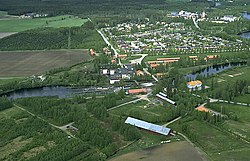
Robertsfors Municipality (Swedish: Robertsfors kommun) is a municipality in Västerbotten County in northern Sweden. Its seat is located in Robertsfors.
History[]
In 1759 the small village Edfastmark became Robertsfors Bruk. It was the Irishman and his brother-in-law, the Scotsman , who founded the new ironworks which also got its name, Robertsfors, from Robert Finlay.[3]
Localities[]

There are three localities (or urban areas) in Robertsfors Municipality:[4]
| # | Locality | Population |
|---|---|---|
| 1 | Robertsfors | 2,010 |
| 2 | Ånäset | 622 |
| 3 | Bygdeå | 506 |
The municipal seat in bold
Notable natives[]
- Carl Olof Rosenius, revivalist preacher
- Frida Hyvönen, artist
- Maud Olofsson, politician
- Sahara Hotnights, rock group
References[]
- ^ "Statistiska centralbyrån, Kommunarealer den 1 januari 2014" (in Swedish). Statistics Sweden. 1 January 2014. Archived from the original (Microsoft Excel) on 27 September 2016. Retrieved 18 April 2014.
- ^ "Folkmängd i riket, län och kommuner 31 december 2019" (in Swedish). Statistics Sweden. 20 February 2020. Retrieved 20 February 2020.
- ^ Official site (in Swedish)
- ^ Statistics Sweden as of December 31, 2005
External links[]
 Media related to Robertsfors Municipality at Wikimedia Commons
- Robertsfors Municipality – Official site (in Swedish)
Places adjacent to Robertsfors Municipality | ||||||||||||||||
|---|---|---|---|---|---|---|---|---|---|---|---|---|---|---|---|---|
| ||||||||||||||||
Municipalities and seats of Västerbotten County | ||
|---|---|---|
| Municipalities | ||
| Municipal seats | ||
Categories:
- Municipalities of Västerbotten County