Rockport Reservoir
| Rockport Reservoir | |
|---|---|
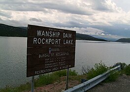 Rockport Lake, June 2009 | |
 Rockport Reservoir | |
| Location | Summit County, Utah, United States |
| Coordinates | 40°47′24″N 111°24′15″W / 40.79000°N 111.40417°WCoordinates: 40°47′24″N 111°24′15″W / 40.79000°N 111.40417°W |
| Type | reservoir |
| Primary inflows | Weber River |
| Primary outflows | Weber River |
| Basin countries | United States |
| Surface area | 1,080 acres (440 ha)[1] |
| Water volume | 2.4 square miles (6.2 km2) |
| Surface elevation | 5,955 feet (1,815 m)[2] |


Rockport Reservoir, also called Wanship Reservoir, is a reservoir along the Weber River within the Rockport State Park in southwestern Summit County, Utah, United States.

Description[]
Rockport Reservoir is located just south of the town of Wanship on Utah State Route 32. It is an impoundment on the Weber River, created by the Waship Dam.
The reservoir was named for the former town of Rockport, which it almost completely submerged in the 1950s.
Wanship Dam[]
Wanship Dam is a 175 feet (53 m) high embankment dam. It has a crest length of 2,015 feet (614 m). It was built as part of the Weber Basin project between 1954 and 1957.[3]
State Park[]
Rockport State Park is a 550-acre (2.2 km2) state park. The park is used for fishing, waterskiing, swimming, and boating on Rockport Reservoir. There are eight campgrounds, featuring a total of 36 RV sites, and 86 tent sites. A cross-country skiing trail is available during the winter.[1]
See also[]
References[]
- ^ Jump up to: a b "Rockport State Park". stateparks.utah.gov. . Retrieved September 20, 2021.
- ^ United States Geological Survey
- ^ United States Bureau of Reclamation (May 18, 2021). "Wanship Dam". United States Department of the Interior. Retrieved May 18, 2021.
External links[]
| Wikimedia Commons has media related to Rockport Reservoir. |
| Wikimedia Commons has media related to Rockport State Park (Utah). |
- Official website
- "Report on Rockport Reservoir" (PDF). (292 KiB) by the Utah Division of Water Quality
- Rockport fishing info on utahfishinginfo.com
- WesternBass.com
| Authority control |
|---|
This article about a location in Utah is a stub. You can help Wikipedia by . |
- Reservoirs in Utah
- Lakes of Summit County, Utah
- Buildings and structures in Summit County, Utah
- State parks of Utah
- Protected areas of Summit County, Utah
- 1950s establishments in Utah
- Utah geography stubs