Rohožník, Malacky District
Rohožník | |
|---|---|
Municipality | |
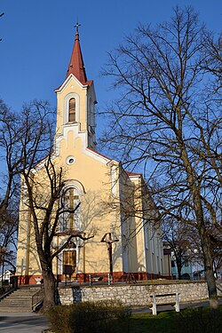 Church of the Assumption of the Virgin Mary | |
 Coat of arms | |
| Nickname(s): Ralboch | |
 Rohožník Location of Rohožník in the Bratislava Region | |
| Coordinates: 48°27′19″N 17°10′3″E / 48.45528°N 17.16750°ECoordinates: 48°27′19″N 17°10′3″E / 48.45528°N 17.16750°E | |
| Country | Slovakia |
| Region | Bratislava |
| District | Malacky |
| First mentioned | 1397 |
| Government | |
| • Mayor | |
| Area | |
| • Total | 27.44 km2 (10.59 sq mi) |
| Elevation | 201 m (659 ft) |
| Population (31.12.2013) | |
| • Total | 3,456 |
| • Density | 130/km2 (330/sq mi) |
| Time zone | UTC+1 (CET) |
| • Summer (DST) | UTC+2 (CEST) |
| Postal code | 906 38 |
| Area code(s) | 421-2 |
| Car plate | MA |
| Website | www.rohoznik.sk |


Rohožník (German: Rohrbach) is a village in Malacky District in the Bratislava Region of western Slovakia close to the town of Malacky, northwest of Slovakia's capital Bratislava.
History[]
First historical record about the village is from book of Hungarian historian "Sacra concilia ecclesiae Romano-catholicae in regno Hungariae celebrata" from year 1397.
Geography[]
The village lies at an altitude of 201 metres and covers an area of 27.44 km2.
External links[]
![]() Media related to Rohožník (Malacky District) at Wikimedia Commons
Media related to Rohožník (Malacky District) at Wikimedia Commons
- Official page
- http://www.statistics.sk/mosmis/eng/run.html
- "..::Obec Rohožník::." rohoznik.sk. Retrieved 2015-11-09.
- Peterffy, C. (1742). Sacra concilia ecclesiae romano-catholicae in regno Hungariae celebrata. Typis Haeredum Royerianrum. Retrieved 2015-11-09.
| hide Municipalities of Malacky District | ||
|---|---|---|
| Authority control |
|
|---|
This Bratislava location article is a stub. You can help Wikipedia by . |
Categories:
- Villages and municipalities in Malacky District
- Bratislava Region geography stubs