Záhorská Ves
Záhorská Ves | |
|---|---|
Village | |
 | |
 Záhorská Ves Location of Záhorská Ves in the Bratislava Region | |
| Coordinates: 48°22′N 16°51′E / 48.367°N 16.850°ECoordinates: 48°22′N 16°51′E / 48.367°N 16.850°E | |
| Country | Slovakia |
| Region | Bratislava |
| District | Malacky |
| First mentioned | 1557 |
| Area | |
| • Total | 13.06 km2 (5.04 sq mi) |
| Elevation | 149 m (489 ft) |
| Population (2005-12-31) | |
| • Total | 1,632 |
| • Density | 120/km2 (320/sq mi) |
| Time zone | UTC+1 (CET) |
| • Summer (DST) | UTC+2 (CEST) |
| Postal code | 900 65 |
| Area code(s) | 421-34 |
| Car plate | MA |
| Website | http://www.zahorskaves.sk |


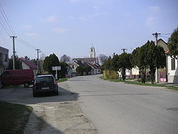
Záhorská Ves (previous name: Uhorská Ves; German: Ungeraiden; Hungarian: Magyarfalu) is a village situated north of Bratislava, the capital city of Slovakia. It is part of the Malacky District and Bratislava Region. The village is located on the Morava river, which forms the border between Slovakia and Austria. A river ferry operates between the village and Angern an der March in Austria
Záhorská Ves is the westernmost settlement in Slovakia and is located near the westernmost point in Slovakia (around 48°23′N 16°50′E / 48.383°N 16.833°E)
Záhorská Ves has a population of 1,632 and area of 13.06 km² at an altitude of 149 m.
The settlement was first mentioned in 1557. Opera singer Lucia Popp was born there in 1939.
References[]
External links[]
![]() Media related to Záhorská Ves at Wikimedia Commons
Media related to Záhorská Ves at Wikimedia Commons
| show Municipalities of Malacky District |
|---|
| show Authority control |
|---|
This Bratislava location article is a stub. You can help Wikipedia by . |
- Villages and municipalities in Malacky District
- Austria–Slovakia border crossings
- Bratislava Region geography stubs