Roman conquest of Anglesey
| Roman conquest of Anglesey | |||||||
|---|---|---|---|---|---|---|---|
| Part of the Roman conquest of Britain | |||||||
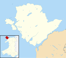 Anglesey within Wales. | |||||||
| |||||||
| Belligerents | |||||||
| Roman Empire | Britons | ||||||
| Commanders and leaders | |||||||
|
Gaius Suetonius Paulinus Agricola | |||||||
| Strength | |||||||
| ? | ? | ||||||
| Casualties and losses | |||||||
| ? | ? | ||||||
The Romans invaded north-west Wales in 60/61 CE after subjugating much of southern Britain.[1] Anglesey, recorded in Latin as Mona and still the island of Môn in modern Welsh, at the north-west corner of Wales, was a centre of resistance to Rome.[2]
In 60/61 CE Suetonius Paulinus, governor of Britannia led a successful assault on the island; he was drawn away by a revolt led by Boudica.[3] The next invasion in 77 CE was led by Gnaeus Julius Agricola. It led to long-term Roman occupation.
Both of these invasions of Anglesey were recorded by the Roman historian Tacitus. The first is described in his last work The Annals, written as a history of the Roman empire from Tiberius' reign until Nero's.[4] The second invasion is detailed in Tacitus' work The Life of Gnaeus Julius Agricola, which was written to record and extol the life and accomplishments of Tacitus' father-in-law.[5] Tacitus may have used first-hand accounts from Agricola, who had been present with the Roman forces on both occasions.
After the conquest, no surviving Roman literature mentions Anglesey. Archaeologists have located a fort dated shortly after the conquest; later, in the middle of the Roman period, there was a trading settlement on the shore of the Menai Strait. In the last decades of Roman rule there are military installations on the northern and western coasts,[6] and a village of huts huddled together on a hill for defence. However, no major civic centres nor prestigious dwellings are known from the island, and cultural change seems to have been much less than in most other parts of the Empire.
First invasion (60 CE)[]
The first invasion of Anglesey took place in 60 or 61 CE following Suetonius Paulinus' success in other parts of the province, subjugating British tribes and establishing Roman forts.[1] Tacitus writes:
Britain was in the hands of Suetonius Paulinus, who in military knowledge and in popular favour, which allows no one to be without a rival, vied with Corbulo, and aspired to equal the glory of the recovery of Armenia by the subjugation of Rome's enemies. He therefore prepared to attack the island of Mona which had a powerful population and was a refuge for fugitives. Tacitus, who later married the daughter of Suetonius Paulinus's young aide-de-camp, Gnaeus Julius Agricola, may have heard first-hand accounts of the campaign and even of Suetonius's personal comments.
The decision to invade may also have been motivated by information about copper mines on Anglesey.[7]
Approach and crossing[]
Tacitus says:
[Suetonius Paulinus] built flat-bottomed vessels to cope with the shallows, and uncertain depths of the sea. Thus the infantry crossed, while the cavalry followed by fording, or, where the water was deep, swam by the side of their horses.
He does not state where these boats were built, perhaps Chester, where a few pre-Flavian coins may indicate an early base whose role would have been tied to the movement of troops by sea along the coasts of north Wales.[8]
Marshy ground to the west of Chester made it a poor base for overland penetration of North Wales, and Suetonius' march to the Menai Strait may have used the oldest known crossing of the river River Dee, some 13km south of Chester at Holt.[9] An army moving on foot along the north coast of Wales would have first seen Anglesey from the mouth of the Sychnant Pass near Abergwyngregyn, where the three land routes converge.[10]
The Roman forces then had to cross the Menai Strait, a narrow strip of water that separates the island of Anglesey from the rest of the Welsh mainland. The sea crossing would be short and relatively easy at slack water, but at full strength the tidal currents can be up to 7.5 knots with much turbulence in the narrower and rockier sections.[11] Local knowledge, at least a long enough period of observation to predict the tidal currents with reasonable accuracy, would be required to plan safe transit.[12] (The later invasion under Agricola took the natives by surprise because they had expected to see a fleet in plenty of time to gather for their defence of the island.)
The locations of the Menai crossing are not known and modern suggestions are purely speculative. William Manning suggested that a possible site is at the northern end of the Strait, near the present city of Bangor,[1] easily accessible from the Sychnant Pass, where travellers on the mediaeval ferry set out across the Lavan Sands to cross the Strait.[13] The Lavan Sands at low tide would be an appropriate place to ground and load flat-bottomed boats, and to assemble cavalry ready to swim. The path across the sand flats is some 4.5km, but the sea crossing would be only some 240 metres at the lowest state of the tide.[14] If Suetonius had established a camp a little further west, across the River Ogwen on the present site of Penrhyn Castle, Bangor Flats would have offered a similar 240-metre crossing, reached by only some 1.5km on tidal sand flats. The attackers would need to time their movement across the tidal flats with care, to avoid being caught by the incoming tide before the boats were loaded and the swimming units in position. Both of these locations would require the Roman troops landing on Anglesey to fight up slopes that rise steeply almost from the water's edge.
The parish of Llanidan is on Anglesey, towards the southwestern end of the Menai Strait. In 1867 it was suggested that local field names "Maes Hir Gad" (Area of long battle) and "Cae Oer Waedd" (Field of cold or bitter lamentation) may indicate the site of a Roman attack.[15] The Llanidan location requires a longer sea crossing (some 830 metres at high tide) and offers less violent currents, less turbulence, and gentler slopes up from the sea shore. A land force moving from the north coast of Wales to cross to Llanidan would have to cross an area of high ground, or move through a glacially-deepened valley between steep slopes that offer possible ambush positions.
Opposition[]
The landing was opposed by a mass of warriors and women. Tacitus describes the scene:
On the shore stood the opposing army with its dense array of armed warriors, while between the ranks dashed women, in black attire like the Furies, with hair dishevelled, waving brands. All around, the Druids, lifting up their hands to heaven, and pouring forth dreadful imprecations, scared our soldiers by the unfamiliar sight, so that, as if their limbs were paralysed, they stood motionless, and exposed to wounds.[16] Roman soldiers are not often described as scared to paralysis and their reception must have been an extraordinary experience even for professional soldiers.
However, the Romans rallied, and won a savage victory over people who they regarded as savages. Tacitus reports:
Then urged by their general's appeals and mutual encouragements not to quail before a troop of frenzied women, they bore the standards onwards, smote down all resistance, and wrapped the foe in the flames of his own brands. A force was next set over the conquered, and their groves, devoted to inhuman superstitions, were destroyed. They deemed it indeed a duty to cover their altars with the blood of captives and to consult their deities through human entrails. No sacred groves have been confirmed on Anglesey by archaeology, but late Iron Age ritual deposits have been found on the other side of Anglesey, in the small lake called Llyn Cerrig Bach.[17]
Occupation and abandonment[]
The Roman army remained on Anglesey long enough to begin the process of garrisoning the island, but shortly received serious news from southern Britain. Tacitus writes:
Suetonius while thus occupied received tidings of the sudden revolt of the province... Suetonius, however, with wonderful resolution, marched amidst a hostile population to Londinium...
The Roman troops left Anglesey, which remained free from Roman rule for sixteen years until the second invasion under Agricola.
Between Roman attacks[]
After the Boudican revolt, the conquest of Wales had been put on hold.[1] There were five British governors between Suetonius and Agricola, and there is little discussion about Wales and Anglesey. In general the Romans, affected by civil war elsewhere in the Empire, by unrest in the army of Britain, and by the aftermath of Boudica's rebellion, did not try to take more territory in this phase. Only when Vespasian ascended the throne in 69 CE was the conquest of Wales resumed, which Tacitus records in his book The Life of Gnaeus Julius Agricola. After several quiet Governors, Agricola's predecessor Julius Frontinus arrived in 74 CE to resume the conquest of Wales.[1] Tacitus only gives one line about Frontinus, claiming he subdued the powerful Silures tribe in South Wales. He continues: Such was the state of Britain, and such were the vicissitudes of the war, which Agricola found on his crossing over about midsummer. Our soldiers made it a pretext for carelessness, as if all fighting was over, and the enemy were biding their time.
Second invasion (77 CE)[]
The second invasion of Anglesey was undertaken by Agricola, by then the Roman Governor of Britannia, in late 77.[18] Tacitus' account of the invasion may be dramatized and his reliability should be carefully considered, especially considering Tacitus' close relationship to Agricola.[1] However, his account is the only written record of the second invasion.
Situation on Agricola's arrival[]
Tacitus implies that the tribes on the border of the Roman province were generally hostile, kept from revolting by fear of the Roman forces and their leadership, and that they were informed of events and major personalities in the rest of Britain: The Ordovices, shortly before Agricola's arrival, had destroyed nearly the whole of a squadron of allied cavalry quartered in their territory. Such a beginning raised the hopes of the country, and all who wished for war approved the precedent, and anxiously watched the temper of the new governor. Meanwhile, Agricola, though summer was past and the detachments were scattered throughout the province, though the soldiers' confident anticipation of inaction for that year would be a source of delay and difficulty in beginning a campaign, and most advisers thought it best simply to watch all weak points, resolved to face the peril.
Defeat of the Ordovices on the mainland of Wales[]
Tacitus presents Agricola as a courageous and aggressive leader: He collected a force of veterans and a small body of auxiliaries; then as the Ordovices would not venture to descend into the plain, he put himself in front of the ranks to inspire all with the same courage against a common danger, and led his troops up a hill. The tribe was all but exterminated. The location of this battle is unknown, but the fort of Dinas Dinorwig is on a foothill some 3km from the Menai Strait.[19] The name Dinorwig has been supposed to mean "fort of the Ordovices".[20]
Exploitation of victory[]
Tacitus again attributes the Roman strategy to the virtue of his father-in-law: Well aware that he must follow up the prestige of his arms, and that in proportion to his first success would be the terror of the other tribes, he formed the design of subjugating the island of Mona, from the occupation of which Paulinus had been recalled, as I have already related, by the rebellion of the entire province. But, as his plans were not matured, he had no fleet. Agricola's victory on the mainland, wherever it was, left him within striking distance of the strait and the island which he and some of his veterans must have remembered.
Crossing the Menai Strait[]
Tacitus again praises Agricola's military audacity and skill. The attack was a tactical surprise by auxiliaries, recruited in Britain, who swam across the strait, without legionaries and without using boats. The leadership on Mona had expected to have more time to prepare, and this sudden attack demoralized them to the point of submission:
The skill and resolution of the general accomplished the passage. With some picked men of the auxiliaries, disencumbered of all baggage, who knew the shallows and had that national experience in swimming which enables the Britons to take care not only of themselves but of their arms and horses, he delivered so unexpected an attack that the astonished enemy who were looking for a fleet, a naval armament, and an assault by sea, thought that to such assailants nothing could be formidable or invincible.
The location of this crossing is also unknown and could have been anywhere along the Strait; possibly, the place names around Llanidan might be associated with this invasion rather than Paulinus' earlier one. An army coming from Dinas Dinorwig might have moved most directly, some 3km, to the south-western reaches of the Menai Strait opposite Llanidan.
Surrender[]
The virtue of Tacitus's hero become widely known: And so, peace having been sued for and the island given up, Agricola became great and famous...[18]
Aftermath[]
After the second invasion of Anglesey the Romans administered the island for over three centuries.
Military occupation[]
The Cemlyn Cropmark is the first Roman military site on the island dated around the time of the second invasion in 77 CE.[21] The cropmark was discovered in 1990 on an aerial photograph during a long dry spell.[21] In 2015 David Hopewell and John Burman performed a geophysical survey of the cropmark, and this revealed characteristics of a typical Roman fortlet. Partial excavation of the site found two coins, one from Nerva's reign and one from Hadrian's, supporting the dating of the fortlet to post-invasion consolidation. The fortlet overlooks Cemlyn Bay, a good landing place on the north-coast of the island, and would have most likely served as a guide for landing sea-craft as well as a policing station for those wanting access to Anglesey.[21]
Life under long-term Roman control[]
The Romans administered the island from Segontium (Caernarfon), a fort in mainland Wales just across the Menai Straits.[7] By the end of that period, over most of the Empire, the city-based elites had assimilated into Roman culture, but no city has been found on the island, nor any sign of such an elite, and archaeology has revealed little Roman-style building.[7][1] At Caer Lêb in the south of the island there is evidence of a possible farmstead, with a few Roman-period rectangular buildings outnumbered by traditional round houses nearby. Presumably the agricultural economy continued functioning with little change after Agricola's conquest.[7]
Copper had been mined on Parys Mountain for centuries before the Roman arrival, and copper production - possibly increased, for export from the island - seems to have continued. Some 18 round ingots of copper, 8 with Roman stamps, have been found on the island, two on Parys Mountain itself though the smelting sites are unknown.[22]
The settlement at Tai Cochion sits close to the Menai Strait across from Segontium (the auxiliary fort that oversaw the island). Excavation of one of the buildings revealed what appears to be Roman-style corridor housing, unlike the circular huts whose use continued in the rest of the island.[6][23] Pottery and coins date its floruit to 100-300 CE; it was probably established as a civilian trading point shortly after the second invasion.
Growing insecurity, raids from the Irish Sea[]
Centuries passed with little known change to the island, but by the mid-fourth century a shore-fort, Caer Gybi, facing Ireland, was created as a base to secure the island against seaborne threats.[7] The fort walls remain visible.[24] Around the same time, Parciau hill fort contained a dense concentration of population in a defensible location, indicating a perception of significant insecurity.[25] (Saint Patrick was kidnapped from somewhere near the west coast of Great Britain about 400 CE and taken as a slave to Ireland, and his Letter to Coroticus complains about a murderous slave raid on Ireland from Great Britain.)
Pen Bryn-yr-Eglwys is a rocky hilltop on the north-western corner of Anglesey, with a square stone platform measuring 9m by 7m on top.[26] This has traditionally been assumed to be the remains of a chapel. However, the positioning of the platform, its small size, and three sherds of probably-Roman pottery, all strongly suggest that Pen Bryn-yr-Eglwys was a Roman watchtower.[6]
A similar site, also interpreted as a watchtower, has been excavated inside the pre-Roman fort of Caer y Twr on Holyhead Mountain.
There is a possible second fortlet on Bwrdd Arthur, towards the eastern end of the north coast of the island.[6]
Failure of empire[]
Direct Roman military control may have ceased on Anglesey about 383, when Magnus Maximus took much of the garrison of Britannia to the Continent to support his unsuccessful bid for imperial power. In 410 Honorius advised the remaining Roman cities in Britain that they should look to their own defence, and no imperial regime is known to have appointed officials to Britain thereafter.[27]
Post-Roman[]
The fort of Caer Gybi in Holyhead is the site of a church, indicating a time when the local ruler had no secular use for this fortification. According to a 12th-century source the site was given to Saint Cybi by Maelgwn Gwynedd in the sixth century.[28]
References[]
- ^ a b c d e f g A companion to Roman Britain. Malcolm, FSA Todd, Historical Association. London: Historical Association. 2004. pp. 60–74. ISBN 1-4051-2893-3. OCLC 55880775.CS1 maint: others (link)
- ^ Rogers, Adam C. (2008). "Religious place and its interaction with urbanization in the Roman era". Journal of Social Archaeology. 8 (1): 37–62. doi:10.1177/1469605307086077. ISSN 1469-6053. S2CID 143531270.
- ^ "Cornelius Tacitus, The Annals, BOOK XIV, chapter 31". www.perseus.tufts.edu. Retrieved 2021-02-28.
- ^ "Cornelius Tacitus, The Annals". www.perseus.tufts.edu. Retrieved 2021-04-05.
- ^ "Cornelius Tacitus, The Life of Cnæus Julius Agricola". www.perseus.tufts.edu. Retrieved 2021-04-05.
- ^ a b c d Hopewell, David (2018-06-05). "Roman Anglesey: Recent Discoveries". Britannia. 49: 313–322. doi:10.1017/s0068113x18000247. ISSN 0068-113X. S2CID 165955694.
- ^ a b c d e Moore, David W. (2011). The other British Isles : a history of Shetland, Orkney, the Hebrides, Isle of Man, Anglesey, Scilly, Isle of Wight, and the Channel Islands. McFarland & Co. pp. 132–135. ISBN 978-0-7864-6434-0. OCLC 683229707.
- ^ III: Chester Early Roman Occupation by D C A Shotter. p.25 and Illustration III in Carrington, P., ed. (2002). Deva Victrix: Roman Chester re-assessed. Chester: Chester Archaeological Society. ISBN 0-9507074-9-X. https://archaeologydataservice.ac.uk/archiveDS/archiveDownload?t=arch-2910-1/dissemination/pdf/CAS_DevaVictrix/CAS_DevaVictrix_025-032.pdf
- ^ III: Chester Early Roman Occupation by D C A Shotter. p.27 in Carrington, P., ed. (2002). Deva Victrix: Roman Chester re-assessed. Chester: Chester Archaeological Society. ISBN 0-9507074-9-X. https://archaeologydataservice.ac.uk/archiveDS/archiveDownload?t=arch-2910-1/dissemination/pdf/CAS_DevaVictrix/CAS_DevaVictrix_025-032.pdf
- ^ Crossing the Menai - an illustrated history of the ferries and bridges of the Menai Strait. Bridge Books, 61 Park Avenue, Wrexham. Reg Chambers Jones 2011. p.15
- ^ Cruising Anglesey and adjoining waters. (Liverpool to Pwllheli). Sixth Edition (Reprint 1). Ralph Morris. North West Venturers Yacht club. 2001. ISBN 0 9511377 6 X. Tidal Stream Atlas, p27.
- ^ "At slack water (high or low) the infamous Swellies is a kitten and there are usually a few local boats to follow through if you have any doubts. At other times it can be (literally) lethal." Cruising Anglesey and adjoining waters. (Liverpool to Pwllheli). Sixth Edition (Reprint 1). Ralph Morris. North West Venturers Yacht club. 2001. ISBN 0 9511377 6 X. Introduction, p5.
- ^ "Llanfaes Ferry Crossing, Menai Strait (240473)". Coflein. RCAHMW. Retrieved 25 October 2021.
- ^ "Llanfaes Ferry Crossing, Menai Strait (240473)". Coflein. RCAHMW. Retrieved 29 September 2021.
- ^ B.A.Malaws, RCAHMW, LLANIDAN, ALLEGED SITE OF ROMANO-BRITISH BATTLE 04 May 2006, quoting W W Williams, 'Mona Antiqua' in Archaeologia Cambrensis 13, Third Series 1867, p283 https://coflein.gov.uk/en/site/404297/details/llanidan-alleged-site-of-romano-british-battle accessed 1 June 2020
- ^ "Cornelius Tacitus, The Annals, BOOK XIV, chapter 30". www.perseus.tufts.edu. Retrieved 2021-04-05.
- ^ "Artefacts from Llyn Cerrig Bach". National Museum Wales. Retrieved 2021-04-03.
- ^ a b "Cornelius Tacitus, The Life of Cnæus Julius Agricola, chapter 18". www.perseus.tufts.edu. Retrieved 2021-02-28.
- ^ "English".
- ^ This connection is noted, and rejected, by the linguist Melville Richards, in Some Welsh place-names containing elements which are found in Continental Celtic. In Études celtiques Année 1972 13-1 pp. 364-410 p. 377 Actes du quatrième congrès international d'études celtiques (Rennes 18-25 juillet 1971) Volume I. Linguistique celtique "A massive hill-fort and the name of a mediaeval township. Persistent attempts have been made to equate -orwig, -orweg with the tribal name Ordovices, but these must be rejected in the absence of an early Welsh form *Orddwig. In view of the obvious importance and extent of the hill-forts of Dinorben and Dinorwig we should perhaps begin to think of a possible element *dinor, i.e. din + a collective suffix -or. The elements byn/-ben and -weg/wig must remain conjectural." https://www.persee.fr/doc/ecelt_0373-1928_1972_num_13_1_1512
- ^ a b c "Cemlyn - Gwynedd Archaeological Trust - Ymddiriedolaeth Archaeolegol Gwynedd". www.heneb.co.uk. Retrieved 2021-02-28.
- ^ "Roman – GRWP Tanddaearol PARYS Underground Group".
- ^ Hopewell, David (2018-06-05). "Roman Anglesey: Recent Discoveries". Britannia. 49: 318. doi:10.1017/s0068113x18000247. ISSN 0068-113X. S2CID 165955694.
- ^ "Roman Anglesey". Coflein. Retrieved 2021-04-04.
- ^ Waddington, K. (2013). Settlements of northwest Wales, from the late Bronze Age to the early medieval period. Cardiff, University of Wales Press. http://e.bangor.ac.uk/640/, as reported in Gwynedd Archaeological Trust Regional Historic Environment Record. On-line database Archwilio. Parciau Hillfort. http://www.cofiadurcahcymru.org.uk/arch/gat/english/gat_interface.html
- ^ Pen Bryn-yr-eglwys, Roman Building or Watchtower. T. Driver RCAHMW, 2019. https://coflein.gov.uk/en/site/43547/
- ^ Heather, Peter (2005). The Fall of the Roman Empire: A New History of Rome and the Barbarians. Oxford University Press. p. 245. ISBN 978-0-330-49136-5.
- ^ "EBK: St. Cybi Felyn". www.earlybritishkingdoms.com.
See also[]

- Battles involving the Roman Empire
- Battles involving the Britons
- Military history of Roman Britain
- 61
- Druidry
- History of Anglesey
- 1st century in Roman Britain
- 60s in the Roman Empire
- 60
- 77
- 60s conflicts
- 70s conflicts
- Invasions of Wales