Rosebud Sioux Tribal Airport
Rosebud Sioux Tribal Airport | |||||||||||
|---|---|---|---|---|---|---|---|---|---|---|---|
| Summary | |||||||||||
| Airport type | Public | ||||||||||
| Owner | Rosebud Sioux Tribe | ||||||||||
| Serves | Rosebud, South Dakota | ||||||||||
| Elevation AMSL | 2,724 ft / 830 m | ||||||||||
| Coordinates | 43°15′30″N 100°51′34″W / 43.25833°N 100.85944°WCoordinates: 43°15′30″N 100°51′34″W / 43.25833°N 100.85944°W | ||||||||||
| Map | |||||||||||
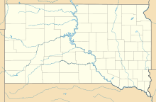 SUO Location of airport in South Dakota | |||||||||||
| Runways | |||||||||||
| |||||||||||
| Statistics (2012) | |||||||||||
| |||||||||||

Rosebud Sioux Tribal Airport (ICAO: KSUO, FAA LID: SUO) is a public use airport located two nautical miles (4 km) south of the central business district of Rosebud, in Todd County, South Dakota, United States.[1] The airport is owned by the Rosebud Sioux Tribe.[1]
Although many U.S. airports use the same three-letter location identifier for the FAA and IATA, this facility is assigned SUO by the FAA but has no designation from the IATA.[2]
Facilities and aircraft[]
Rosebud Sioux Tribal Airport resides at elevation of 2,724 feet (830 m) above mean sea level. It has one runway designated 16/34 with a concrete surface measuring 4,800 by 75 feet (1,463 x 23 m).[1]
For the 12-month period ending June 19, 2012, the airport had 700 general aviation aircraft operations, an average of 58 per month.[1]
See also[]
References[]
- ^ a b c d e FAA Airport Form 5010 for SUO PDF. Federal Aviation Administration. Effective November 15, 2012.
- ^ "Airline and Airport Code Search". International Air Transport Association (IATA). Retrieved May 23, 2013.
External links[]
- Resources for this airport:
- FAA airport information for SUO
- AirNav airport information for SUO
- FlightAware airport information and live flight tracker
- SkyVector aeronautical chart for SUO
- Airports in South Dakota
- Buildings and structures in Todd County, South Dakota
- Native American airports