Rumersheim-le-Haut
Rumersheim-le-Haut | |
|---|---|
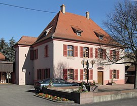 The town hall in Rumersheim-le-Haut | |
 Coat of arms | |
show Location of Rumersheim-le-Haut | |
 Rumersheim-le-Haut | |
| Coordinates: 47°51′10″N 7°31′22″E / 47.8528°N 7.5228°ECoordinates: 47°51′10″N 7°31′22″E / 47.8528°N 7.5228°E | |
| Country | France |
| Region | Grand Est |
| Department | Haut-Rhin |
| Arrondissement | Colmar-Ribeauvillé |
| Canton | Ensisheim |
| Government | |
| • Mayor (2020–2026) | Thierry Schelcher[1] |
| Area 1 | 16.67 km2 (6.44 sq mi) |
| Population (Jan. 2018)[2] | 1,069 |
| • Density | 64/km2 (170/sq mi) |
| Time zone | UTC+01:00 (CET) |
| • Summer (DST) | UTC+02:00 (CEST) |
| INSEE/Postal code | 68291 /68740 |
| Elevation | 210–224 m (689–735 ft) (avg. 217 m or 712 ft) |
| 1 French Land Register data, which excludes lakes, ponds, glaciers > 1 km2 (0.386 sq mi or 247 acres) and river estuaries. | |


Rumersheim-le-Haut (German: Rumersheim) is a commune in the Haut-Rhin department in Grand Est in north-eastern France.
See also[]
References[]
- ^ "Répertoire national des élus: les maires". data.gouv.fr, Plateforme ouverte des données publiques françaises (in French). 2 December 2020.
- ^ "Populations légales 2018". INSEE. 28 December 2020.
| Wikimedia Commons has media related to Rumersheim-le-Haut. |
| show Authority control |
|---|
This Haut-Rhin geographical article is a stub. You can help Wikipedia by . |
Categories:
- Communes of Haut-Rhin
- Haut-Rhin geography stubs