Saariselkä
| Saariselkä | |
|---|---|
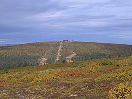 Kaunispää ski resort | |
| Highest point | |
| Peak | Mount |
| Elevation | 718 m (2,356 ft) |
| Geography | |
 Location | |
| Location | Lapland, (Finland) |
| Range coordinates | 68°25.25′N 27°25.03′E / 68.42083°N 27.41717°ECoordinates: 68°25.25′N 27°25.03′E / 68.42083°N 27.41717°E[1] |
| Parent range | Maanselka |
| Climbing | |
| Easiest route | From Saariselkä village |

Saariselkä (Inari Sami: Suolluščielgi, Northern Sami: Suoločielgi, literally islandback) is a fell area in Lapland, northern Finland. It is located in the Inari, Savukoski and Sodankylä municipalities. The highest point is 718 meters (2,356 ft) high Mt .[2] The range is mostly 2 billion-year-old granulite. The last ice age ended 9500 years ago in Saariselkä.
Tourism[]
Saariselkä is partly in Urho Kekkonen National Park. The hill area is a popular tourist destination, providing activities such as skiing, hiking and spa. Saariselkä village is located in the area and belongs to the Inari municipality, about 300 meters (980 ft) above sea level. Kaunispää-fell, rising next to the village, is 438 meters (1,437 ft) high.[3]
Many couples want to have a "white wedding" in Lapland in the winter when there is snow everywhere. A couple may come to the chapel in a sledge pulled by husky dogs or reindeer. Pyhän Olavin Kappeli (St. Olaf's Chapel) and a small wooden Tievakappeli (Tieva Chapel) near Hotel & Igloo Village Kakslauttanen in Saariselkä have been popular places for white weddings. Other possible venues include reindeer farms.
 Saariselkä village |
 Restaurant at the top of Kaunispää-fell, 438 meters above sea level |
Magnetic hill[]
Part of the former Finnish Highway 4 in Saariselkä is known nowadays as Magnetic hill. During World War II the road from Rovaniemi to Petsamo () was extremely important to the Finns. Petsamo and its harbour was the only open way to the ocean. The hills beside Kaunispää-fjeld are so steep that 1940's trucks could not easily climb them. Folks thought there was some magnetic force in the hill that squeezed all the power out of the motors. After a realignment of Highway 4 that short section was taken out of daily use. It has been declared the "Magnetic Hill Road Museum".
References[]
External links[]
 Media related to Saariselkä at Wikimedia Commons
| Wikivoyage has a travel guide for Saariselkä. |
- Official home page of Saariselkä (Finnish)
- Official home page of Saariselkä (English)
- Saariselka.com/ Accommodation, activities and much more in Saariselkä
- Saariselka Finland - Information on the area and resort
- Saariselkä webcam
This Lapland (Finland) location article is a stub. You can help Wikipedia by . |
- Mountains of Finland
- Villages in Inari, Finland
- Lapland (Finland) geography stubs