Sabanalarga, Atlántico
Sabanalarga | |
|---|---|
Municipality and town | |
 Flag | |
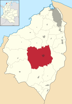 Location of the municipality and town of Sabanalarga, Atlántico in the Atlántico Department of Colombia | |
 Sabanalarga Location in Colombia | |
| Coordinates: 10°37′52″N 74°55′16″W / 10.63111°N 74.92111°W | |
| Country | |
| Department | Atlántico Department |
| Founded | 1620 |
| Incorporated | 1833 |
| Government | |
| • Mayor | Roberto Carlos León Peña |
| Area | |
| • Total | 399 km2 (154 sq mi) |
| Elevation | 87 m (285 ft) |
| Population (2019)[1] | |
| • Total | 102,334 |
| • Density | 260/km2 (660/sq mi) |
| Demonym(s) | Sabanalarguero |
| Time zone | UTC-5 (Colombia Standard Time) |
| Area code(s) | 57 + 3 |
| Website | Official website (in Spanish) |

Sabanalarga (Spanish pronunciation: [saβanaˈlaɾɣa], Spanish for Large Plains) is a municipality in the Atlántico Department, Colombia. Founded in 1620 by and . Became a municipality in 1680.
Geography[]
Sabanalarga is located in the middle of the Atlántico Department, Sabanalarga is surrounded to the North by the municipalities of Usiacurí, Baranoa and Polonuevo; to the East by the municipality of Ponedera; to the South by the municipalities of Candelaria and Manatí; to the Southwest with the municipality of Repelón and to the West with the municipalities of Luruaco and Piojó.
Notable people[]
- Juana de J. Sarmiento (1899-1979), politician, activist
References[]
- ^ "Estimaciones de Población 1985 - 2005 y Proyecciones de Población 2005 - 2020 Total Municipal por Área (estimate)". DANE. Retrieved 20 June 2019.
External links[]
- (in Spanish) Sabanalarga official website
- (in Spanish) Gobernacion del Atlantico - Sabanalarga
| show Municipalities in the Atlántico Department |
|---|
Coordinates: 6°51′N 75°49′W / 6.850°N 75.817°W
| show Authority control |
|---|
This Colombian location article is a stub. You can help Wikipedia by . |
Categories:
- Municipalities of Atlántico Department
- 1620 establishments in the Spanish Empire
- Colombia geography stubs