Sagua de Tánamo
Sagua de Tánamo | |
|---|---|
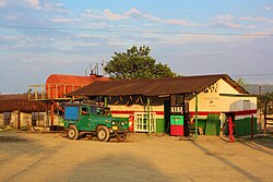 A gas station in Sagua de Tánamo | |
 Sagua de Tánamo municipality (red) within Holguín Province (yellow) and Cuba | |
| Coordinates: 20°35′9″N 75°14′30″W / 20.58583°N 75.24167°WCoordinates: 20°35′9″N 75°14′30″W / 20.58583°N 75.24167°W | |
| Country | Cuba |
| Province | Holguín |
| Established | 1804[1] |
| Area | |
| • Total | 704 km2 (272 sq mi) |
| Elevation | 10 m (30 ft) |
| Population (2004)[3] | |
| • Total | 52,013 |
| • Density | 73.9/km2 (191/sq mi) |
| Time zone | UTC-5 (EST) |
| Area code(s) | +53-24 |

Sagua de Tánamo (Spanish pronunciation: [ˈsaɣwa ðe ˈtamano]) is a municipality and town in the Holguín Province of Cuba.
Overview[]
The Sierra Cristal National Park (Spanish: Parque Nacional Sierra Cristal) is partly located in the Sagua de Tánamo municipality and partly in neighboring Mayarí.[4]
The municipality is divided into the barrios of Barrederas, Bazán, Cananovas, Catalina, Esterón, Juan Díaz, Miguel, Pueblo, Sitio and Zabala.[1] Carpintero, la Rosa, Rio Grande, La Guira, Naranjo.
Demographics[]
In 2004, the municipality of Sagua de Tánamo had a population of 52,013.[3] With a total area of 704 km2 (272 sq mi),[2] it has a population density of 73.9/km2 (191/sq mi).
See also[]
References[]
- ^ Jump up to: a b Guije.com. "Sagua de Tánamo" (in Spanish). Retrieved 2007-10-05.
- ^ Jump up to: a b Statoids. "Municipios of Cuba". Retrieved 2007-10-05.
- ^ Jump up to: a b Atenas.cu (2004). "2004 Population trends, by Province and Municipality" (in Spanish). Archived from the original on 2006-07-14. Retrieved 2007-10-05.
- ^ Radio Habana. "Parque Nacional Sierra Cristal" (in Spanish). Archived from the original on October 4, 2007. Retrieved 2007-10-09.
External links[]
![]() Media related to Sagua de Tánamo at Wikimedia Commons
Media related to Sagua de Tánamo at Wikimedia Commons
| show Places adjacent to Sagua de Tánamo |
|---|
| Authority control |
|
|---|
This Cuban location article is a stub. You can help Wikipedia by . |
- Populated places in Holguín Province
- 1800s in Cuba
- Populated places established in 1804
- 1804 establishments in New Spain
- 1800s establishments in the Spanish West Indies
- Cuba geography stubs