Saint-Édouard-de-Lotbinière, Quebec
Saint-Édouard-de-Lotbinière | |
|---|---|
Parish municipality | |
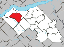 Location within Lotbinière RCM. | |
 Saint-Édouard-de-Lotbinière Location in southern Quebec. | |
| Coordinates: 46°34′N 71°50′W / 46.567°N 71.833°WCoordinates: 46°34′N 71°50′W / 46.567°N 71.833°W[1] | |
| Country | |
| Province | |
| Region | Chaudière-Appalaches |
| RCM | Lotbinière |
| Constituted | December 1, 1862 |
| Government | |
| • Mayor | |
| • Federal riding | Lotbinière— Chutes-de-la-Chaudière |
| • Prov. riding | Lotbinière-Frontenac |
| Area | |
| • Total | 98.50 km2 (38.03 sq mi) |
| • Land | 98.54 km2 (38.05 sq mi) |
| There is an apparent contradiction between two authoritative sources | |
| Population | |
| • Total | 1,248 |
| • Density | 12.7/km2 (33/sq mi) |
| • Pop 2006-2011 | |
| • Dwellings | 531 |
| Time zone | UTC−5 (EST) |
| • Summer (DST) | UTC−4 (EDT) |
| Postal code(s) | G0S 1Y0 |
| Area code(s) | 418 and 581 |
| Highways | |
| Website | www.municipalite. st-edouard.qc.ca |

Saint-Édouard-de-Lotbinière is a parish municipality in the Lotbinière Regional County Municipality in the Chaudière-Appalaches region of Quebec, Canada. Its population is 1,248 as of the Canada 2011 Census. It is named after Édouard Faucher, founder and first priest of the parish, and René-Louis Chartier de Lotbinière, first owner of the seigneurie in which Saint-Édouard lay.
References[]
- ^ Reference number 56141 of the Commission de toponymie du Québec (in French)
- ^ Jump up to: a b Geographic code 33080 in the official Répertoire des municipalités (in French)
- ^ Jump up to: a b "(Code 2433080) Census Profile". 2011 census. Statistics Canada. 2012.
| show Places adjacent to Saint-Édouard-de-Lotbinière, Quebec |
|---|
| show |
|---|
| show Authority control |
|---|
Categories:
- Parish municipalities in Quebec
- Incorporated places in Chaudière-Appalaches
- Lotbinière Regional County Municipality