Les Appalaches Regional County Municipality
show This article may be expanded with text translated from the corresponding article in Spanish. (June 2015) Click [show] for important translation instructions. |
Les Appalaches | |
|---|---|
 | |
| Coordinates: 46°05′N 71°18′W / 46.083°N 71.300°WCoordinates: 46°05′N 71°18′W / 46.083°N 71.300°W[1] | |
| Country | |
| Province | |
| Region | Chaudière-Appalaches |
| Effective | January 1, 1982 |
| County seat | Thetford Mines |
| Settlements | show
List |
| Government | |
| • Type | Prefecture |
| • Prefect | Ghislain Hamel |
| Area | |
| • Total | 1,987.10 km2 (767.22 sq mi) |
| • Land | 1,912.49 km2 (738.42 sq mi) |
| Population (2016)[3] | |
| • Total | 42,346 |
| • Density | 22.1/km2 (57/sq mi) |
| • Change 2011-2016 | |
| • Dwellings | 22,714 |
| Time zone | UTC−5 (EST) |
| • Summer (DST) | UTC−4 (EDT) |
| Area code(s) | 418 and 581 |
| Website | www.mrc desappalaches.ca |
| [4] | |

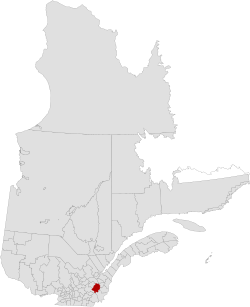
Les Appalaches ((in French) Municipalité régionale de comté des Appalaches) is a regional county municipality (RCM) in the Chaudière-Appalaches region in southeastern Quebec, Canada. It was established in 1982 from parts of the historic counties of Beauce, Frontenac, , and . The county seat and largest city is Thetford Mines.
The name of the RCM is linked to its location in the Appalachian Mountains with Mounts Adstock, Caribou, Oak, and Saint-Adrien being the highest. Until 2008, it was known as L'Amiante Regional County Municipality, because of the importance of asbestos mining in the region (amiante is French for "asbestos").
Subdivisions[]
There are 19 subdivisions within the RCM:[2]
|
|
|
Demographics[]
Language[]
Mother tongue from Canada 2016 Census[3]
| Language | Population | Pct (%) |
|---|---|---|
| French only | 40,675 | 97.7% |
| English only | 495 | 1.2% |
| Both English and French | 145 | 0.3% |
| Other languages | 325 | 0.8% |
Transportation[]
Access Routes[]
Highways and numbered routes that run through the municipality, including external routes that start or finish at the county border:[5]
|
|
Attractions[]
- Chemins Craig and Gosford Historic Route
- Serpentine-de-Coleraine Ecological Reserve (Saint-Joseph-de-Coleraine)
- Frontenac National Park (Adstock)
- Heritage Kinnear's Mills (Kinnear's Mills)
- Mount Adstock (Adstock)
- Musée minéralogique et minier de Thetford Mines (Thetford Mines)
- Thetford Mines Bike Path (Thetford Mines)
See also[]
References[]
- ^ Reference number 403501 of the Commission de toponymie du Québec (in French)
- ^ Jump up to: a b c "Ministère des Affaires municipales, des Régions et de l'Occupation du territoire: Les Appalaches Regional County Municipality". Archived from the original on 2015-02-03. Retrieved 2012-03-11.
- ^ Jump up to: a b c "Census Profile, 2016 Census: Les Appalaches, Municipalité régionale de comté [Census division], Quebec". Statistics Canada. Retrieved November 28, 2019.
- ^ 2011 Statistics Canada Census Profile: L'Amiante Regional County Municipality, Quebec
- ^ Official Transport Quebec Road Map
| show Adjacent Counties & Equivalent Territories |
|---|
| show Authority control |
|---|
- Regional county municipalities in Chaudière-Appalaches
- Census divisions of Quebec