Saint-Adrien-d'Irlande, Quebec
Saint-Adrien-d'Irlande | |
|---|---|
Municipality | |
 | |
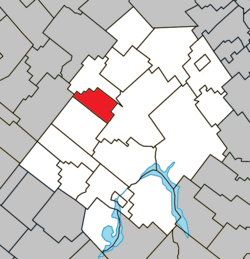 Location within Les Appalaches RCM | |
 St-Adrien-d'Irlande Location in province of Quebec | |
| Coordinates: 46°07′N 71°27′W / 46.12°N 71.45°WCoordinates: 46°07′N 71°27′W / 46.12°N 71.45°W[1] | |
| Country | |
| Province | |
| Region | Chaudière-Appalaches |
| RCM | Les Appalaches |
| Constituted | January 1, 1873 |
| Government | |
| • Mayor | Jessika Lacombe |
| • Federal riding | Mégantic—L'Érable |
| • Prov. riding | Lotbinière-Frontenac |
| Area | |
| • Total | 53.00 km2 (20.46 sq mi) |
| • Land | 53.29 km2 (20.58 sq mi) |
| There is an apparent contradiction between two authoritative sources | |
| Population | |
| • Total | 389 |
| • Density | 7.3/km2 (19/sq mi) |
| • Pop 2006-2011 | |
| • Dwellings | 193 |
| Time zone | UTC−5 (EST) |
| • Summer (DST) | UTC−4 (EDT) |
| Postal code(s) | G0N 1M0 |
| Area code(s) | 418 and 581 |
| Highways | |
| Website | stadriendirlande |

Saint-Adrien-d'Irlande is a municipality in the Municipalité régionale de comté des Appalaches in Quebec, Canada. It is part of the Chaudière-Appalaches region and the population is 415 as of 2009.
Until 1982, Saint-Adrien-d'Irlande was known as Ireland-Partie-Nord, to differentiate from the south part, today's Irlande. Then it took the name of the parish, which was named after Pope Adrian III.
References[]
- ^ Reference number 125043 of the Commission de toponymie du Québec (in French)
- ^ Jump up to: a b Geographic code 31095 in the official Répertoire des municipalités (in French)
- ^ Jump up to: a b "(Code 2431095) Census Profile". 2011 census. Statistics Canada. 2012.
External links[]
 Media related to Saint-Adrien-d'Irlande at Wikimedia Commons
- Commission de toponymie du Québec
- Ministère des Affaires municipales, des Régions et de l'Occupation du territoire
| show Places adjacent to Saint-Adrien-d'Irlande, Quebec |
|---|
| show |
|---|
| Authority control |
|
|---|
Categories:
- Municipalities in Quebec
- Incorporated places in Chaudière-Appalaches
- Irish diaspora in Quebec