Saint-Pamphile, Quebec
Saint-Pamphile | |
|---|---|
City | |
 A rural school in 1939. | |
 Location within L'Islet RCM. | |
 Saint-Pamphile Location in southern Quebec. | |
| Coordinates: 46°58′N 69°47′W / 46.967°N 69.783°WCoordinates: 46°58′N 69°47′W / 46.967°N 69.783°W[1] | |
| Country | |
| Province | |
| Region | Chaudière-Appalaches |
| RCM | L'Islet |
| Constituted | 21 January 1888 |
| Government | |
| • Mayor | Réal Laverdière (2009-2013) |
| • Federal riding | Montmagny—L'Islet— Kamouraska—Rivière- du-Loup |
| • Prov. riding | Côte-du-Sud |
| Area | |
| • Total | 137.90 km2 (53.24 sq mi) |
| • Land | 137.21 km2 (52.98 sq mi) |
| Population | |
| • Total | 2,685 |
| • Density | 19.6/km2 (51/sq mi) |
| • Pop 2006-2011 | |
| • Dwellings | 1,281 |
| Demonym(s) | Pamphilien(ne) |
| Time zone | UTC−5 (EST) |
| • Summer (DST) | UTC−4 (EDT) |
| Postal code(s) | G0R 3X0 |
| Area code(s) | 418 and 581 |
| Highways | |
| Website | www |

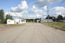
Saint-Pamphile is a town in Quebec situated in the L'Islet Regional County Municipality in the Chaudière-Appalaches administrative district.[2] While the official municipal territory ends at the Canada–United States border located at the eastern end of town, there is a tiny hamlet located immediately east of the border, known as St-Pamphile, Maine. The hamlet is historically part of the larger entity located in Quebec and is considered integral part of the town by locals. The economy of St-Pamphile, Maine is entirely dependent upon the economy of St-Pamphile, Quebec, from which Maine residents obtain goods and services, and sometimes even employment.[citation needed] Saint-Pamphile, Quebec is the central town of 7 neighboring parishes, and provides a CLSC, elementary school, and high school for the area.
History[]
The first settler in the town was Frédéric Vaillancourt from the nearby Saint-Aubert municipality in the year 1859. Given that the surrounding land appeared to be fertile amongst a mostly rocky landscape, many settlers followed his lead, and in 1870, Saint-Pamphile became a parish. In 1889, the area was officially declared a municipality. It wasn't until 1963 that Saint-Pamphile was granted the legal status of city.[1]
The community was named in tribute to Pamphile-Gaspard Verreault, a notary who represented L'Islet in the Legislative Assembly of Quebec from 1867 to 1878.[1][4]
Demographics[]
In 2011, the population was 2685, and the density was 19.6 people per km². This is a significant drop from 2005, when the population was 2804.
Economy[]
The Saint Pamphile Border Crossing connects Canada and the United States.[5] It is at a logging yard; the main economic activity of the region is timber. There are two major companies present who deal with raw materials: Maibec and Matériaux Blanchet.
Tourism[]
The lumberjack festival is always held in the last full weekend of August. It showcases a variety of sporting activities that call to mind the dominance of forestry in the region. At the event, one may watch forestry competitions and shows (comedy, music, dance, among others)[6] Other activities include barbecues, picnics, golf tournaments, and so on, and the gathering attracts more than 25,000 visitors annually.[citation needed]
In mid-February, another event takes place in St-Pamphile, known as the Appalachian Odyssey.[7] It attracts a large number of mushers for dog sled races, the longest trail for which is some 200 kilometres (120 mi) long and crosses each of the seven parishes in the county. In addition to the dog sled tracks, there are also many other competitions during the event. This annual event gains popularity every year.[citation needed]
See also[]
- L'Islet Regional County Municipality
- Gobeil River, a river
- Big Black River (Saint John River), a river
- List of municipalities in Quebec
References[]
- ^ Jump up to: a b c Reference number 57364 of the Commission de toponymie du Québec (in French)
- ^ Jump up to: a b c Geographic code 17010 in the official Répertoire des municipalités (in French)
- ^ Jump up to: a b "(Code 2417010) Census Profile". 2011 census. Statistics Canada. 2012.
- ^ "Itinéraire toponymique au cœur de l'arrière-pays" (in French). Histoire Québec. June 1998. Retrieved 10 February 2013.
- ^ "Chapter 1: Northern Maine and New Hampshire". United Divide: A Linear Portrait of the USA/Canada Border. The Center for Land Use Interpretation. Winter 2015.
- ^ "Festival du bûcheux de Saint-Pamphile". Retrieved 10 February 2013.
- ^ "Fêtes et Événements - Tourisme - St-Pamphile" (in French). City of Saint-Pamphile. Archived from the original on 2013-03-06. Retrieved 10 Feb 2013.
| show Adjacent Municipal Subdivisions |
|---|
| hide | |
|---|---|
| Cities & Towns | |
| Municipalities | |
| Parishes |
|
| |
| show Authority control |
|---|
- Cities and towns in Quebec
- Incorporated places in Chaudière-Appalaches