Sainte-Marie, Quebec
Sainte-Marie | |
|---|---|
City | |
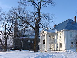 Taschereau Mansion and Sainte-Anne Chapel | |
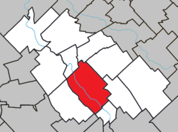 Location within La Nouvelle-Beauce RCM | |
 Sainte-Marie Location in southern Quebec | |
| Coordinates: 46°27′N 71°02′W / 46.450°N 71.033°WCoordinates: 46°27′N 71°02′W / 46.450°N 71.033°W[1] | |
| Country | Canada |
| Province | Quebec |
| Region | Chaudière-Appalaches |
| RCM | La Nouvelle-Beauce |
| Constituted | April 15, 1978 |
| Government | |
| • Mayor | Guetan Vachon |
| • Federal riding | Beauce |
| • Prov. riding | Beauce-Nord |
| Area | |
| • Total | 108.90 km2 (42.05 sq mi) |
| • Land | 107.57 km2 (41.53 sq mi) |
| Population (2016)[3] | |
| • Total | 13,565 |
| • Density | 126.1/km2 (327/sq mi) |
| • Pop 2011-2016 | |
| • Dwellings | 5,857 |
| Demonym(s) | Mariverains, Mariveraines |
| Time zone | UTC−5 (EST) |
| • Summer (DST) | UTC−4 (EDT) |
| Postal code(s) | G6E |
| Area code(s) | 418 and 581 |
| Highways | |
| Website | www |

Sainte-Marie is a city in the province of Quebec, Canada. It is the seat of the Municipalité régionale de la Nouvelle-Beauce, in Chaudière-Appalaches. The population was 12,889 as of the Canada 2011 Census, and was 99.0% French-speaking as of 2006. It is located 59 kilometres (37 mi) south-east of Quebec City, on the Chaudière River.
History[]
The seigneurie of Sainte-Marie-de-la-Nouvelle-Beauce was granted to Thomas-Jacques Taschereau in 1736. He chose the name in honour of his wife, Marie-Claire de Fleury de La Gorgendière. The religious parish was founded in 1737 and the municipality in 1845.
The territory of Sainte-Marie was divided on several occasions, as population increased, in order to found neighbouring communities: Saint-Bernard, Saint-Isidore, Saint-Maxime-de-Scott (now Scott), Sainte-Marguerite, Sainte-Hénédine, Saint-Sylvestre, Saint-Elzéar, Saint-Séverin, Saints-Anges, and Vallée-Jonction.
In 1913, the territory was split again, following the detachment of the village (urban part of the territory) from the parish municipality (rural part). In 1958, the village was constituted as a city and in 1959, Sainte-Marie-de-la-Nouvelle-Beauce was renamed as Sainte-Marie. In 1978, the city and the parish municipality governments amalgamated.
Demographics[]
| Year | Pop. | ±% |
|---|---|---|
| 1986 | 9,536 | — |
| 1991 | 10,542 | +10.5% |
| 1996 | 10,966 | +4.0% |
| 2001 | 11,320 | +3.2% |
| 2006 | 11,584 | +2.3% |
| 2011 | 12,889 | +11.3% |
| 2016 | 13,565 | +5.2% |
| Source: Statistics Canada | ||
Notable natives or residents[]
- Marius Barbeau, ethnographer
- Elzéar-Henri Juchereau Duchesnay, Canadian politician
- Ernest Savard, hockey executive, head coach, general manager (Montreal Canadiens)
- Nycole Turmel, Canadian politician
- Henri-Jules Juchereau Duchesnay, Canadian politician
- Gabriel-Elzéar Taschereau, Quebec politician
- Elzéar-Alexandre Taschereau, clergyman
- Henri Elzéar Taschereau, lawyer
- Jean-Thomas Taschereau, lawyer
- Joseph-André Taschereau, judge
- Pierre-Elzéar Taschereau, Canadian politician
- Thomas Linière Taschereau, Canadian politician
- Mario Gosselin, NASCAR driver
- Thomas Chabot, ice hockey defenceman for the NHL’s Ottawa Senators
Partner cities[]
 Pont-du-Château, Auvergne, France
References[]
- ^ Reference number 56297 of the Commission de toponymie du Québec (in French)
- ^ Jump up to: a b Geographic code 26030 in the official Répertoire des municipalités (in French)
- ^ Jump up to: a b "(Code 2426030) Census Profile". 2016 census. Statistics Canada. 2017.
External links[]
 Media related to Sainte-Marie, Quebec at Wikimedia Commons
- Official website

- Commission de toponymie du Québec
- Ministère des Affaires municipales, des Régions et de l'Occupation du territoire
| show Places adjacent to Sainte-Marie, Quebec |
|---|
| show |
|---|
| show Authority control |
|---|
- Sainte-Marie, Quebec
- Cities and towns in Quebec