Saint-Christophe-Dodinicourt
show This article may be expanded with text translated from the corresponding article in French. (December 2008) Click [show] for important translation instructions. |
Saint-Christophe-Dodinicourt | |
|---|---|
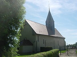 The church in Saint-Christophe-Dodinicourt | |
show Location of Saint-Christophe-Dodinicourt | |
 Saint-Christophe-Dodinicourt | |
| Coordinates: 48°26′23″N 4°28′15″E / 48.4397°N 4.4708°ECoordinates: 48°26′23″N 4°28′15″E / 48.4397°N 4.4708°E | |
| Country | France |
| Region | Grand Est |
| Department | Aube |
| Arrondissement | Bar-sur-Aube |
| Canton | Brienne-le-Château |
| Government | |
| • Mayor (2008–2014) | Jacques Lesniczek |
| Area 1 | 4.87 km2 (1.88 sq mi) |
| Population (Jan. 2018)[1] | 34 |
| • Density | 7.0/km2 (18/sq mi) |
| Time zone | UTC+01:00 (CET) |
| • Summer (DST) | UTC+02:00 (CEST) |
| INSEE/Postal code | 10337 /10500 |
| 1 French Land Register data, which excludes lakes, ponds, glaciers > 1 km2 (0.386 sq mi or 247 acres) and river estuaries. | |


Saint-Christophe-Dodinicourt is a commune in the Aube department in north-central France.
Population[]
| Year | Pop. | ±% |
|---|---|---|
| 1962 | 31 | — |
| 1968 | 39 | +25.8% |
| 1975 | 22 | −43.6% |
| 1982 | 41 | +86.4% |
| 1990 | 43 | +4.9% |
| 1999 | 42 | −2.3% |
| 2008 | 37 | −11.9% |
See also[]
References[]
- ^ "Populations légales 2018". INSEE. 28 December 2020.
| Wikimedia Commons has media related to Saint-Christophe-Dodinicourt. |
This Aube geographical article is a stub. You can help Wikipedia by . |
Categories:
- Communes of Aube
- Aube geography stubs