Saint-Jean-de-Cherbourg
Saint-Jean-de-Cherbourg | |
|---|---|
Parish municipality | |
 Landscape of St-Jean-de-Cherbourg. | |
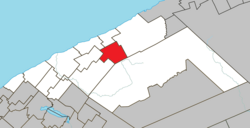 Location within La Matanie RCM. | |
 Saint-Jean-de-Cherbourg Location in eastern Quebec. | |
| Coordinates: 48°51′N 67°07′W / 48.850°N 67.117°WCoordinates: 48°51′N 67°07′W / 48.850°N 67.117°W[1] | |
| Country | |
| Province | |
| Region | Bas-Saint-Laurent |
| RCM | La Matanie |
| Settled | 1930 |
| Constituted | May 1, 1954 |
| Government | |
| • Mayor | Jocelyn Bergeron |
| • Federal riding | Haute-Gaspésie—La Mitis—Matane—Matapédia |
| • Prov. riding | Matane-Matapédia |
| Area | |
| • Total | 112.90 km2 (43.59 sq mi) |
| • Land | 114.05 km2 (44.03 sq mi) |
| There is an apparent contradiction between two authoritative sources | |
| Population | |
| • Total | 193 |
| • Density | 1.7/km2 (4/sq mi) |
| • Pop 2006-2011 | |
| • Dwellings | 109 |
| Time zone | UTC−5 (EST) |
| • Summer (DST) | UTC−4 (EDT) |
| Postal code(s) | G0J 2R0 |
| Area code(s) | 418 and 581 |
| Highways | No major routes |

Saint-Jean-de-Cherbourg is a parish municipality in the Canadian province of Quebec, located in La Matanie Regional County Municipality.
Demographics[]
Population[]
| hideCanada census – Saint-Jean-de-Cherbourg community profile | |||
|---|---|---|---|
| 2011 | 2006 | ||
| Population: | 193 (−11.5% from 2006) | 218 (+8.5% from 2001) | |
| Land area: | 114.05 km2 (44.03 sq mi) | 114.05 km2 (44.03 sq mi) | |
| Population density: | 1.7/km2 (4.4/sq mi) | 1.9/km2 (4.9/sq mi) | |
| Median age: | 51.4 (M: 52.8, F: 46.9) | 45.3 (M: 46.8, F: 41.3) | |
| Total private dwellings: | 109 | 145 | |
| Median household income: | $.N/A | $.N/A | |
| Notes: Income data suppressed to meet the confidentiality requirements of the Statistics Act. – References: 2011[3] 2006[4] earlier[5] | |||
Census data before 2001:[6]
- Population in 1996: 239 (+3.9% from 1991)
- Population in 1991: 230
See also[]
References[]
- ^ Reference number 56875 of the Commission de toponymie du Québec (in French)
- ^ Jump up to: a b "Saint-Jean-de-Cherbourg". Répertoire des municipalités (in French). Ministère des Affaires municipales, des Régions et de l'Occupation du territoire. Retrieved 2012-01-20.
- ^ Jump up to: a b c "2011 Community Profiles". 2011 Canadian Census. Statistics Canada. July 5, 2013. Retrieved 2014-02-01.
- ^ "2006 Community Profiles". 2006 Canadian Census. Statistics Canada. March 30, 2011. Retrieved 2012-01-20.
- ^ "2001 Community Profiles". 2001 Canadian Census. Statistics Canada. February 17, 2012.
- ^ Statistics Canada: 1996
| Wikimedia Commons has media related to Saint-Jean-de-Cherbourg. |
| show Adjacent Municipal Subdivisions |
|---|
| hide | |
|---|---|
| Cities & Towns | |
| Municipalities | |
| Parishes | |
| Unorganized territories | |
| |
| Authority control |
|
|---|
This Bas-Saint-Laurent location article is a stub. You can help Wikipedia by . |
Categories:
- Parish municipalities in Quebec
- Incorporated places in Bas-Saint-Laurent
- Bas-Saint-Laurent geography stubs