Saint-Lupicin
Saint-Lupicin | |
|---|---|
Part of Coteaux du Lizon | |
 | |
 Coat of arms | |
show Location of Saint-Lupicin | |
 Saint-Lupicin | |
| Coordinates: 46°24′01″N 5°47′33″E / 46.4003°N 5.7925°ECoordinates: 46°24′01″N 5°47′33″E / 46.4003°N 5.7925°E | |
| Country | France |
| Region | Bourgogne-Franche-Comté |
| Department | Jura |
| Arrondissement | Saint-Claude |
| Canton | Saint-Lupicin |
| Commune | Coteaux du Lizon |
| Area 1 | 9.54 km2 (3.68 sq mi) |
| Population (2017)[1] | 2,073 |
| • Density | 220/km2 (560/sq mi) |
| Time zone | UTC+01:00 (CET) |
| • Summer (DST) | UTC+02:00 (CEST) |
| Postal code | 39170 |
| Elevation | 410–915 m (1,345–3,002 ft) |
| 1 French Land Register data, which excludes lakes, ponds, glaciers > 1 km2 (0.386 sq mi or 247 acres) and river estuaries. | |


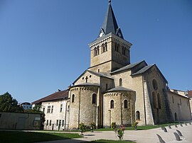
Saint-Lupicin (French pronunciation: [sɛ̃ lypisɛ̃]) is a former commune in the Jura department in the Bourgogne-Franche-Comté region in eastern France. On 1 January 2017, it was merged into the new commune Coteaux du Lizon.[2]
Population[]
| Year | Pop. | ±% |
|---|---|---|
| 1793 | 532 | — |
| 1806 | 706 | +32.7% |
| 1821 | 569 | −19.4% |
| 1831 | 696 | +22.3% |
| 1841 | 694 | −0.3% |
| 1851 | 671 | −3.3% |
| 1861 | 629 | −6.3% |
| 1872 | 681 | +8.3% |
| 1881 | 797 | +17.0% |
| 1891 | 827 | +3.8% |
| 1901 | 819 | −1.0% |
| 1911 | 947 | +15.6% |
| 1921 | 897 | −5.3% |
| 1931 | 1,106 | +23.3% |
| 1946 | 1,128 | +2.0% |
| 1954 | 1,157 | +2.6% |
| 1962 | 1,286 | +11.1% |
| 1968 | 1,478 | +14.9% |
| 1975 | 1,648 | +11.5% |
| 1982 | 1,882 | +14.2% |
| 1990 | 2,007 | +6.6% |
| 1999 | 2,081 | +3.7% |
| 2008 | 2,200 | +5.7% |
| 2013 | 2,091 | −5.0% |
See also[]
References[]
- ^ Téléchargement du fichier d'ensemble des populations légales en 2017, INSEE
- ^ Arrêté préfectoral 4 July 2016 (in French)
| Wikimedia Commons has media related to Saint-Lupicin. |
This Jura geographical article is a stub. You can help Wikipedia by . |
Categories:
- Former communes of Jura (department)
- Jura (department) geography stubs