Saint-Paul, Quebec
Saint-Paul | |
|---|---|
Municipality | |
 | |
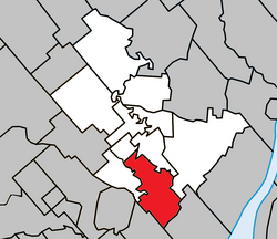 Location within Joliette RCM | |
 Saint-Paul Location in central Quebec | |
| Coordinates: 45°59′N 73°27′W / 45.983°N 73.450°WCoordinates: 45°59′N 73°27′W / 45.983°N 73.450°W[1] | |
| Country | |
| Province | |
| Region | Lanaudière |
| RCM | Joliette |
| Constituted | July 1, 1855 |
| Government | |
| • Mayor | Alain Bellemare |
| • Federal riding | Joliette |
| • Prov. riding | Joliette |
| Area | |
| • Total | 49.90 km2 (19.27 sq mi) |
| • Land | 49.39 km2 (19.07 sq mi) |
| Population (2011)[3] | |
| • Total | 5,122 |
| • Density | 103.7/km2 (269/sq mi) |
| • Pop 2006-2011 | |
| • Dwellings | 2,115 |
| Time zone | UTC−5 (EST) |
| • Summer (DST) | UTC−4 (EDT) |
| Postal code(s) | J0K 3E0 |
| Area code(s) | 450 and 579 |
| Highways | |
| Website | www.municipalite stpaul.qc.ca |

Saint-Paul is a municipality in the Lanaudière region of Quebec, Canada, part of the Joliette Regional County Municipality.
Demographics[]
Population trend:[4]
- Population in 2011: 5122 (2006 to 2011 population change: 28.0%)
- Population in 2006: 3987
- Population in 2001: 3616 (or 3606 with 2006 boundaries)
- Population in 1996: 3644
- Population in 1991: 3648
Private dwellings occupied by usual residents: 2058 (total dwellings: 2115)
Mother tongue:
- English as first language: 0.3%
- French as first language: 98.6%
- English and French as first language: 0%
- Other as first language: 1.1%
Education[]
This section needs expansion. You can help by . (September 2017) |
Commission scolaire des Samares operates francophone public schools, including:
The Sir Wilfrid Laurier School Board operates anglophone public schools, including:
- Joliette Elementary School in Saint-Charles-Borromée[7]
- Joliette High School in Joliette[8]
The sole private school is operated by a cult, Mission de l'Esprit-Saint. It opened in 2016, following the foreclosure of the former illegal school, a decade ago :[9]
- École l'Accord[10]
See also[]
References[]
- ^ Reference number 57403 of the Commission de toponymie du Québec (in French)
- ^ Jump up to: a b Geographic code 61005 in the official Répertoire des municipalités (in French)
- ^ Jump up to: a b Statistics Canada 2011 Census - Saint-Paul census profile
- ^ Statistics Canada: 1996, 2001, 2006, 2011 census
- ^ "La Passerelle (pavillon Notre-Dame-du-Sacré-Coeur)." Commission scolaire des Samares. Retrieved on September 23, 2017.
- ^ "La Passerelle (pavillon Vert-Demain)." Commission scolaire des Samares. Retrieved on September 23, 2017.
- ^ "JOLIETTE ELEMENTARY ZONE." Sir Wilfrid Laurier School Board. Retrieved on September 17, 2017.
- ^ "Joliette High School Zone Sec 1-5." Sir Wilfrid Laurier School Board. Retrieved on September 5, 2017.
- ^ "[1] Québec autorise une école pour la Mission de l'Esprit-Saint" Retrieved on May 9, 2019.
- ^ Official website [2]."Retrieved on May 9, 2019.
External links[]
 Media related to Saint-Paul, Quebec at Wikimedia Commons
| show Adjacent Municipal Subdivisions |
|---|
| hide | |
|---|---|
| Cities & Towns | |
| Municipalities | |
| Parishes | |
| Villages | |
| |
| show Authority control |
|---|
This Quebec location article is a stub. You can help Wikipedia by . |
Categories:
- Incorporated places in Lanaudière
- Municipalities in Quebec
- Quebec geography stubs