Saint-Pie, Quebec
show This article may be expanded with text translated from the corresponding article in French. (December 2017) Click [show] for important translation instructions. |
Saint-Pie | |
|---|---|
City | |
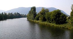 Riviere Noire | |
 Location within Les Maskoutains RCM | |
 Saint-Pie Location in southern Quebec | |
| Coordinates: 45°30′N 72°54′W / 45.500°N 72.900°WCoordinates: 45°30′N 72°54′W / 45.500°N 72.900°W[1] | |
| Country | |
| Province | |
| Region | Montérégie |
| RCM | Les Maskoutains |
| Constituted | February 28, 2003 |
| Government | |
| • Mayor | Pierre St-Onge |
| • Federal riding | Saint-Hyacinthe—Bagot |
| • Prov. riding | Saint-Hyacinthe |
| Area | |
| • Total | 108.60 km2 (41.93 sq mi) |
| • Land | 109.03 km2 (42.10 sq mi) |
| There is an apparent contradiction between two authoritative sources | |
| Population | |
| • Total | 5,438 |
| • Density | 49.9/km2 (129/sq mi) |
| • Pop (2006-2011) | |
| • Dwellings | 2,319 |
| Time zone | UTC−5 (EST) |
| • Summer (DST) | UTC−4 (EDT) |
| Postal code(s) | J0H |
| Area code(s) | 450 and 579 |
| Highways | |
| Website | www |

Saint-Pie is a city in the Montérégie region of southwest Quebec. The population as of the Canada 2011 Census was 5,438.
The former parish municipality of Saint-Pie was amalgamated into the City of Saint-Pie on February 28, 2003.
Demographics[]
Population[]
| hideCanada census – Saint-Pie, Quebec community profile | |||
|---|---|---|---|
| 2011 | 2006 | ||
| Population: | 5,438 (+6.4% from 2006) | 5,109 (+3.7% from 2001) | |
| Land area: | 109.03 km2 (42.10 sq mi) | 109.03 km2 (42.10 sq mi) | |
| Population density: | 49.9/km2 (129/sq mi) | 46.9/km2 (121/sq mi) | |
| Median age: | 38.8 (M: 39.1, F: 38.4) | 37.4 (M: 36.9, F: 37.8) | |
| Total private dwellings: | 2,319 | 2,133 | |
| Median household income: | $53,639 | $44,588 | |
| Notes: Amalgamated with Parish of Saint-Pie on February 28, 2003. – References: 2011[4] 2006[5] earlier[6] | |||
|
|
| |||||||||||||||||||||||||||
(M) merger with Parish of Saint-Pie on February 28, 2003. | |||||||||||||||||||||||||||||
Language[]
| Canada Census Mother Tongue - Saint-Pie, Quebec[7] | ||||||||||||||||||
|---|---|---|---|---|---|---|---|---|---|---|---|---|---|---|---|---|---|---|
| Census | Total | French
|
English
|
French & English
|
Other
| |||||||||||||
| Year | Responses | Count | Trend | Pop % | Count | Trend | Pop % | Count | Trend | Pop % | Count | Trend | Pop % | |||||
2011
|
5,395
|
5,315 | 98.52% | 30 | 0.55% | 15 | 0.28% | 35 | 0.65% | |||||||||
2006
|
5,090
|
4,985 | 97.94% | 80 | 1.57% | 10 | 0.20% | 15 | 0.29% | |||||||||
2001
|
2,360
|
2,335 | 98.94% | 15 | 0.64% | 0 | 0.00% | 10 | 0.42% | |||||||||
1996
|
2,235
|
2,185 | n/a | 97.76% | 15 | n/a | 0.67% | 10 | n/a | 0.45% | 25 | n/a | 1.12% | |||||
See also[]
- List of cities in Quebec
References[]
- ^ Reference number 362829 of the Commission de toponymie du Québec (in French)
- ^ Jump up to: a b Ministère des Affaires municipales, des Régions et de l'Occupation du territoire: Saint-Pie
- ^ Parliament of Canada Federal Riding History: SAINT-HYACINTHE--BAGOT (Quebec)
- ^ Jump up to: a b c "2011 Community Profiles". 2011 Canadian Census. Statistics Canada. July 5, 2013. Retrieved 2014-03-15.
- ^ "2006 Community Profiles". 2006 Canadian Census. Statistics Canada. March 30, 2011. Retrieved 2014-03-15.
- ^ "2001 Community Profiles". 2001 Canadian Census. Statistics Canada. February 17, 2012.
- ^ Jump up to: a b Statistics Canada: 1996, 2001, 2006, 2011 census
External links[]
| Wikimedia Commons has media related to Saint-Pie. |
| show Adjacent Municipal Subdivisions |
|---|
| hide | |
|---|---|
| Cities |
|
| Municipalities | |
| Parishes | |
| Villages | |
| |
| show Authority control |
|---|
Categories:
- Cities and towns in Quebec
- Incorporated places in Les Maskoutains Regional County Municipality