Salt Creek Township, Decatur County, Indiana
Salt Creek Township | |
|---|---|
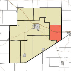 Location of Salt Creek Township in Decatur County | |
| Coordinates: 39°18′34″N 85°20′31″W / 39.30944°N 85.34194°WCoordinates: 39°18′34″N 85°20′31″W / 39.30944°N 85.34194°W | |
| Country | United States |
| State | Indiana |
| County | Decatur |
| Government | |
| • Type | Indiana township |
| Area | |
| • Total | 29.86 sq mi (77.3 km2) |
| • Land | 29.86 sq mi (77.3 km2) |
| • Water | 0 sq mi (0 km2) |
| Elevation | 991 ft (302 m) |
| Population (2010) | |
| • Total | 1,179 |
| • Density | 39.5/sq mi (15.3/km2) |
| FIPS code | 18-67536[2] |
| GNIS feature ID | 453826 |

Salt Creek Township is one of nine townships in Decatur County, Indiana. As of the 2010 census, its population was 1,179 and it contained 483 housing units.[3]
History[]
Salt Creek Township was organized in 1836.[4]
Geography[]
According to the 2010 census, the township has a total area of 29.86 square miles (77.3 km2), all land.[3]
Cities and towns[]
Unincorporated towns[]
(This list is based on USGS data and may include former settlements.)
Adjacent townships[]
- Fugit Township (north)
- Ray Township, Franklin County (east)
- Laughery Township, Ripley County (southeast)
- Jackson Township, Ripley County (south)
- Marion Township (southwest)
- Washington Township (west)
Major highways[]
Cemeteries[]
The township contains two cemeteries: Maple and Ross.
References[]
- ^ "US Board on Geographic Names". United States Geological Survey. 2007-10-25. Retrieved 2008-01-31.
- ^ "U.S. Census website". United States Census Bureau. Retrieved 2008-01-31.
- ^ a b "Population, Housing Units, Area, and Density: 2010 - County -- County Subdivision and Place -- 2010 Census Summary File 1". United States Census. Archived from the original on 2020-02-12. Retrieved 2013-05-10.
- ^ Harding, Lewis Albert (1915). History of Decatur County, Indiana: Its People, Industries and Institutions. B.F. Bowen. p. 95.
External links[]
- Indiana Township Association
- United Township Association of Indiana
- United States Census Bureau cartographic boundary files
- U.S. Board on Geographic Names
Municipalities and communities of Decatur County, Indiana, United States | ||
|---|---|---|
| City | ||
| Towns | ||
| Townships | ||
| CDPs | ||
| Other unincorporated communities |
| |
| Ghost town | ||
| Footnotes | ‡This populated place also has portions in an adjacent county or counties | |
| ||
Categories:
- Townships in Decatur County, Indiana
- Townships in Indiana