Samara (Dnieper)
This article needs additional citations for verification. (April 2020) |
| Samara River | |
|---|---|
 | |
 | |
| Location | |
| Country | Ukraine |
| Physical characteristics | |
| Mouth | |
• location | Dnieper |
• coordinates | 48°28′51″N 35°09′13″E / 48.48083°N 35.15361°ECoordinates: 48°28′51″N 35°09′13″E / 48.48083°N 35.15361°E |
| Length | 320 km (200 mi) |
| Basin size | 22,600 km2 (8,700 sq mi) |
| Discharge | |
| • average | 20 m3/s (710 cu ft/s) |
| Basin features | |
| Progression | Dnieper→ Dnieper–Bug estuary→ Black Sea |

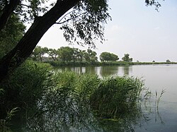
The Samara (Ukrainian: Самара) is a river in Ukraine, a left tributary of the Dnieper. The city of Dnipro is located near the confluence of Dnieper and Samara.
The river has a length of 320 km and a drainage basin of 22,600 km².[1] The water quantities are variable, mainly because the river is fed by the spring thaw. The width of the river varies between 40 and 60 meters, with 300 m being the maximum.
The most important tributaries of the Samara are the Vovcha and the Byk.
The largest cities on the river are Ternivka and Novomoskovsk.
References[]
| Tributaries1 |  | |
|---|---|---|
| Reservoirs | ||
| Hydroelectric stations | ||
| Canals | ||
| Cities | ||
| Crossings | ||
| ||
Categories:
- Tributaries of the Dnieper
- Rivers of Dnipropetrovsk Oblast
- Ukraine river stubs