Putina Province
Putina pruwinsya | |
|---|---|
 | |
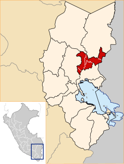 Location of San Antonio de Putina in the Puno Region | |
| Country | Peru |
| Region | Puno |
| Founded | June 12, 1989 |
| Capital | Putina |
| Government | |
| • Mayor | Alex Max Sullca Cáceres (2007-10) |
| Area | |
| • Total | 3,207.38 km2 (1,238.38 sq mi) |
| Elevation | 3,874 m (12,710 ft) |
| Population | |
| • Total | 44,853 |
| • Density | 14/km2 (36/sq mi) |
| UBIGEO | 2110 |
| Website | www |
Putina Province is a province of the Puno Region in Peru.[1]
Political division[]
The province measures 3,207.38 square kilometres (1,238.38 sq mi) and is divided into five districts:
| District | Mayor | Capital | Ubigeo |
|---|---|---|---|
| Ananea | Crispin Amanqui Rodriguez | 211002 | |
| Pedro Vilca Apaza | Juan Pablo Salas Chipana | 211003 | |
| Putina | Alex Max Sullca Caceres | Putina | 211001 |
| Quilcapuncu | Leonardo Lipa Alvarez | 211004 | |
| Sina | Marcial Huanca Mamani | 211005 |
Geography[]
The Apolobamba mountain range traverses the province. Wisk'achani (Chawpi Urqu), the highest mountain of the range, lies on the border with Bolivia. Other peaks of the province are listed below:[2]
|
|
|
Ethnic groups[]
The people in the province are mainly indigenous citizens of Quechua descent. Quechua is the language which the majority of the population (60.23%) learnt to speak in childhood, 30.24% of the residents started speaking using the Spanish language and 9.37% using Aymara (2007 Peru Census).[3]
See also[]
- Chullpaqucha
- Ch'uxñaquta
References[]
- ^ (in Spanish) Instituto Nacional de Estadística e Informática. Banco de Información Digital Archived 2008-04-23 at the Wayback Machine, Retrieved January 2, 2008
- ^ escale.minedu.gob.pe/ UGEL map Putina Province (Puno Region)
- ^ inei.gob.pe Archived 2013-01-27 at the Wayback Machine INEI, Peru, Censos Nacionales 2007
| |
|---|---|
Coordinates: 14°54′50″S 69°52′25″W / 14.91389°S 69.87361°W

This Puno Region geography article is a stub. You can help Wikipedia by . |
- Provinces of the Puno Region
- Puno Region geography stubs