San Fidel, New Mexico
San Fidel, New Mexico | |
|---|---|
 | |
 San Fidel | |
| Coordinates: 35°04′56″N 107°35′57″W / 35.08222°N 107.59917°WCoordinates: 35°04′56″N 107°35′57″W / 35.08222°N 107.59917°W | |
| Country | United States |
| State | New Mexico |
| County | Cibola |
| Area | |
| • Total | 4.208 sq mi (10.90 km2) |
| • Land | 4.208 sq mi (10.90 km2) |
| • Water | 0 sq mi (0 km2) |
| Elevation | 6,174 ft (1,882 m) |
| Population | |
| • Total | 138 |
| • Density | 33/sq mi (13/km2) |
| Time zone | UTC-7 (Mountain (MST)) |
| • Summer (DST) | UTC-6 (MDT) |
| ZIP code | 87049 |
| Area code(s) | 505 |
| GNIS feature ID | 923676[3] |
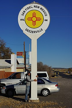
San Fidel is a census-designated place in Cibola County, New Mexico, United States. Its population was 138 as of the 2010 census. San Fidel has a post office with ZIP code 87049, which opened on December 24, 1910.[4][5] New Mexico State Road 124, the original Route 66, also known as the "Old Road," passes through the community.
The Acoma Curio Shop, which is listed on the National Register of Historic Places, is located in San Fidel.[6]
References[]
- ^ "US Gazetteer files: 2010, 2000, and 1990". United States Census Bureau. 2011-02-12. Retrieved 2011-04-23.
- ^ "U.S. Census website". United States Census Bureau. Retrieved 2011-05-14.
- ^ "San Fidel". Geographic Names Information System. United States Geological Survey.
- ^ United States Postal Service (2012). "USPS - Look Up a ZIP Code". Retrieved 2012-02-15.
- ^ "Postmaster Finder - Post Offices by ZIP Code". United States Postal Service. Retrieved August 10, 2013.
- ^ "National Register Information System". National Register of Historic Places. National Park Service. July 9, 2010.
External links[]
![]() Media related to San Fidel, New Mexico at Wikimedia Commons
Media related to San Fidel, New Mexico at Wikimedia Commons
Municipalities and communities of Cibola County, New Mexico, United States | ||
|---|---|---|
| City |  | |
| Village | ||
| CDPs |
| |
| Other communities | ||
| Indian reservations | ||
| Footnotes | ‡This populated place also has portions in an adjacent county or counties | |
| ||
This New Mexico state location article is a stub. You can help Wikipedia by . |
Categories:
- Census-designated places in New Mexico
- Census-designated places in Cibola County, New Mexico
- New Mexico geography stubs