San Ignacio Municipality, Sinaloa
San Ignacio Municipality
Municipio de San Ignacio | |
|---|---|
 Coat of arms | |
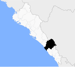 Location of the municipality in Sinaloa | |
| Coordinates: 23°56′12″N 105°25′39″W / 23.93667°N 105.42750°W | |
| Country | |
| State | |
| Seat | San Ignacio |
| No. of Sindicaturas | 8 |
| Foundation | 1915 |
| Government | |
| • Municipal president | Dr. Jesús Alfonso Lafarga Zazueta |
| Area | |
| • Total | 4,650.97 km2 (1,795.75 sq mi) |
| Population (2010) | |
| • Total | 22,527[1] |
| Time zone | UTC-7 (Mountain Standard Time) |
| • Summer (DST) | UTC-6 (Mountain Daylight Time) |
| Website | Official website |

Municipality of San Ignacio is a municipality in Sinaloa in northwestern Mexico.[2]
It stands at 23°56′12″N 106°25′39″W / 23.93667°N 106.42750°W.
Political subdivision[]
San Ignacio Municipality is subdivided in 8 sindicaturas:
- Central de San Ignacio
- Estación Dimas
- Contraestaca
- Ixpalino
- Coyotitán
- San Juan
- Ajoya
- San Javier
References[]
- ^ "Main results by locality 2010". INEGI. 2010.
- ^ "-". Enciclopedia de los Municipios de México. Instituto Nacional para el Federalismo y el Desarrollo Municipal. Retrieved January 11, 2010.
Culiacán (capital) | ||
| Municipalities and (municipal seats) |
|  |
Categories:
- Municipalities of Sinaloa
- Northern Mexico geography stubs