Sandøy
Sandøy kommune | |
|---|---|
 View of the village of Ona | |
 Møre og Romsdal within Norway | |
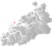 Sandøy within Møre og Romsdal | |
| Coordinates: 62°45′40″N 06°27′5″E / 62.76111°N 6.45139°ECoordinates: 62°45′40″N 06°27′5″E / 62.76111°N 6.45139°E | |
| Country | Norway |
| County | Møre og Romsdal |
| District | Romsdal |
| Established | 1 Jan 1867 |
| Disestablished | 1 Jan 2020 |
| Administrative centre | Steinshamn |
| Government | |
| • Mayor (2015-2019) | Oddvar Myklebust (Ap) |
| Area | |
| • Total | 21.43 km2 (8.27 sq mi) |
| • Land | 21.36 km2 (8.25 sq mi) |
| • Water | 0.07 km2 (0.03 sq mi) 0.3% |
| Area rank | 416 in Norway |
| *Area at municipal dissolution. | |
| Population (2018) | |
| • Total | 1,263 |
| • Rank | 371 in Norway |
| • Density | 59.1/km2 (153/sq mi) |
| • Change (10 years) | −1.4% |
| Demonym(s) | Sandøying[1] |
| Time zone | UTC+01:00 (CET) |
| • Summer (DST) | UTC+02:00 (CEST) |
| ISO 3166 code | NO-1546 |
| Official language form | Nynorsk[2] |
| Preceded by | Akerø in 1867 |
| Succeeded by | Ålesund and Aukra in 2020 |
| Website | sandoy |


Sandøy is a former municipality in Møre og Romsdal county, Norway. It was part of the Romsdal region. The administrative centre was the village of Steinshamn. Other villages included Ona and Myklebost. The municipality was spread out over many islands in the mouth of the vast Romsdal Fjord. The Flatflesa Lighthouse and Ona Lighthouse protect the boats traveling around the municipality. The Nordøy Fixed Link project was constructed from 2018 until 2023 and it includes three undersea tunnels and several bridges that will connect the main islands of Sandøy Municipality and the islands of Haram Municipality to the mainland.[3]
At the time if its dissolution in 2020, the 21-square-kilometre (8.1 sq mi) municipality is the 416th largest by area out of the 422 municipalities in Norway. Sandøy is the 371st most populous municipality in Norway with a population of 1,263. The municipality's population density is 59.1 inhabitants per square kilometre (153/sq mi) and its population has decreased by 1.4% over the last decade.[4][5]
General information[]


The municipality of Sandø i Romsdal was established on 1 January 1867 when it was separated from Akerø Municipality. The initial population was 601. The spelling of the name was later changed to Sandøy. During the 1960s, there were many municipal mergers across Norway due to the work of the Schei Committee. On 1 January 1965, the Myklebost area on Harøya island and some smaller islands to the west (population: 287) were transferred from Haram Municipality to Sandøy Municipality.[6]
On 1 January 2020, the municipality of Sandøy was dissolved. The islands of Orta and Lyngværet (and the small surrounding islands) were merged into Aukra Municipality.[7] The remainder of the old Sandøy Municipality was merged with Haram Municipality, Ørskog Municipality, Skodje Municipality, and Ålesund Municipality to form one large municipality of Ålesund.[8]
Name[]
The municipality (originally the parish) is named after the farm and the small island, Sandøya (Old Norse: Sandøy), since the first Sandøy Church was built there. The first element is sandr which means "sand" and the last element is øy which means "island". The name was historically spelled Sandø or Sandøen.[9]
Coat of arms[]
The coat of arms was granted on 12 December 1986. The arms show the light beams from the Ona Lighthouse, since lighthouses play an important role in the safety in the municipality, which consists of 871 islands and skerries.[10]
Churches[]
The Church of Norway had one parish (sokn) within the municipality of Sandøy. It is part of the Molde domprosti (arch-deanery) in the Diocese of Møre.
| Parish (sokn) | Church name | Location of the church | Year built |
|---|---|---|---|
| Sandøy | Sandøy Church | Sandøya | 1812 |
| Harøy Church | Harøya | 1934 |
Geography[]
Sandøy is an island municipality. Sandøy consists of 871 islands, but only five are regularly inhabited. The main inhabited islands are Harøya, Sandøya, Finnøya, Ona, and Orta. Ona is the most famous of the islands and is a popular tourist destination due to its history and the Ona Lighthouse.
Government[]
All municipalities in Norway, including Sandøy, are responsible for primary education (through 10th grade), outpatient health services, senior citizen services, unemployment and other social services, zoning, economic development, and municipal roads. The municipality is governed by a municipal council of elected representatives, which in turn elect a mayor.[11] The municipality falls under the Romsdal District Court and the Frostating Court of Appeal.
Municipal council[]
The municipal council (Kommunestyre) of Sandøy is made up of 19 representatives that are elected to four year terms. The party breakdown for the final municipal council was as follows:
| Party Name (in Nynorsk) | Number of representatives | |
|---|---|---|
| Labour Party (Arbeidarpartiet) | 10 | |
| Conservative Party (Høgre) | 6 | |
| Liberal Party (Venstre) | 3 | |
| Total number of members: | 19 | |
See also[]
References[]
- ^ "Navn på steder og personer: Innbyggjarnamn" (in Norwegian). Språkrådet.
- ^ "Forskrift om målvedtak i kommunar og fylkeskommunar" (in Norwegian). Lovdata.no.
- ^ "Fv 659 Nordøyvegen" (in Norwegian). Statens vegvesen. Retrieved 2017-10-19.
- ^ Statistisk sentralbyrå (2018). "Table: 06913: Population 1 January and population changes during the calendar year (M)" (in Norwegian). Retrieved 2019-07-27.
- ^ Statistisk sentralbyrå. "09280: Area of land and fresh water (km²) (M)" (in Norwegian). Retrieved 2019-07-27.
- ^ Jukvam, Dag (1999). "Historisk oversikt over endringer i kommune- og fylkesinndelingen" (PDF) (in Norwegian). Statistisk sentralbyrå.
- ^ "Meir om grensejusteringa i Sandøy" (in Norwegian). Nye Ålesund kommune. Retrieved 2019-07-27.
- ^ "Nye Ålesund" (in Norwegian). Retrieved 2017-10-19.
- ^ Rygh, Oluf (1908). Norske gaardnavne: Romsdals amt (in Norwegian) (13 ed.). Kristiania, Norge: W. C. Fabritius & sønners bogtrikkeri. p. 311.
- ^ "Civic heraldry of Norway - Norske Kommunevåpen". Heraldry of the World. Retrieved 2019-07-27.
- ^ Hansen, Tore, ed. (2016-05-12). "kommunestyre". Store norske leksikon (in Norwegian). Kunnskapsforlaget. Retrieved 2019-04-06.
- ^ Jump up to: a b c d "Table: 04813: Members of the local councils, by party/electoral list at the Municipal Council election (M)" (in Norwegian). Statistics Norway.
- ^ "Tall for Norge: Kommunestyrevalg 2011 - Møre og Romsdal" (in Norwegian). Statistics Norway. Retrieved 2019-10-19.
- ^ "Kommunestyrevalget 1995" (PDF) (in Norwegian). Oslo-Kongsvinger: Statistisk sentralbyrå. 1996. Retrieved 2020-04-26.
- ^ "Kommunestyrevalget 1991" (PDF) (in Norwegian). Oslo-Kongsvinger: Statistisk sentralbyrå. 1993. Retrieved 2020-04-26.
- ^ "Kommunestyrevalget 1987" (PDF) (in Norwegian). Oslo-Kongsvinger: Statistisk sentralbyrå. 1988. Retrieved 2020-04-26.
- ^ "Kommunestyrevalget 1983" (PDF) (in Norwegian). Oslo-Kongsvinger: Statistisk sentralbyrå. 1984. Retrieved 2020-04-26.
- ^ "Kommunestyrevalget 1979" (PDF) (in Norwegian). Oslo: Statistisk sentralbyrå. 1979. Retrieved 2020-04-26.
- ^ "Kommunevalgene 1975" (PDF) (in Norwegian). Oslo: Statistisk sentralbyrå. 1977. Retrieved 2020-04-26.
- ^ "Kommunevalgene 1972" (PDF) (in Norwegian). Oslo: Statistisk sentralbyrå. 1973. Retrieved 2020-04-26.
- ^ "Kommunevalgene 1967" (PDF) (in Norwegian). Oslo: Statistisk sentralbyrå. 1967. Retrieved 2020-04-26.
- ^ "Kommunevalgene 1963" (PDF) (in Norwegian). Oslo: Statistisk sentralbyrå. 1964. Retrieved 2020-04-26.
- ^ "Kommunevalgene og Ordførervalgene 1959" (PDF) (in Norwegian). Oslo: Statistisk sentralbyrå. 1960. Retrieved 2020-04-26.
- ^ "Kommunevalgene og Ordførervalgene 1955" (PDF) (in Norwegian). Oslo: Statistisk sentralbyrå. 1957. Retrieved 2020-04-26.
- ^ "Kommunevalgene og Ordførervalgene 1951" (PDF) (in Norwegian). Oslo: Statistisk sentralbyrå. 1952. Retrieved 2020-04-26.
- ^ "Kommunevalgene og Ordførervalgene 1947" (PDF) (in Norwegian). Oslo: Statistisk sentralbyrå. 1948. Retrieved 2020-04-26.
- ^ "Kommunevalgene og Ordførervalgene 1945" (PDF) (in Norwegian). Oslo: Statistisk sentralbyrå. 1947. Retrieved 2020-04-26.
- ^ "Kommunevalgene og Ordførervalgene 1937" (PDF) (in Norwegian). Oslo: Statistisk sentralbyrå. 1938. Retrieved 2020-04-26.
External links[]
 Media related to Sandøy at Wikimedia Commons
 Møre og Romsdal travel guide from Wikivoyage
- Municipal fact sheet from Statistics Norway (in Norwegian)
| hide Møre og Romsdal county, Norway | |||
|---|---|---|---|
| |||
 | Towns and cities |
|  |
| Municipalities | |||
| Authority control |
|
|---|
- Sandøy
- Ålesund
- Aukra
- Former municipalities of Norway
- 1867 establishments in Norway
- 2020 disestablishments in Norway
- Populated places disestablished in 2020