Santa Clarita station
Santa Clarita | |||||||||||
|---|---|---|---|---|---|---|---|---|---|---|---|
| Metrolink commuter rail station | |||||||||||
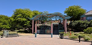 The Santa Clarita station | |||||||||||
| Location | 22122 Soledad Canyon Road Santa Clarita, California | ||||||||||
| Coordinates | 34°24′53″N 118°31′26″W / 34.41472°N 118.52389°WCoordinates: 34°24′53″N 118°31′26″W / 34.41472°N 118.52389°W | ||||||||||
| Owned by | City of Santa Clarita | ||||||||||
| Line(s) | SCRRA Valley Subdivision[1] | ||||||||||
| Platforms | 1 side platform | ||||||||||
| Tracks | 1 | ||||||||||
| Connections | |||||||||||
| Construction | |||||||||||
| Parking | 473 spaces | ||||||||||
| Bicycle facilities | Racks, lockers, bikeway connection | ||||||||||
| Disabled access | Yes | ||||||||||
| History | |||||||||||
| Opened | October 26, 1992[2] | ||||||||||
| Services | |||||||||||
| |||||||||||
| Location | |||||||||||
 | |||||||||||

Santa Clarita is a Metrolink rail station in the city of Santa Clarita, California. It is served by Metrolink's Antelope Valley Line from Los Angeles Union Station to Lancaster. Thirty Metrolink trains serve the station each weekday and 12 serve the station on Saturday and Sunday. Sunday service began in September 2007. Weekday Metrolink service runs primarily at peak hours in the peak direction of travel while weekend departures and arrivals are fairly evenly spaced throughout the day. City of Santa Clarita Transit offers connecting bus service at the station. Because the City of Santa Clarita has two other Metrolink stations, this station is sometimes referred to as Soledad Metrolink.
Platforms and tracks[]
| Main track | ■ Antelope Valley Line | toward Lancaster (Via Princessa) |
| ■ Antelope Valley Line | toward L.A. Union Station (Newhall) |
Connections[]
City of Santa Clarita Transit:
- Local: 5, 6
- Station Link : 501, 502
- Commuter Express: 792, 796, 797, 799
Kern Transit: 130 to Bakersfield via Frazier Park
Bikeway:
- Santa Clara River Trail- There is a direct connection to the station; the bikeway runs along Soledad Canyon Road across the street on north side of the station.
See also[]
- Lang Southern Pacific Station a California Historic Landmark
References[]
- ^ SMA Rail Consulting (April 2016). "California Passenger Rail Network Schematics" (PDF). California Department of Transportation.
- ^ Trombley, William (October 26, 1992). "Remote Control Clears Path for Metrolink Trains". The Los Angeles Times. p. A23. Retrieved January 8, 2021 – via Newspapers.com.

External links[]
- Santa Clarita at the Metrolink website
| Wikimedia Commons has media related to Santa Clarita station. |
| City | |
|---|---|
| Neighborhoods | |
| Public schools | |
| Private schools | |
| Colleges and universities | |
| Points of interest |
|
| Services | |
| Media | |
| Transportation | |
| History | |
| Companies | |
This California train station-related article is a stub. You can help Wikipedia by . |
- Metrolink stations in Los Angeles County, California
- Railway stations in the United States opened in 1992
- Santa Clarita, California
- California railway station stubs