Santa Cruz, Marinduque
Santa Cruz | |
|---|---|
| Municipality of Santa Cruz | |
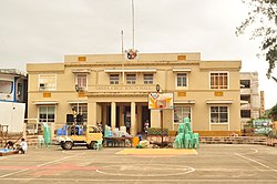 Municipal Hall | |
 Flag  Seal | |
 Map of Marinduque with Santa Cruz highlighted | |
OpenStreetMap  | |
 Santa Cruz Location within the Philippines | |
| Coordinates: 13°29′N 122°02′E / 13.48°N 122.03°ECoordinates: 13°29′N 122°02′E / 13.48°N 122.03°E | |
| Country | Philippines |
| Region | Mimaropa |
| Province | Marinduque |
| District | Lone district |
| Founded | 1609 |
| Barangays | 55 (see Barangays) |
| Government | |
| • Type | Sangguniang Bayan |
| • Mayor | Antonio L. Uy Jr. |
| • Vice Mayor | Geraldine M. del Rosario |
| • Representative | Lord Allan Jay Q. Velasco |
| • Municipal Council | Members |
| • Electorate | 38,308 voters (2019) |
| Area | |
| • Total | 270.77 km2 (104.54 sq mi) |
| Elevation | 131 m (430 ft) |
| Highest elevation | 663 m (2,175 ft) |
| Lowest elevation | 0 m (0 ft) |
| Population (2020 census) [3] | |
| • Total | 54,692 |
| • Density | 200/km2 (520/sq mi) |
| • Households | 13,309 |
| Economy | |
| • Income class | 1st municipal income class |
| • Poverty incidence | 15.62% (2015)[4] |
| • Revenue | ₱224,213,015.65 (2020) |
| • Assets | ₱556,342,904.97 (2020) |
| • Expenditure | ₱183,922,198.41 (2020) |
| • Liabilities | ₱145,854,960.04 (2020) |
| Service provider | |
| • Electricity | Marinduque Electric Cooperative (MARELCO) |
| Time zone | UTC+8 (PST) |
| ZIP code | 4902 |
| PSGC | |
| IDD : area code | +63 (0)42 |
| Native languages | Tagalog |

Santa Cruz, officially the Municipality of Santa Cruz (Tagalog: Bayan ng Santa Cruz), is a 1st class municipality in the province of Marinduque, Philippines. According to the 2020 census, it has a population of 54,692 people. [3]
Geography[]
The municipal jurisdiction also includes the islands of Maniwaya, Mongpong, Salomague, and Santa Cruz (also known as Polo Island), as well as several minor islets.
Climate[]
| Climate data for Santa Cruz, Marinduque | |||||||||||||
|---|---|---|---|---|---|---|---|---|---|---|---|---|---|
| Month | Jan | Feb | Mar | Apr | May | Jun | Jul | Aug | Sep | Oct | Nov | Dec | Year |
| Average high °C (°F) | 27 (81) |
28 (82) |
30 (86) |
31 (88) |
31 (88) |
30 (86) |
29 (84) |
29 (84) |
29 (84) |
29 (84) |
28 (82) |
28 (82) |
29 (84) |
| Average low °C (°F) | 21 (70) |
21 (70) |
21 (70) |
23 (73) |
24 (75) |
25 (77) |
24 (75) |
24 (75) |
24 (75) |
23 (73) |
23 (73) |
22 (72) |
23 (73) |
| Average precipitation mm (inches) | 31 (1.2) |
23 (0.9) |
25 (1.0) |
30 (1.2) |
85 (3.3) |
145 (5.7) |
182 (7.2) |
153 (6.0) |
172 (6.8) |
150 (5.9) |
113 (4.4) |
68 (2.7) |
1,177 (46.3) |
| Average rainy days | 11.3 | 8.5 | 9.7 | 11.3 | 18.3 | 23.2 | 26.6 | 25.4 | 25.9 | 24.2 | 19.7 | 15.2 | 219.3 |
| Source: Meteoblue [5] | |||||||||||||
Barangays[]

Santa Cruz is politically subdivided into 55 barangays. [6] In 1957 the sitio of Kalangkang, barrio of Kasily, was converted into a barrio.[7]
- Alobo
- Angas
- Aturan
- Bagong Silang Pob. (2nd Zone)
- Baguidbirin
- Baliis
- Balogo
- Banahaw Pob. (3rd Zone Pob.)
- Bangcuangan
- Banogbog
- Biga
- Botilao
- Buyabod
- Dating Bayan
- Devilla
- Dolores
- Haguimit
- Hupi
- Ipil
- Jolo
- Kaganhao
- Kalangkang
- Kamandugan
- Kasily
- Kilo-kilo
- Kinyaman
- Labo
- Lamesa
- Landy(Perez)
- Lapu-lapu Pob. (5th Zone)
- Libjo
- Lipa
- Lusok
- Maharlika Pob. (1st Zone)
- Makulapnit
- Maniwaya
- Manlibunan
- Masaguisi
- Masalukot
- Matalaba
- Mongpong
- Morales
- Napo (Malabon)
- Pag-Asa Pob. (4th Zone)
- Pantayin
- Polo
- Pulong-Parang
- Punong
- San Antonio
- San Isidro
- Tagum
- Tamayo
- Tambangan
- Tawiran
- Taytay
History[]
Republic Act No. 204, approved May 28, 1948, converted the sitios of Angas of the barrio of Tagum, Biga of the barrio of Alobo, Kamandungan of the barrio of Lusok, Kilokilo of the barrio of San Antonio, and Makulapnit of the barrio of Devilla to regular and independent barrios.[8]
In 1953, the sitio of Baguidbirin was converted into a barrio.[9]
Demographics[]
| Year | Pop. | ±% p.a. |
|---|---|---|
| 1903 | 16,350 | — |
| 1918 | 16,681 | +0.13% |
| 1939 | 24,537 | +1.85% |
| 1948 | 27,430 | +1.25% |
| 1960 | 32,765 | +1.49% |
| 1970 | 41,300 | +2.34% |
| 1975 | 49,274 | +3.60% |
| 1980 | 51,846 | +1.02% |
| 1990 | 52,926 | +0.21% |
| 1995 | 56,991 | +1.40% |
| 2000 | 60,055 | +1.13% |
| 2007 | 61,322 | +0.29% |
| 2010 | 55,673 | −3.46% |
| 2015 | 56,408 | +0.25% |
| 2020 | 54,692 | −0.61% |
| Source: Philippine Statistics Authority [10] [11] [12][13] | ||
In the 2020 census, the population of Santa Cruz, Marinduque, was 54,692 people, [3] with a density of 200 inhabitants per square kilometre or 520 inhabitants per square mile.
Economy[]
| Poverty Incidence of Santa Cruz | |
| Source: Philippine Statistics Authority[14][15][16][17][18][19] | |
Transportation[]
Access to the municipality:
- Via sea - Balanacan Port Mogpog (ferry coming from Lucena, ro/ro and fastcrafts)
- Via air - Marinduque Airport-(Cebu Pacific Operate by Cebgo) Starts Operation on April 1, 2019- Jeepney to Santa Cruz via Boac
Twin towns/cities[]
 Valenzuela City, Philippines (2008)
- Virac, Catanduanes, Philippines (2008)
- Naval, Biliran, Philippines (2008)
- Jolo, Sulu, Philippines (2010)
- Basco, Batanes, Philippines (2010)
References[]
- ^ Municipality of Santa Cruz | (DILG)
- ^ "2015 Census of Population, Report No. 3 – Population, Land Area, and Population Density" (PDF). Philippine Statistics Authority. Quezon City, Philippines. August 2016. ISSN 0117-1453. Archived (PDF) from the original on May 25, 2021. Retrieved July 16, 2021.
- ^ a b c Census of Population (2020). "MIMAROPA". Total Population by Province, City, Municipality and Barangay. PSA. Retrieved 8 July 2021.
- ^ https://psa.gov.ph/sites/default/files/City%20and%20Municipal-level%20Small%20Area%20Poverty%20Estimates_%202009%2C%202012%20and%202015_0.xlsx; publication date: 10 July 2019; publisher: Philippine Statistics Authority.
- ^ "Santa Cruz: Average Temperatures and Rainfall". Meteoblue. Retrieved 28 April 2020.
- ^ "Province: Marinduque". PSGC Interactive. Quezon City, Philippines: Philippine Statistics Authority. Retrieved 12 November 2016.
- ^ "An Act Converting the Sitio of Kalangkang, Barrio of Kasily, Municipality of Santa Cruz, Province of Marinduque, into a Barrio to Be Known As the Barrio of Kalangkang of Said Municipality". LawPH.com. Retrieved 2011-04-12.
- ^ "An act converting the sitios of Angas, Biga, Kamandungan, Kilokilo and Makulapnit of the municipality of Santa Cruz, province of Marinduque, into independent barrios". LawPH.com. Retrieved 2011-04-08.
- ^ "An Act Creating the Barrio of Baguidbirin in the Municipality of Santa Cruz, Province of Marinduque". LawPH.com. Retrieved 2011-04-09.
- ^ Census of Population (2015). "Region IV-B (Mimaropa)". Total Population by Province, City, Municipality and Barangay. PSA. Retrieved 20 June 2016.
- ^ Census of Population and Housing (2010). "Region IV-B (Mimaropa)". Total Population by Province, City, Municipality and Barangay. NSO. Retrieved 29 June 2016.
- ^ Censuses of Population (1903–2007). "Region IV-B (Mimaropa)". Table 1. Population Enumerated in Various Censuses by Province/Highly Urbanized City: 1903 to 2007. NSO.
- ^ "Province of Marinduque". Municipality Population Data. Local Water Utilities Administration Research Division. Retrieved 17 December 2016.
- ^ "Poverty incidence (PI):". Philippine Statistics Authority. Retrieved 28 December 2020.
- ^ https://psa.gov.ph/sites/default/files/NSCB_LocalPovertyPhilippines_0.pdf; publication date: 29 November 2005; publisher: Philippine Statistics Authority.
- ^ https://psa.gov.ph/sites/default/files/2003%20SAE%20of%20poverty%20%28Full%20Report%29_1.pdf; publication date: 23 March 2009; publisher: Philippine Statistics Authority.
- ^ https://psa.gov.ph/sites/default/files/2006%20and%202009%20City%20and%20Municipal%20Level%20Poverty%20Estimates_0_1.pdf; publication date: 3 August 2012; publisher: Philippine Statistics Authority.
- ^ https://psa.gov.ph/sites/default/files/2012%20Municipal%20and%20City%20Level%20Poverty%20Estima7tes%20Publication%20%281%29.pdf; publication date: 31 May 2016; publisher: Philippine Statistics Authority.
- ^ https://psa.gov.ph/sites/default/files/City%20and%20Municipal-level%20Small%20Area%20Poverty%20Estimates_%202009%2C%202012%20and%202015_0.xlsx; publication date: 10 July 2019; publisher: Philippine Statistics Authority.
External links[]
| Wikisource has the text of the 1905 New International Encyclopedia article "Santa Cruz de Napo". |
| Wikimedia Commons has media related to Santa Cruz, Marinduque. |
- Santa Cruz Profile at PhilAtlas.com
- Philippine Standard Geographic Code
- Philippine Census Information
- Local Governance Performance Management System
Places adjacent to Santa Cruz, Marinduque | ||||||||||||||||
|---|---|---|---|---|---|---|---|---|---|---|---|---|---|---|---|---|
| ||||||||||||||||
Boac (capital) | |
| Municipalities | |
- Municipalities of Marinduque