Santanyí
Santany | |
|---|---|
 Plaça Major in Santanyí | |
 Flag  Coat of arms | |
| Nickname(s): Santany (Spanish) | |
 Location of Satanyí on Majorca | |
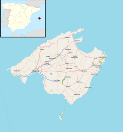 Santany Location in Majorca | |
| Coordinates: 39°21′15″N 3°7′42″E / 39.35417°N 3.12833°ECoordinates: 39°21′15″N 3°7′42″E / 39.35417°N 3.12833°E | |
| Government | |
| Area | |
| • Land | 124.47 km2 (48.06 sq mi) |
| Population (2018)[1] | |
| • Total | 12,112 |
| • Density | 89.76/km2 (232.5/sq mi) |
| 69 | |
| Time zone | UTC+1 (CET) |
| • Summer (DST) | UTC+2 (CEST) |
| Website | www.ajsantanyi.net |


Santanyí is a municipality on the Spanish island of Majorca, one of the Balearic Islands, situated in the most western part of the Mediterranean Sea.
This municipality in the south east of Majorca is home to the towns of Santanyí, Calonge, and , as well as Cala d'Or, Portopetro, , Cala Figuera, , Cala Llombards and . The municipality encompasses a variety of beaches popular for their scenic beauty. The coast covered by the municipality extends around 35 kilometres along the south east coast of the island. It also holds 172 archaeological sites, evidence of the existence of a productive agriculture and farming tradition since at least the Talaiotic period.
Santanyi is also home to a protected natural area, the .
Town[]
| Town | Inhabitants (2005)¹ |
|---|---|
| S'Alqueria Blanca | 936 |
| Cala d'Or | 3539 |
| Cala Figuera | 577 |
| Calonge | 820 |
| La Costa | 31 |
| Es Llombards | 524 |
| Portopetro | 497 |
| Santanyí | 2912 |
| Cala Llombards | 283 |
| Cala Santanyí | 447 |
| Cap d'es Moro | 107 |
1 Information from the Spanish National Institute of Statistics
Evolution of the Municipality's population.
| 1996 | 2001 | 2002 | 2003 | 2004 | 2005 | |
|---|---|---|---|---|---|---|
| TOTAL | 7702 | 9405 | 10,020 | 10,253 | 10,337 | 10,673 |
| Men | 3862 | 4801 | 5151 | 5230 | 5260 | 5405 |
| Women | 3840 | 4604 | 4869 | 5023 | 5077 | 5268 |
Source:
References[]
- ^ Municipal Register of Spain 2018. National Statistics Institute.
External links[]
| Wikimedia Commons has media related to Santanyí. |
| show Municipalities in the Balearic Islands |
|---|
| show Authority control |
|---|
This article about a location in the Balearic Islands is a stub. You can help Wikipedia by . |
- Santanyí
- Populated places in Mallorca
- Balearic Islands geography stubs