Satellite
| Part of a series on |
| Spaceflight |
|---|
 |
| History |
|
| Applications |
|
| Spacecraft |
|
| Space launch |
|
| Spaceflight types |
|
| Space agencies |
| Space forces |
| Space commands |
| Private spaceflight |
|
|
|
In the context of spaceflight, a satellite is an object that has been intentionally placed into orbit. These objects are called artificial satellites to distinguish them from natural satellites such as Earth's Moon.
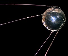
On 4 October 1957, the Soviet Union launched the world's first artificial satellite, Sputnik 1. Since then, about 8,900 satellites from more than 40 countries have been launched. According to a 2018 estimate, about 5,000 remained in orbit. Of those, about 1,900 were operational, while the rest had exceeded their useful lives and become space debris. Approximately 63% of operational satellites are in low Earth orbit, 6% are in medium-Earth orbit (at 20,000 km), 29% are in geostationary orbit (at 36,000 km) and the remaining 2% are in various elliptical orbits. In terms of countries with the most satellites, the United States has the most with 1,897 satellites, China is second with 412, and Russia third with 176.[1] A few large space stations, including the International Space Station, have been launched in parts and assembled in orbit. Over a dozen space probes have been placed into orbit around other bodies and become artificial satellites of the Moon, Mercury, Venus, Mars, Jupiter, Saturn, a few asteroids,[2] a comet and the Sun.
Satellites are used for many purposes. Among several other applications, they can be used to make star maps and maps of planetary surfaces, and also take pictures of planets they are launched into. Common types include military and civilian Earth observation satellites, communications satellites, navigation satellites, weather satellites, and space telescopes. Space stations and human spacecraft in orbit are also satellites.
Satellites can operate by themselves or as part of a larger system, a satellite formation or satellite constellation.
Satellite orbits vary greatly, depending on the purpose of the satellite, and are classified in a number of ways. Well-known (overlapping) classes include low Earth orbit, polar orbit, and geostationary orbit.
A launch vehicle is a rocket that places a satellite into orbit. Usually, it lifts off from a launch pad on land. Some are launched at sea from a submarine or a mobile maritime platform, or aboard a plane (see air launch to orbit).
Satellites are usually semi-independent computer-controlled systems. Satellite subsystems attend many tasks, such as power generation, thermal control, telemetry, attitude control, scientific instrumentation, communication, etc.
History[]


The first published mathematical study of the possibility of an artificial satellite was Newton's cannonball, a thought experiment by Isaac Newton to explain the motion of natural satellites, in his Philosophiæ Naturalis Principia Mathematica (1687). The first fictional depiction of a satellite being launched into orbit was a short story by Edward Everett Hale, "The Brick Moon" (1869).[3][4] The idea surfaced again in Jules Verne's The Begum's Fortune (1879).
In 1903, Konstantin Tsiolkovsky (1857–1935) published Exploring Space Using Jet Propulsion Devices, which is the first academic treatise on the use of rocketry to launch spacecraft. He calculated the orbital speed required for a minimal orbit, and that a multi-stage rocket fueled by liquid propellants could achieve this.
In 1928, Herman Potočnik (1892–1929) published his sole book, The Problem of Space Travel – The Rocket Motor. He described the use of orbiting spacecraft for observation of the ground and described how the special conditions of space could be useful for scientific experiments.
In a 1945 Wireless World article, the English science fiction writer Arthur C. Clarke described in detail the possible use of communications satellites for mass communications.[5] He suggested that three geostationary satellites would provide coverage over the entire planet.
In May 1946, the United States Air Force's Project RAND released the Preliminary Design of an Experimental World-Circling Spaceship, which stated that "A satellite vehicle with appropriate instrumentation can be expected to be one of the most potent scientific tools of the Twentieth Century."[6] The United States had been considering launching orbital satellites since 1945 under the Bureau of Aeronautics of the United States Navy. Project RAND eventually released the report, but considered the satellite to be a tool for science, politics, and propaganda, rather than a potential military weapon.[7]
In 1946, American theoretical astrophysicist Lyman Spitzer proposed an orbiting space telescope.[8]
In February 1954 Project RAND released "Scientific Uses for a Satellite Vehicle", written by R.R. Carhart.[9] This expanded on potential scientific uses for satellite vehicles and was followed in June 1955 with "The Scientific Use of an Artificial Satellite", by H.K. Kallmann and W.W. Kellogg.[10]
In the context of activities planned for the International Geophysical Year (1957–58), the White House announced on 29 July 1955 that the U.S. intended to launch satellites by the spring of 1958. This became known as Project Vanguard. On 31 July, the Soviets announced that they intended to launch a satellite by the fall of 1957.
The first artificial satellite was Sputnik 1, launched by the Soviet Union on 4 October 1957 under the Sputnik program, with Sergei Korolev as chief designer. Sputnik 1 helped to identify the density of high atmospheric layers through measurement of its orbital change and provided data on radio-signal distribution in the ionosphere. The unanticipated announcement of Sputnik 1's success precipitated the Sputnik crisis in the United States and ignited the so-called Space Race within the Cold War.
Sputnik 2 was launched on 3 November 1957 and carried the first living passenger into orbit, a dog named Laika.[11]
In early 1955, following pressure by the American Rocket Society, the National Science Foundation, and the International Geophysical Year, the Army and Navy were working on Project Orbiter with two competing programs. The army used the Jupiter C rocket, while the civilian/Navy program used the Vanguard rocket to launch a satellite. Explorer 1 became the United States' first artificial satellite on 31 January 1958.[12]
In June 1961, three-and-a-half years after the launch of Sputnik 1, the United States Space Surveillance Network cataloged 115 Earth-orbiting satellites.[13]
Early satellites were constructed to unique designs. With advancements in technology, multiple satellites began to be built on single model platforms called satellite buses. The first standardized satellite bus design was the HS-333 geosynchronous (GEO) communication satellite launched in 1972. Beginning in 1997, FreeFlyer is a commercial off-the-shelf software application for satellite mission analysis, design and operations.
Currently the largest artificial satellite ever is the International Space Station.[14]
Tracking[]
Satellites can be tracked from Earth stations and also from other satellites.
Space Surveillance Network[]
The United States Space Surveillance Network (SSN), a division of the United States Strategic Command, has been tracking objects in Earth's orbit since 1957 when the Soviet Union opened the Space Age with the launch of Sputnik I. Since then, the SSN has tracked more than 26,000 objects. The SSN currently tracks more than 8,000-artificial orbiting objects. The rest have re-entered Earth's atmosphere and disintegrated, or survived re-entry and impacted the Earth. The SSN tracks objects that are 10 centimeters in diameter or larger; those now orbiting Earth range from satellites weighing several tons to pieces of spent rocket bodies weighing only 10 pounds. About seven percent are operational satellites (i.e. ~560 satellites), the rest are space debris.[15] The United States Strategic Command is primarily interested in the active satellites, but also tracks space debris which upon reentry might otherwise be mistaken for incoming missiles.
Services[]
There are three basic categories of (non-military) satellite services:[16]
Fixed satellite services[]
Fixed satellite services handle hundreds of billions of voice, data, and video transmission tasks across all countries and continents between certain points on the Earth's surface.
Mobile satellite systems[]
Mobile satellite systems help connect remote regions, vehicles, ships, people and aircraft to other parts of the world and/or other mobile or stationary communications units, in addition to serving as navigation systems.
Scientific research satellites (commercial and noncommercial)[]
Scientific research satellites provide meteorological information, land survey data (e.g. remote sensing), Amateur (HAM) Radio, and other different scientific research applications such as earth science, marine science, and atmospheric research.
Types[]
- Astronomical satellites are satellites used for observation of distant planets, galaxies, and other outer space objects.

- Biosatellites are satellites designed to carry living organisms, generally for scientific experimentation.
- Communication satellites are satellites stationed in space for the purpose of telecommunications. Modern communications satellites typically use geosynchronous orbits, Molniya orbits or Low Earth orbits.
- Earth observation satellites are satellites intended for non-military uses such as environmental monitoring, meteorology, map making etc. (See especially Earth Observing System.)
- Navigational satellites are satellites that use radio time signals transmitted to enable mobile receivers on the ground to determine their exact location. The relatively clear line of sight between the satellites and receivers on the ground, combined with ever-improving electronics, allows satellite navigation systems to measure location to accuracies on the order of a few meters in real time.
- Killer satellites are satellites that are designed to destroy enemy warheads, satellites, and other space assets.
- Crewed spacecraft (spaceships) are large satellites able to put humans into (and beyond) an orbit, and return them to Earth. (The Lunar Module of the U.S. Apollo program was an exception, in that it did not have the capability of returning human occupants to Earth.) Spacecraft including spaceplanes of reusable systems have major propulsion or landing facilities. They can be used as transport to and from the orbital stations.
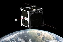
- Miniaturized satellites are satellites of unusually low masses and small sizes.[17] New classifications are used to categorize these satellites: minisatellite (500–1000 kg), microsatellite (below 100 kg), nanosatellite (below 10 kg).[citation needed]
- Reconnaissance satellites are Earth observation satellite or communications satellite deployed for military or intelligence applications. Very little is known about the full power of these satellites, as governments who operate them usually keep information pertaining to their reconnaissance satellites classified.
- Recovery satellites are satellites that provide a recovery of reconnaissance, biological, space-production and other payloads from orbit to Earth.
- Space-based solar power satellites are proposed satellites that would collect energy from sunlight and transmit it for use on Earth or other places.
- Space stations are artificial orbital structures that are designed for human beings to live on in outer space. A space station is distinguished from other crewed spacecraft by its lack of major propulsion or landing facilities. Space stations are designed for medium-term living in orbit, for periods of weeks, months, or even years.

- Tether satellites are satellites that are connected to another satellite by a thin cable called a tether.
- Weather satellites are primarily used to monitor Earth's weather and climate.[18]
Orbits[]

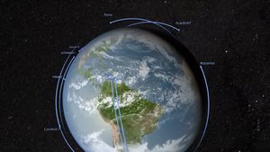
The first satellite, Sputnik 1, was put into orbit around Earth and was therefore in geocentric orbit. This is the most common type of orbit by far, with approximately 3,372[19] active artificial satellites orbiting the Earth. Geocentric orbits may be further classified by their altitude, inclination and eccentricity.
The commonly used altitude classifications of geocentric orbit are Low Earth orbit (LEO), Medium Earth orbit (MEO) and High Earth orbit (HEO). Low Earth orbit is any orbit below 2,000 km. Medium Earth orbit is any orbit between 2,000 and 35,786 km. High Earth orbit is any orbit higher than 35,786 km.
Centric classifications[]
- Galactocentric orbit: An orbit around the centre of a galaxy. The Sun follows this type of orbit about the galactic centre of the Milky Way.
- Geocentric orbit: An orbit around the planet Earth, such as the Moon or artificial satellites. Currently there are over 2,787[19] active artificial satellites orbiting the Earth.
- Heliocentric orbit: An orbit around the Sun. In our Solar System, all planets, comets, and asteroids are in such orbits, as are many artificial satellites and pieces of space debris. Moons by contrast are not in a heliocentric orbit but rather orbit their parent planet.
- Areocentric orbit: An orbit around the planet Mars, such as by moons or artificial satellites.
Altitude classifications[]
- Low Earth orbit (LEO): Geocentric orbits ranging in altitude from 180 km – 2,000 km (1,200 mi)
- Medium Earth orbit (MEO): Geocentric orbits ranging in altitude from 2,000 km (1,200 mi) – 35,786 km (22,236 mi). Also known as an intermediate circular orbit.
- Geosynchronous orbit (GEO): Geocentric circular orbit with an altitude of 35,786 kilometres (22,236 mi). The period of the orbit equals one sidereal day, coinciding with the rotation period of the Earth. The speed is 3,075 metres per second (10,090 ft/s).
- High Earth orbit (HEO): Geocentric orbits above the altitude of geosynchronous orbit 35,786 km (22,236 mi).

Inclination classifications[]
- Inclined orbit: An orbit whose inclination in reference to the equatorial plane is not zero degrees.
- Polar orbit: An orbit that passes above or nearly above both poles of the planet on each revolution. Therefore, it has an inclination of (or very close to) 90 degrees.
- Polar sun synchronous orbit: A nearly polar orbit that takes advantage of nodal precession such that a satellite in such an orbit passes the equator at the same local time on every pass. Useful for image taking satellites because shadows will be nearly the same on every pass, and for solar observation satellites because they can have a continuous view of the Sun throughout the year.
Eccentricity classifications[]
- Circular orbit: An orbit that has an eccentricity of 0 and whose path traces a circle.
- Hohmann transfer orbit: An orbit that moves a spacecraft from one approximately circular orbit, usually the orbit of a planet, to another, using two engine impulses. The perihelion of the transfer orbit is at the same distance from the Sun as the radius of one planet's orbit, and the aphelion is at the other. The two rocket burns change the spacecraft's path from one circular orbit to the transfer orbit, and later to the other circular orbit. This maneuver was named after Walter Hohmann.
- Elliptic orbit: An orbit with an eccentricity greater than 0 and less than 1 whose orbit traces the path of an ellipse.
- Geosynchronous transfer orbit: An elliptic orbit where the perigee is at the altitude of a Low Earth orbit (LEO) and the apogee at the altitude of a geosynchronous orbit. Satellites use this orbit to transfer to a geostationary orbit.
- Geostationary transfer orbit: A geosynchronous transfer orbit that is used to transfer to a geostationary orbit.
- Molniya orbit: A highly eccentric orbit with inclination of 63.4° and orbital period of half of a sidereal day (roughly 12 hours). Such a satellite spends most of its time over two designated areas of the planet (usually Russia and North America).
- Tundra orbit: A highly eccentric orbit with inclination of 63.4° and orbital period of one sidereal day (roughly 24 hours). Such a satellite spends most of its time over a single designated area of the planet.
Synchronous classifications[]
- Synchronous orbit: An orbit where the satellite has an orbital period equal to the average rotational period (earth's is: 23 hours, 56 minutes, 4.091 seconds) of the body being orbited and in the same direction of rotation as that body. To a ground observer such a satellite would trace an analemma (figure 8) in the sky.
- Semi-synchronous orbit (SSO): An orbit with an altitude of approximately 20,200 km (12,600 mi) and an orbital period equal to one-half of the average rotational period (Earth's is approximately 12 hours) of the body being orbited
- Geosynchronous orbit (GSO): Orbits with an altitude of approximately 35,786 km (22,236 mi). Such a satellite would trace an analemma (figure 8) in the sky.
- Geostationary orbit (GEO): A geosynchronous orbit with an inclination of zero. To an observer on the ground this satellite would appear as a fixed point in the sky.[20]
- Clarke orbit: Another name for a geostationary orbit. Named after scientist and writer Arthur C. Clarke.
- Supersynchronous orbit: A disposal / storage orbit above GSO/GEO. Satellites will drift west. Also a synonym for Disposal orbit.
- Subsynchronous orbit: A drift orbit close to but below GSO/GEO. Satellites will drift east.
- Graveyard orbit: An orbit a few hundred kilometers above geosynchronous that satellites are moved into at the end of their operation.
- Disposal orbit: A synonym for graveyard orbit.
- Junk orbit: A synonym for graveyard orbit.
- Geostationary orbit (GEO): A geosynchronous orbit with an inclination of zero. To an observer on the ground this satellite would appear as a fixed point in the sky.[20]
- Areosynchronous orbit: A synchronous orbit around the planet Mars with an orbital period equal in length to Mars' sidereal day, 24.6229 hours.
- Areostationary orbit (ASO): A circular areosynchronous orbit on the equatorial plane and about 17000 km (10557 miles) above the surface. To an observer on the ground this satellite would appear as a fixed point in the sky.
- Heliosynchronous orbit: A heliocentric orbit about the Sun where the satellite's orbital period matches the Sun's period of rotation. These orbits occur at a radius of 24,360 Gm (0.1628 AU) around the Sun, a little less than half of the of Mercury.
Special classifications[]
- Sun-synchronous orbit: An orbit which combines altitude and inclination in such a way that the satellite passes over any given point of the planets' surface at the same local solar time. Such an orbit can place a satellite in constant sunlight and is useful for imaging, spy, and weather satellites.
- Moon orbit: The orbital characteristics of Earth's Moon. Average altitude of 384,403 kilometers (238,857 mi), elliptical–inclined orbit.
Pseudo-orbit classifications[]
- Horseshoe orbit: An orbit that appears to a ground observer to be orbiting a certain planet but is actually in co-orbit with the planet. See asteroids 3753 (Cruithne) and 2002 AA29.
- Suborbital spaceflight: A maneuver where a spacecraft approaches the height of orbit but lacks the velocity to sustain it.
- Lunar transfer orbit (LTO)
- Prograde orbit: An orbit with an inclination of less than 90°. Or rather, an orbit that is in the same direction as the rotation of the primary.
- Retrograde orbit: An orbit with an inclination of more than 90°. Or rather, an orbit counter to the direction of rotation of the planet. Apart from those in sun-synchronous orbit, few satellites are launched into retrograde orbit because the quantity of fuel required to launch them is much greater than for a prograde orbit. This is because when the rocket starts out on the ground, it already has an eastward component of velocity equal to the rotational velocity of the planet at its launch latitude.
- Halo orbit and Lissajous orbit: Orbits "around" Lagrangian points.
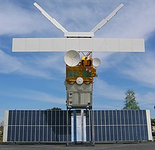
Subsystems[]
The satellite's functional versatility is embedded within its technical components and its operations characteristics. Looking at the "anatomy" of a typical satellite, one discovers two modules.[16] Note that some novel architectural concepts such as Fractionated spacecraft somewhat upset this taxonomy.
Spacecraft bus or service module[]
The bus module consists of the following subsystems:
Structure[]
The structural subsystem provides the mechanical base structure with adequate stiffness to withstand stress and vibrations experienced during launch, maintain structural integrity and stability while on station in orbit, and shields the satellite from extreme temperature changes and micro-meteorite damage.
Telemetry[]
The telemetry subsystem (aka Command and Data Handling, C&DH) monitors the on-board equipment operations, transmits equipment operation data to the earth control station, and receives the earth control station's commands to perform equipment operation adjustments.
Power[]
The power subsystem may consist of solar panels to convert solar energy into electrical power, regulation and distribution functions, and batteries that store power and supply the satellite when it passes into the Earth's shadow. Nuclear power sources (Radioisotope thermoelectric generator) have also been used in several successful satellite programs including the Nimbus program (1964–1978).[21]
Thermal control[]
The thermal control subsystem helps protect electronic equipment from extreme temperatures due to intense sunlight or the lack of sun exposure on different sides of the satellite's body (e.g. optical solar reflector)
Attitude and orbit control[]
The attitude and orbit control subsystem consists of sensors to measure vehicle orientation, control laws embedded in the flight software, and actuators (reaction wheels, thrusters). These apply the torques and forces needed to re-orient the vehicle to the desired attitude, keep the satellite in the correct orbital position, and keep antennas pointed in the right directions.
Communications[]
The second major module is the communication payload, which is made up of transponders. A transponder is capable of :
- Receiving uplinked radio signals from earth satellite transmission stations (antennas).
- Amplifying received radio signals
- Sorting the input signals and directing the output signals through input/output signal multiplexers to the proper downlink antennas for retransmission to earth satellite receiving stations (antennas).
End of life[]
When satellites reach the end of their mission (this normally occurs within 3 or 4 years after launch), satellite operators have the option of de-orbiting the satellite, leaving the satellite in its current orbit or moving the satellite to a graveyard orbit. Historically, due to budgetary constraints at the beginning of satellite missions, satellites were rarely designed to be de-orbited. One example of this practice is the satellite Vanguard 1. Launched in 1958, Vanguard 1, the 4th artificial satellite to be put in Geocentric orbit, was still in orbit as of March 2015, as well as the upper stage of its launch rocket.[22][23]
Instead of being de-orbited, most satellites are either left in their current orbit or moved to a graveyard orbit.[24] As of 2002, the FCC requires all geostationary satellites to commit to moving to a graveyard orbit at the end of their operational life prior to launch.[25] In cases of uncontrolled de-orbiting, the major variable is the solar flux, and the minor variables the components and form factors of the satellite itself, and the gravitational perturbations generated by the Sun and the Moon (as well as those exercised by large mountain ranges, whether above or below sea level). The nominal breakup altitude due to aerodynamic forces and temperatures is 78 km, with a range between 72 and 84 km. Solar panels, however, are destroyed before any other component at altitudes between 90 and 95 km.[26]
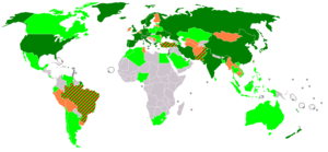
Launch-capable countries[]
This list includes countries with an independent capability to place satellites in orbit, including production of the necessary launch vehicle. Note: many more countries have the capability to design and build satellites but are unable to launch them, instead relying on foreign launch services. This list does not consider those numerous countries, but only lists those capable of launching satellites indigenously, and the date this capability was first demonstrated. The list does not include the European Space Agency, a multi-national state organization, nor private consortiums.
| Order | Country | Date of first launch | Rocket | Satellite(s) |
|---|---|---|---|---|
| 1 | Soviet Union | 4 October 1957 | Sputnik-PS | Sputnik 1 |
| 2 | United States | 1 February 1958 | Juno I | Explorer 1 |
| 3 | France | 26 November 1965 | Diamant-A | Astérix |
| 4 | Japan | 11 February 1970 | Lambda-4S | Ohsumi |
| 5 | China | 24 April 1970 | Long March 1 | Dong Fang Hong I |
| 6 | United Kingdom | 28 October 1971 | Black Arrow | Prospero |
| 7 | India | 18 July 1980 | SLV | Rohini D1 |
| 8 | Israel | 19 September 1988 | Shavit | Ofeq 1 |
| – [1] | Russia | 21 January 1992 | Soyuz-U | Kosmos 2175 |
| – [1] | Ukraine | 13 July 1992 | Tsyklon-3 | Strela |
| 9 | Iran | 2 February 2009 | Safir-1 | Omid |
| 10 | North Korea | 12 December 2012 | Unha-3 | Kwangmyŏngsŏng-3 Unit 2 |
| 11 | South Korea | 30 January 2013 | Naro-1 | STSAT-2C |
| 12 | New Zealand | 12 November 2018 | Electron | CubeSat |
Attempted first launches[]
- The United States tried in 1957 to launch the first satellite using its own launcher before successfully completing a launch in 1958.
- Japan tried four times in 1966–1969 to launch a satellite with its own launcher before successfully completing a launch in 1970.
- China tried in 1969 to launch the first satellite using its own launcher before successfully completing a launch in 1970.
- India, after launching its first national satellite using a foreign launcher in 1975, tried in 1979 to launch the first satellite using its own launcher before succeeding in 1980.
- Iraq have claimed an orbital launch of a warhead in 1989, but this claim was later disproved.[30]
- Brazil, after launching its first national satellite using a foreign launcher in 1985, tried to launch a satellite using its own launcher three times in 1997, 1999, and 2003, but all attempts were unsuccessful.
- North Korea claimed a launch of Kwangmyŏngsŏng-1 and Kwangmyŏngsŏng-2 satellites in 1998 and 2009, but U.S., Russian and other officials and weapons experts later reported that the rockets failed to send a satellite into orbit, if that was the goal. The United States, Japan and South Korea believe this was actually a ballistic missile test, which was a claim also made after North Korea's 1998 satellite launch, and later rejected.[31] The first (April 2012) launch of Kwangmyŏngsŏng-3 was unsuccessful, a fact publicly recognized by the DPRK. However, the December 2012 launch of the "second version" of Kwangmyŏngsŏng-3 was successful, putting the DPRK's first confirmed satellite into orbit.
- South Korea (Korea Aerospace Research Institute), after launching their first national satellite by foreign launcher in 1992, unsuccessfully tried to launch its own launcher, the KSLV (Naro)-1, (created with the assistance of Russia) in 2009 and 2010 until success was achieved in 2013 by Naro-3.
- The First European multi-national state organization ELDO tried to make the orbital launches at Europa I and Europa II rockets in 1968–1970 and 1971 but stopped operation after failures.
Other notes[]
- ^ Russia and Ukraine were parts of the Soviet Union and thus inherited their launch capability without the need to develop it indigenously. Through the Soviet Union they are also on the number one position in this list of accomplishments.
- France, the United Kingdom, and Ukraine launched their first satellites by own launchers from foreign spaceports.
- Some countries such as South Africa, Spain, Italy, Germany, Canada, Australia, Argentina, Egypt and private companies such as OTRAG, have developed their own launchers, but have not had a successful launch.
- Only twelve, countries from the list below (USSR, USA, France, Japan, China, UK, India, Russia, Ukraine, Israel, Iran and North Korea) and one regional organization (the European Space Agency, ESA) have independently launched satellites on their own indigenously developed launch vehicles.
- Several other countries, including Brazil, Argentina, Pakistan, Romania, Taiwan, Indonesia, Australia, Malaysia, Turkey and Switzerland are at various stages of development of their own small-scale launcher capabilities.
Launch capable private entities[]
Orbital Sciences Corporation launched a satellite into orbit on the Pegasus in 1990. SpaceX launched a satellite into orbit on the Falcon 1 in 2008. Rocket Lab launched three cubesats into orbit on the Electron in 2018.
First satellites of countries[]
While Canada was the third country to build a satellite which was launched into space,[32] it was launched aboard an American rocket from an American spaceport. The same goes for Australia, who launched first satellite involved a donated U.S. Redstone rocket and American support staff as well as a joint launch facility with the United Kingdom.[33] The first Italian satellite San Marco 1 launched on 15 December 1964 on a U.S. Scout rocket from Wallops Island (Virginia, United States) with an Italian launch team trained by NASA.[34] By similar occasions, almost all further first national satellites was launched by foreign rockets.
Attempted first satellites[]
- United States tried unsuccessfully to launch its first satellite in 1957; they were successful in 1958.
- China tried unsuccessfully to launch its first satellite in 1969; they were successful in 1970.
- Chile tried unsuccessfully in 1995 to launch its first satellite FASat-Alfa by foreign rocket; in 1998 they were successful.†
- North Korea has tried in 1998, 2009, 2012 to launch satellites, first successful launch on 12 December 2012.[35]
- Libya since 1996 developed its own national satellite project with the goal of providing telecommunication and remote sensing services[36] that was postponed after the fall of Gaddafi.
- Belarus tried unsuccessfully in 2006 to launch its first satellite BelKA by foreign rocket.†
†-note: Both Chile and Belarus used Russian companies as principal contractors to build their satellites, they used Russian-Ukrainian manufactured rockets and launched either from Russia or Kazakhstan.
Planned first satellites[]
- Armenia founded ArmCosmos in 2012[37] and announced an intention to create and launch the countries first telecommunication satellite, named . The investment estimate is $250 million and potential contractors for building the satellite includes Russia, China and Canada.[38][39]
- Cambodia's Royal Group plans to purchase for $250–350 million and launch in the beginning of 2013 the telecommunication satellite.[40]
- Cayman Islands's private company plans to launch GiSAT-1 geostationary communications satellite in 2018.
- Democratic Republic of Congo ordered at November 2012 in China (Academy of Space Technology (CAST) and Great Wall Industry Corporation (CGWIC)) the first telecommunication satellite -1 which will be built on DFH-4 satellite bus platform and will be launched in China till the end of 2015.[41]
- Croatia has a goal to construct a satellite by 2013–2014. Launch into Earth orbit would be done by a foreign provider.[42]
- Ireland's team of Dublin Institute of Technology intends to launch the first Irish satellite within European University program CubeSat QB50.[43]
- Republic of Moldova's first remote sensing satellite plans to start in 2013 by Space centre at national Technical University.[44]
- Myanmar plans to purchase for $200 million their own telecommunication satellite.[45]
- Nicaragua ordered for $254 million at November 2013 in China the first telecommunication satellite -1 (to be built at DFH-4 satellite bus platform by CAST and CGWIC), that planning to launch in China at 2016.[46]
- Paraguay under new airspace agency plans first Eart observation satellite.[47][48]
- Serbia's first satellite was designed, developed and assembled by nongovernmental organisations in 2009 but still remains unlaunched.
- Sri Lanka has a goal to construct two satellites beside of rent the national SupremeSAT payload in Chinese satellites. Sri Lankan Telecommunications Regulatory Commission has signed an agreement with Surrey Satellite Technology Ltd to get relevant help and resources. Launch into Earth orbit would be done by a foreign provider.[49][50]
- Syrian Space Research Center developing CubeSat-like small first national satellite since 2008.[51]
- Tunisia is developing its first satellite, . Consisting of a CubeSat of 1 kg mass, it will be developed by the Sfax School of Engineering. ERPSat satellite is planned to be launched into orbit in 2013.[52]
- Uzbekistan's State Space Research Agency (UzbekCosmos) announced in 2001 about intention of launch in 2002 first remote sensing satellite.[53] Later in 2004 was stated that two satellites (remote sensing and telecommunication) will be built by Russia for $60–70 million each[54]
- Bangladesh Bangladesh launched Bangabandhu-1 at 12 May 2018. SpaceX helped with the launching.
Attacks on satellites[]
Since the mid-2000s, satellites have been hacked by militant organizations to broadcast propaganda and to pilfer classified information from military communication networks.[55][56]
For testing purposes, satellites in low earth orbit have been destroyed by ballistic missiles launched from earth. Russia, United States, China and India have demonstrated the ability to eliminate satellites.[57] In 2007 the Chinese military shot down an aging weather satellite,[57] followed by the US Navy shooting down a defunct spy satellite in February 2008.[58] On 27 March 2019 India shot down a live test satellite at 300 km altitude in 3 minutes. India became the fourth country to have the capability to destroy live satellites.[59][60]
Jamming[]
Due to the low received signal strength of satellite transmissions, they are prone to jamming by land-based transmitters. Such jamming is limited to the geographical area within the transmitter's range. GPS satellites are potential targets for jamming,[61][62] but satellite phone and television signals have also been subjected to jamming.[63][64]
Also, it is very easy to transmit a carrier radio signal to a geostationary satellite and thus interfere with the legitimate uses of the satellite's transponder. It is common for Earth stations to transmit at the wrong time or on the wrong frequency in commercial satellite space, and dual-illuminate the transponder, rendering the frequency unusable. Satellite operators now have sophisticated monitoring that enables them to pinpoint the source of any carrier and manage the transponder space effectively.[citation needed]
Earth observation[]
During the last five decades, space agencies have sent thousands of space crafts, space capsules, or satellites to the universe. In fact, weather forecasters make predictions on the weather and natural calamities based on observations from these satellites.[65]
The National Aeronautics and Space Administration (NASA)[66] requested the National Academies to publish a report, "Earth Observations from Space; The First 50 Years of Scientific Achievements", in 2008. It described how the capability to view the whole globe simultaneously from satellite observations revolutionized studies about the planet Earth. This development brought about a new age of combined Earth sciences. The National Academies report concluded that continuing Earth observations from the galaxy are necessary to resolve scientific and social challenges in the future.[67]
NASA[]
The NASA introduced an Earth Observing System (EOS)[68] composed of several satellites, science component, and data system described as the Earth Observing System Data and Information System (EOSDIS). It disseminates numerous science data products as well as services designed for interdisciplinary education. EOSDIS data can be accessed online and accessed through File Transfer Protocol (FTP) and Hyper Text Transfer Protocol Secure (HTTPS).[69] Scientists and researchers perform EOSDIS science operations within a distributed platform of multiple interconnected nodes or Science Investigator-led Processing Systems (SIPS) and discipline-specific Distributed Active Archive Centers (DACCs).[70]
ESA[]
The European Space Agency[71] have been operating Earth Observation satellites since the launch of Meteosat 1 in November 1977.[72] ESA currently has plans to launch a satellite equipped with an artificial intelligence (AI) processor that will allow the spacecraft to make decisions on images to capture and data to transmit to the Earth.[73] BrainSat will use the Intel Myriad X vision processing unit (VPU). The launching will be scheduled in 2019. ESA director for Earth Observation Programs Josef Aschbacher made the announcement during the PhiWeek in November 2018.[74] This is the five-day meet that focused on the future of Earth observation. The conference was held at the ESA Center for Earth Observation in Frascati, Italy.[73] ESA also launched the PhiLab, referring to the future-focused team that works to harness the potentials of AI and other disruptive innovations.[75] Meanwhile, the ESA also announced that it expects to commence the qualification flight of the Space Rider space plane in 2021. This will come after several demonstration missions.[76] Space Rider is the sequel of the Agency's Intermediate Experimental vehicle (IXV) which was launched in 2015. It has the capacity payload of 800 kilograms for orbital missions that will last a maximum of two months.[77]
Pollution and regulation[]
| Part of a series on |
| Pollution |
|---|
 |
| WikiProject Environment WikiProject Ecology |
|
Category (By country)
|
Generally liability has been covered by the Liability Convention. Issues like space debris, radio and light pollution are increasing in magnitude and at the same time lack progress in national or international regulation.[78] With future increase in numbers of satellite constellations, like SpaceX Starlink, it is feared especially by the astronomical community, such as the IAU, that orbital pollution will increase significantly.[79][80] A report from the SATCON1 workshop in 2020 concluded that the effects of large satellite constellations can severely affect some astronomical research efforts and lists six ways to mitigate harm to astronomy.[81][82] Some notable satellite failures that polluted and dispersed radioactive materials are Kosmos 954, Kosmos 1402 and the Transit 5-BN-3. Using wood as an alternative material has been posited in order to reduce pollution and debris from satellites that reenter the atmosphere.[83]
Open source satellites[]
Several open source satellites both in terms of open source hardware and open source software were flown or are in development. The satellites have usually form of a CubeSat or PocketQube. In 2013 an amateur radio satellite OSSI-1 was launched and remained in orbit for about 2 months.[84] In 2017 UPSat created by the Greek University of Patras and remained in orbit for 18 months. In 2019 FossaSat-1 was launched.[85][86][87][88] As of February 2021 the Portland State Aerospace Society is developing two open source satellites called OreSat[89][90] and the Libre Space Foundation also has ongoing satellite projects.[91][92][93]
Satellite services[]
- Satellite crop monitoring
- Satellite Internet access
- Satellite navigation
- Satellite phone
- Satellite radio
- Satellite television
See also[]
- 2009 satellite collision
- Artificial moon
- Artificial satellites in retrograde orbit
- Atmospheric satellite
- Crowdfunded satellites
- Cubesat
- Fractionated spacecraft
- Ground track
- Imagery intelligence
- International Designator
- List of communications satellite firsts
- List of Earth observation satellites
- List of passive satellites
- Rocket engine test facility
- Satellite Catalog Number
- Satellite formation flying
- Satellite geolocation
- Satellite watching
- Space exploration
- Research station – Station that is built for the purpose of conducting scientific research
- Space observatory
- Space station
- Space probe
- Spaceport (including list of spaceports)
- Satellites on stamps
- USA-193 (2008 American anti-satellite missile test)
- Sputnik-1
References[]
- ^ "UCS Satellite Database". ucsusa. 1 January 2021. Retrieved 30 March 2021.
- ^ "NASA Spacecraft Becomes First to Orbit a Dwarf Planet". NASA. 6 March 2015.
- ^ "Rockets in Science Fiction (Late 19th Century)". Marshall Space Flight Center. Archived from the original on 1 September 2000. Retrieved 21 November 2008.
- ^ Bleiler, Everett Franklin; Bleiler, Richard (1991). Science-fiction, the Early Years. Kent State University Press. p. 325. ISBN 978-0-87338-416-2.
- ^ Rhodes, Richard (2000). Visions of Technology. Simon & Schuster. p. 160. ISBN 978-0-684-86311-5.
- ^ "Preliminary Design of an Experimental World-Circling Spaceship". RAND. July 1946. Retrieved 6 March 2008.
- ^ Rosenthal, Alfred (1968). Venture into Space: Early Years of Goddard Space Flight Center. NASA. p. 15.
- ^ "Hubble Essentials: About Lyman Spitzer, Jr". Hubble Site.
- ^ R.R. Carhart, Scientific Uses for a Satellite Vehicle, Project RAND Research Memorandum. (Rand Corporation, Santa Monica) 12 February 1954.
- ^ 2. H.K Kallmann and W.W. Kellogg, Scientific Use of an Artificial Satellite, Project RAND Research Memorandum. (Rand Corporation, Santa Monica) 8 June 1955.
- ^ Gray, Tara; Garber, Steve (2 August 2004). "A Brief History of Animals in Space". NASA.
- ^ Chang, Alicia (30 January 2008). "50th anniversary of first U.S. satellite launch celebrated". San Francisco Chronicle. Associated Press. Archived from the original on 1 February 2008.
- ^ Portree, David S. F.; Loftus, Jr, Joseph P. (1999). "Orbital Debris: A Chronology" (PDF). Lyndon B. Johnson Space Center. p. 18. Archived from the original (PDF) on 1 September 2000. Retrieved 21 November 2008.
- ^ Welch, Rosanne; Lamphier, Peg A. (22 February 2019). Technical Innovation in American History: An Encyclopedia of Science and Technology [3 volumes]. ABC-CLIO. p. 126. ISBN 978-1-61069-094-2.
- ^ "Orbital Debris Education Package" (PDF). Lyndon B. Johnson Space Center. Archived from the original (PDF) on 8 April 2008. Retrieved 6 March 2008.
- ^ Jump up to: a b Grant, A.; Meadows, J. (2004). Communication Technology Update (ninth ed.). Focal Press. p. 284. ISBN 978-0-240-80640-2.
- ^ "Workshop on the Use of Microsatellite Technologies" (PDF). United Nations. 2008. p. 6. Retrieved 6 March 2008.
- ^ "Earth Observations from Space" (PDF). National Academy of Sciences. 2007. Archived from the original (PDF) on 12 November 2007.
- ^ Jump up to: a b "UCS Satellite Database". Union of Concerned Scientists. 1 August 2020. Retrieved 15 October 2020.
- ^ Oberg, James (July 1984). "Pearl Harbor in Space". Omni. pp. 42–44.
- ^ Schmidt, George; Houts, Mike (16 February 2006). "Radioisotope-based Nuclear Power Strategy for Exploration Systems Development" (PDF). STAIF Nuclear Symposium. 813: 334–339. Bibcode:2006AIPC..813..334S. doi:10.1063/1.2169210.
- ^ "Vanguard 1 – Satellite Information". Satellite database. Heavens-Above. Retrieved 7 March 2015.
- ^ "Vanguard 1 Rocket – Satellite Information". Satellite database. Heavens-Above. Retrieved 7 March 2015.
- ^ "Conventional Disposal Method: Rockets and Graveyard Orbits". Tethers.
- ^ "FCC Enters Orbital Debris Debate". Space.com. Archived from the original on 24 July 2009.
- ^ "Object SL-8 R/B – 29659U – 06060B". Forecast for Space Junk Reentry. Satview. 11 March 2014.
- ^ "UNMOVIC report" (PDF). United Nations Monitoring, Verification and Inspection Commission. p. 434 ff.
- ^ "Deception Activities – Iraq Special Weapons". FAS. Archived from the original on 22 April 1999.
- ^ "Al-Abid LV".
- ^ The video tape of a partial launch attempt which was retrieved by UN weapons inspectors later surfaced showing that the rocket prematurely exploded 45 seconds after its launch.[27][28][29]
- ^ Myers, Steven Lee (15 September 1998). "U.S. Calls North Korean Rocket a Failed Satellite". The New York Times. Archived from the original on 9 December 2018. Retrieved 9 September 2019.
- ^ Burleson, Daphne (2005). Space Programs Outside the United States. McFarland & Company. p. 43. ISBN 978-0-7864-1852-7.
- ^ Mike Gruntman (2004). Blazing the Trail. American Institute of Aeronautics and Astronautics. p. 426. ISBN 978-1-56347-705-8.
- ^ Harvey, Brian (2003). Europe's Space Programme. Springer Science+Business Media. p. 114. ISBN 978-1-85233-722-3.
- ^ "North Korea says it successfully launched controversial satellite into orbit". NBC News. 12 December 2012.
- ^ Wissam Said Idrissi. "Libsat – Libyan Satellite Project". libsat.ly.
- ^ "Satellite department to be set up in Armenia's national telecommunication center". arka.am.
- ^ "Canada's MDA Ready to Help Armenia Launch First Comsat". Asbarez News. 9 August 2013.
- ^ "China keen on Armenian satellite launch project". arka.am.
- ^ "Royal Group receives right to launch first Cambodia satellite". 19 April 2011.
- ^ "China to launch second African satellite-Science-Tech-chinadaily.com.cn". China Daily.
- ^ "Vremenik". Astronautica.
- ^ Bray, Allison (1 December 2012). "Students hope to launch first ever Irish satellite". The Independent. Ireland.
- ^ "Наши публикации". ComelPro.
- ^ "Burma to launch first state-owned satellite, expand communications". News. Mizzima. 14 June 2011. Archived from the original on 17 June 2011.
- ^ "Nicaragua says Nicasat-1 satellite still set for 2016 launch". telecompaper.com.
- ^ Zachary Volkert (26 December 2013). "Paraguay to vote on aerospace agency bill in 2014". BNamericas.
- ^ "Why a little country like Paraguay is launching a space program". GlobalPost.
- ^ "SSTL Contracted to Establish Sri Lanka Space Agency". Satellite Today. Retrieved 28 November 2009.
- ^ "SSTL contracted to establish Sri Lanka Space Agency". Adaderana. Retrieved 28 November 2009.
- ^ "Syria on the Internet". souria.com. Archived from the original on 3 April 2015.
- ^ Hamrouni, C.; Neji, B.; Alimi, A. M.; Schilling, K. (2009). 2009 4th International Conference on Recent Advances in Space Technologies. Explore. IEEE. pp. 750–755. doi:10.1109/RAST.2009.5158292. ISBN 978-1-4244-3626-2. S2CID 34741975.
- ^ "Uzbekistan Planning First Satellite". Sat News. 18 May 2001. Archived from the original on 13 July 2001.
- ^ "Uzbekistan Planning to Launch Two Satellites With Russian Help". Red Orbit. 8 June 2004. Archived from the original on 12 January 2012.
- ^ Morrill, Dan. "Hack a Satellite while it is in orbit". ITtoolbox. Archived from the original on 20 March 2008. Retrieved 25 March 2008.
- ^ "AsiaSat accuses Falungong of hacking satellite signals". Press Trust of India. 22 November 2004.
- ^ Jump up to: a b Broad, William J.; Sanger, David E. (18 January 2007). "China Tests Anti-Satellite Weapon, Unnerving U.S." The New York Times.
- ^ "Navy Missile Successful as Spy Satellite Is Shot Down". Popular Mechanics. 2008. Retrieved 25 March 2008.
- ^ "India successfully tests anti-satellite weapon: Modi". The Week. Retrieved 27 March 2019.
- ^ Diplomat, Harsh Vasani, The. "India's Anti-Satellite Weapons". The Diplomat. Retrieved 27 March 2019.
- ^ Singer, Jeremy (2003). "U.S.-Led Forces Destroy GPS Jamming Systems in Iraq". Space.com. Archived from the original on 26 May 2008. Retrieved 25 March 2008.
- ^ Brewin, Bob (2003). "Homemade GPS jammers raise concerns". Computerworld. Archived from the original on 22 April 2008. Retrieved 25 March 2008.
- ^ "Iran government jamming exile satellite TV". . 2008. Retrieved 25 March 2008.
- ^ Selding, Peter de (2007). "Libya Pinpointed as Source of Months-Long Satellite Jamming in 2006". Space.com. Archived from the original on 29 April 2008.
- ^ "Earth Observations from Space " Earth Observations from Space". nas-sites.org. Retrieved 28 November 2018.
- ^ "Home | The National Academies of Sciences, Engineering, and Medicine | National-Academies.org | Where the Nation Turns for Independent, Expert Advice". www.nationalacademies.org. Retrieved 28 November 2018.
- ^ Council, National Research (17 December 2008). Earth Observations from Space. doi:10.17226/11991. ISBN 978-0-309-11095-2.
- ^ "About EOSDIS | Earthdata". earthdata.nasa.gov. Retrieved 28 November 2018.
- ^ "Earth Observation Data | Earthdata". earthdata.nasa.gov. Retrieved 28 November 2018.
- ^ "EOSDIS Distributed Active Archive Centers (DAACs) | Earthdata". earthdata.nasa.gov. Retrieved 28 November 2018.
- ^ esa. "ESA". European Space Agency. Retrieved 28 November 2018.
- ^ "50 years of Earth Observation". ESA. Retrieved 21 August 2019.
- ^ Jump up to: a b "ESA preps Earth observation satellite with onboard AI processor". SpaceNews.com. 13 November 2018. Retrieved 28 November 2018.
- ^ "Movidius Myriad X VPU | Intel Newsroom". Intel Newsroom. Retrieved 28 November 2018.
- ^ "The ESA Earth Observation Φ-week EO Open Science and FutureEO". phiweek.esa.int. Retrieved 28 November 2018.
- ^ "ESA targets 2021 for Space Rider demo flight". SpaceNews.com. 13 November 2018. Retrieved 28 November 2018.
- ^ esa. "IXV". European Space Agency. Retrieved 28 November 2018.
- ^ "Problem Weltraumschrott: Die kosmische Müllkippe – Wissenschaft". Der Spiegel. Retrieved 22 April 2017.
- ^ "IAU's statement on satellite constellations". International Astronomical Union. Retrieved 3 June 2019.
- ^ "Light pollution from satellites will get worse. But how much?". astronomy.com. 14 June 2019.
- ^ Zhang, Emily. "SpaceX's Dark Satellites Are Still Too Bright for Astronomers". Scientific American. Retrieved 16 September 2020.
- ^ "Report Offers Roadmap to Mitigate Effects of Large Satellite Constellations on Astronomy | American Astronomical Society". aas.org. Retrieved 16 September 2020.
- ^ Harper, Justin (29 December 2020). "Japan developing wooden satellites to cut space junk". bbc.co.uk. Retrieved 29 December 2020.
- ^ "ossicode - Overview". GitHub. Retrieved 27 February 2021.
- ^ Kulu, Erik. "FossaSat-1 @ Nanosats Database". Nanosats Database. Retrieved 27 February 2021.
- ^ "FossaSat 1, 1b". Gunter's Space Page. Retrieved 27 February 2021.
- ^ "FossaSat-1, an Open Source Satellite for the Internet of Things". Hackster.io. Retrieved 27 February 2021.
- ^ FOSSASystems/FOSSASAT-1, FOSSA Systems, 24 February 2021, retrieved 27 February 2021
- ^ "oresat". www.oresat.org. Retrieved 27 February 2021.
- ^ "Oregon Small Satellite Project". GitHub. Retrieved 27 February 2021.
- ^ "PocketQubes". Libre Space Foundation. Retrieved 27 February 2021.
- ^ "QUBIK". Libre Space Foundation. Retrieved 27 February 2021.
- ^ "Qubik". GitLab. Retrieved 27 February 2021.
Further reading[]
- Ann Finkbeiner, "Orbital Aggression: How do we prevent war in space?", Scientific American, vol. 323, no. 5 (November 2020), pp. 50–57.
External links[]
| Wikiquote has quotations related to: Satellite |
| Wikimedia Commons has media related to Satellites. |
- Satellite at Curlie
- Eyes in the Sky Free video by the Vega Science Trust and the BBC/OU Satellites and their implications over the last 50 years.
| show Spaceflight |
|---|

| show Authority control |
|---|
- Satellites
- Spacecraft
- Russian inventions