Schöpstal
Schöpstal | |
|---|---|
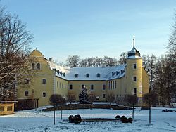 Ebersbach Castle | |
show Location of Schöpstal within Görlitz district | |
 Schöpstal | |
| Coordinates: 51°11′0″N 14°53′36″E / 51.18333°N 14.89333°ECoordinates: 51°11′0″N 14°53′36″E / 51.18333°N 14.89333°E | |
| Country | Germany |
| State | Saxony |
| District | Görlitz |
| Municipal assoc. | Weißer Schöps/Neiße |
| Subdivisions | 4 |
| Government | |
| • Mayor (2015–22) | Bernd Kalkbrenner[1] |
| Area | |
| • Total | 29.62 km2 (11.44 sq mi) |
| Elevation | 231 m (758 ft) |
| Population (2020-12-31)[2] | |
| • Total | 2,387 |
| • Density | 81/km2 (210/sq mi) |
| Time zone | UTC+01:00 (CET) |
| • Summer (DST) | UTC+02:00 (CEST) |
| Postal codes | 02829 |
| Dialling codes | 03581 |
| Vehicle registration | GR, LÖB, NOL, NY, WSW, ZI |
| Website | www.schoepstal.net |


Schöpstal is a municipality in the district Görlitz, Saxony, Germany. It consists of the villages of Ebersbach, Girbigsdorf, Kunnersdorf and Liebstein, which are Waldhufendörfer located along the river Weißer Schöps.
References[]
- ^ Bürgermeisterwahlen 2015, Freistaat Sachsen, accessed 12 July 2021.
- ^ "Bevölkerung des Freistaates Sachsen nach Gemeinden am 31. Dezember 2020". Statistisches Landesamt des Freistaates Sachsen (in German). June 2021.
| show Towns and municipalities in Görlitz (district) |
|---|
| Authority control |
|---|
This Görlitz location article is a stub. You can help Wikipedia by . |
Categories:
- Municipalities in Saxony
- Localities in Upper Lusatia
- German Silesia
- Bezirk Dresden
- Görlitz (district) geography stubs