Schaprode
Schaprode | |
|---|---|
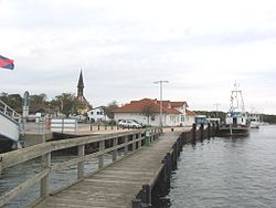 Harbour of Schaprode | |
 Coat of arms | |
show Location of Schaprode within Vorpommern-Rügen district | |
 Schaprode | |
| Coordinates: 54°30′48″N 13°9′58″E / 54.51333°N 13.16611°ECoordinates: 54°30′48″N 13°9′58″E / 54.51333°N 13.16611°E | |
| Country | Germany |
| State | Mecklenburg-Vorpommern |
| District | Vorpommern-Rügen |
| Municipal assoc. | West-Rügen |
| Government | |
| • Mayor | Rüdiger Gau |
| Area | |
| • Total | 19.65 km2 (7.59 sq mi) |
| Elevation | 3 m (10 ft) |
| Population (2020-12-31)[1] | |
| • Total | 419 |
| • Density | 21/km2 (55/sq mi) |
| Time zone | UTC+01:00 (CET) |
| • Summer (DST) | UTC+02:00 (CEST) |
| Postal codes | 18569 |
| Dialling codes | 038309 |
| Vehicle registration | RÜG |
| Website | www.amt-westruegen.de |


Schaprode is a municipality in the Vorpommern-Rügen district, in Mecklenburg-Vorpommern, Germany.
References[]
- ^ "Statistisches Amt M-V – Bevölkerungsstand der Kreise, Ämter und Gemeinden 2020". Statistisches Amt Mecklenburg-Vorpommern (in German). July 2021.
External links[]
| show Towns and municipalities in Vorpommern-Rügen |
|---|
| Authority control |
|---|
This Vorpommern-Rügen district location article is a stub. You can help Wikipedia by . |
Categories:
- Municipalities in Mecklenburg-Vorpommern
- Towns and villages on Rügen
- Bezirk Rostock
- Vorpommern-Rügen geography stubs