Senago
Senago | |
|---|---|
| Comune di Senago | |
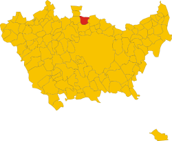 | |
show Location of Senago | |
 Senago Location of Senago in Italy | |
| Coordinates: 45°35′N 9°8′E / 45.583°N 9.133°ECoordinates: 45°35′N 9°8′E / 45.583°N 9.133°E | |
| Country | Italy |
| Region | Lombardy |
| Metropolitan city | Milan (MI) |
| Frazioni | Castelletto, Senaghino, Traversagna, Villaggio Gaggiolo, Mascagni, Villaggio Papa Giovanni XXIII |
| Government | |
| • Mayor | Magda Beretta (LN) |
| Area | |
| • Total | 8.6 km2 (3.3 sq mi) |
| Elevation | 176 m (577 ft) |
| Population (Dec. 2004)[2] | |
| • Total | 21.527 |
| • Density | 2.5/km2 (6.5/sq mi) |
| Demonym(s) | Senaghesi |
| Time zone | UTC+1 (CET) |
| • Summer (DST) | UTC+2 (CEST) |
| Postal code | 20030 |
| Dialing code | 02 |
| Patron saint | St. Martin |
| Saint day | 11 November |
| Website | Official website |


Senago (Lombard: Senagh [seˈnɑːk]) is a comune (municipality) in the Metropolitan City of Milan in the Italian region Lombardy, located about 13 kilometres (8 mi) north of Milan. As of 30 November 2017, it had a population of 21.519 and an area of 8.6 square kilometres (3.3 sq mi).[3]
Senago borders the following municipalities: Limbiate, Cesate, Paderno Dugnano, Garbagnate Milanese, Bollate.
The Villa San Carlo Borromeo is located in Senago. A historic residence, that has been built in the XIV century, it is immersed in a secular park of eleven hectares, 12 kilometers from Milan.
References[]
- ^ "Superficie di Comuni Province e Regioni italiane al 9 ottobre 2011". Istat. Retrieved 16 March 2019.
- ^ "Popolazione Residente al 1° Gennaio 2018". Istat. Retrieved 16 March 2019.
- ^ All demographics and other statistics: Italian statistical institute Istat.
External links[]
| Authority control |
|
|---|
This article on a location in the Province of Milan is a stub. You can help Wikipedia by . |
Categories:
- Cities and towns in Lombardy
- Municipalities of the Metropolitan City of Milan
- Province of Milan geography stubs