Sepo County
Sep'o County
세포군 | |
|---|---|
| 세포군 · Sepo County | |
| Korean transcription(s) | |
| • Chosŏn'gŭl | 세포군 |
| • Hancha | 洗浦郡 |
| • McCune–Reischauer | Sep'o-gun |
| • Revised Romanization | Sepo-gun |
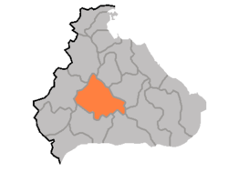 Map of Kangwon showing the location of Sepo | |
| Country | North Korea |
| Province | Kangwŏn Province |
| Administrative divisions | 1 ŭp, 1 workers' district, 24 ri |
| Area | |
| • Total | 969 km2 (374 sq mi) |
| Population (2008[1]) | |
| • Total | 61,113 |
| • Density | 63/km2 (160/sq mi) |
Sep'o County is a kun, or county, in Kangwŏn province, North Korea. It was created as a separate entity following the division of Korea.
Physical features[]
The county is primarily mountainous, and is traversed by the and ranges. There are numerous mountains outside of these two ranges as well. The chief streams include the , , and (고미탄천). 75% of the county's area is occupied by forestland.
Administrative divisions[]
Sep'o county is divided into 1 ŭp (town), 1 rodongjagu (workers' district) and 24 ri (villages):
|
|
Economy[]
Sep'o is host to deposits of molybdenum, silver, zinc, and fluorite. Agriculture also contributes to the local economy; Sepo is particularly known for its radishes. In addition, livestock raising and orcharding play a role, and there is some small-scale manufacturing as well.
Transport[]
Sep'o county is served by several stations on the Kangwŏn and Ch'ŏngnyŏn Ich'ŏn lines of the Korean State Railway, including Sep'o Ch'ŏngnyŏn station in Sep'o-ŭp, which is the junction point of the two lines.
See also[]
- Geography of North Korea
- Administrative divisions of North Korea
- Kangwon (North Korea)
References[]
External links[]
- (in Korean) In Korean language online encyclopedias:
| Capital |  | |
|---|---|---|
| Cities | ||
| Counties | ||
- Counties of Kangwon Province (North Korea)