Sheakleyville, Pennsylvania
Sheakleyville, Pennsylvania | |
|---|---|
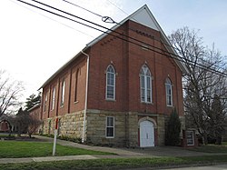 Church in Sheakleyville | |
 Location of Sheakleyville in Mercer County, Pennsylvania. | |
 Sheakleyville, Pennsylvania Location of Sheakleyville within Pennsylvania | |
| Coordinates: 41°26′36″N 80°12′26″W / 41.44333°N 80.20722°WCoordinates: 41°26′36″N 80°12′26″W / 41.44333°N 80.20722°W | |
| Country | United States |
| State | Pennsylvania |
| County | Mercer |
| Established | 1820 |
| Area | |
| • Total | 0.20 sq mi (0.51 km2) |
| • Land | 0.20 sq mi (0.51 km2) |
| • Water | 0.00 sq mi (0.00 km2) |
| Elevation [2] (center of borough) | 1,282 ft (391 m) |
| Highest elevation [2] (southern border of borough) | 1,298 ft (396 m) |
| Lowest elevation [2] (Mill Run) | 1,240 ft (380 m) |
| Population (2010) | |
| • Total | 142 |
| • Estimate (2019)[3] | 133 |
| • Density | 678.57/sq mi (261.54/km2) |
| Time zone | UTC-4 (EST) |
| • Summer (DST) | UTC-5 (EDT) |
| Zip code | 16151 |
| Area code(s) | 724, 878 |

Sheakleyville is a borough in Mercer County, Pennsylvania, United States. The population was 164 at the 2000 census. The population was 142 at the 2010 census.[4] It is part of the Youngstown-Warren-Boardman, OH-PA Metropolitan Statistical Area.
Geography[]
Sheakleyville is located at 41°26′36″N 80°12′26″W / 41.44333°N 80.20722°W (41.443244, -80.207305).[5]
According to the United States Census Bureau, the borough has a total area of 0.2 square miles (0.52 km2), all of it land.
Demographics[]
| Historical population | |||
|---|---|---|---|
| Census | Pop. | %± | |
| 1860 | 218 | — | |
| 1870 | 273 | 25.2% | |
| 1880 | 222 | −18.7% | |
| 1890 | 191 | −14.0% | |
| 1900 | 164 | −14.1% | |
| 1910 | 126 | −23.2% | |
| 1920 | 108 | −14.3% | |
| 1930 | 93 | −13.9% | |
| 1940 | 138 | 48.4% | |
| 1950 | 141 | 2.2% | |
| 1960 | 138 | −2.1% | |
| 1970 | 141 | 2.2% | |
| 1980 | 155 | 9.9% | |
| 1990 | 145 | −6.5% | |
| 2000 | 164 | 13.1% | |
| 2010 | 142 | −13.4% | |
| 2019 (est.) | 133 | [3] | −6.3% |
| Sources:[6][7][8] | |||
As of the census[7] of 2000, there were 164 people, 65 households, and 49 families residing in the borough. The population density was 1,023.0 people per square mile (395.8/km2). There were 71 housing units at an average density of 442.9 per square mile (171.3/km2). The racial makeup of the borough was 98.17% White, 0.61% Native American, and 1.22% from two or more races. 29.6% were of German, 22.6% American, 15.7% English and 9.6% Dutch ancestry according to Census 2000.
There were 65 households, out of which 33.8% had children under the age of 18 living with them, 67.7% were married couples living together, 6.2% had a female householder with no husband present, and 23.1% were non-families. 20.0% of all households were made up of individuals, and 12.3% had someone living alone who was 65 years of age or older. The average household size was 2.52 and the average family size was 2.92.
In the borough the population was spread out, with 21.3% under the age of 18, 8.5% from 18 to 24, 28.0% from 25 to 44, 26.8% from 45 to 64, and 15.2% who were 65 years of age or older. The median age was 40 years. For every 100 females there were 105.0 males. For every 100 females age 18 and over, there were 92.5 males.
The median income for a household in the borough was $28,750, and the median income for a family was $38,750. Males had a median income of $32,813 versus $22,083 for females. The per capita income for the borough was $15,479. About 4.1% of families and 9.5% of the population were below the poverty line, including 16.2% of those under the age of eighteen and 18.8% of those sixty five or over.
References[]
- ^ "2019 U.S. Gazetteer Files". United States Census Bureau. Retrieved July 28, 2020.
- ^ a b c "Hadley Dam Reservoir Topo Map, Mercer County PA (Greenville East Area)". TopoZone. Locality, LLC. Retrieved 7 September 2019.
- ^ a b "Population and Housing Unit Estimates". United States Census Bureau. May 24, 2020. Retrieved May 27, 2020.
- ^ United States Census Bureau. "2010 Census - Sheakleyville Borough data". 2010.census.gov. Archived from the original on 2012-12-21.
- ^ "US Gazetteer files: 2010, 2000, and 1990". United States Census Bureau. 2011-02-12. Retrieved 2011-04-23.
- ^ "Census of Population and Housing". U.S. Census Bureau. Retrieved 11 December 2013.
- ^ a b "U.S. Census website". United States Census Bureau. Retrieved 2008-01-31.
- ^ "Incorporated Places and Minor Civil Divisions Datasets: Subcounty Resident Population Estimates: April 1, 2010 to July 1, 2012". Population Estimates. U.S. Census Bureau. Archived from the original on 17 June 2013. Retrieved 11 December 2013.
| Wikimedia Commons has media related to Sheakleyville, Pennsylvania. |
Municipalities and communities of Mercer County, Pennsylvania, United States | ||
|---|---|---|
| Cities |  | |
| Boroughs | ||
| Townships |
| |
| CDPs | ||
| Unincorporated communities | ||
| ||
- Populated places established in 1820
- 1820 establishments in Pennsylvania
- Boroughs in Mercer County, Pennsylvania